March 19, 1948 - "East Toledo Takes Severe Pounding in Gale."
Gusts as high as 85mph recorded at Municipal Airport. "4
Dead, 20 Injured in Area Storm." Some evidence of a tornado on
the edge of Perrysburg. - Toledo Blade
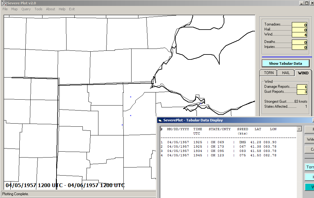
April 5, 1957 - "Hurricane Force Winds Hit Toledo" - Toledo
Blade. An 83 knot (96 mph) wind gust happened
at the airport. The wind gusts did damage in Toledo and Defiance. The
Fassett St. Bridge in Toledo was ruined by a freighter that crashed
into it because of a 90mph wind gust. Storm Reports
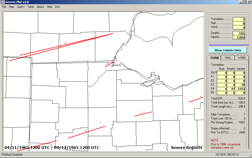
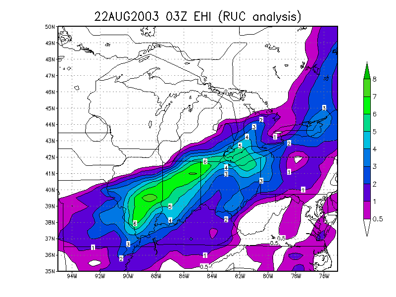
April 11, 1965 - Palm Sunday Killer Tornado Outbreak "Tornadoes Kill 13 in City, 34 in Area" "Hundreds Hurt, Homeless" "Guard Units Called Out" "Death Toll 210 in 5 States" The tornado path was "10 miles through north and west Toledo last night..." - Toledo Blade. Storm Reports
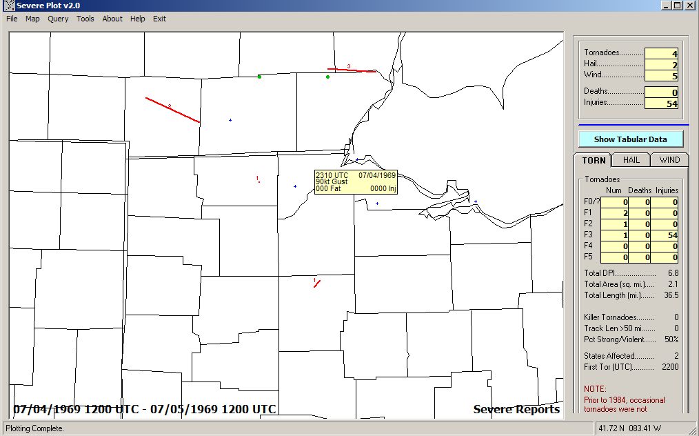
July 4, 1969 - July 4 Fireworks Derecho of 1969 - 100mph wind gust,
boats sunk on the lake, tornadoes, and severe flash floods in Sandusky
and southward Storm Reports
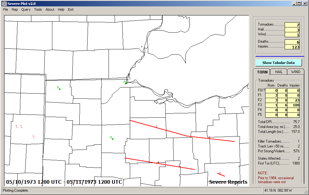
May 10, 1973 - Tornado Outbreak - Deadly Tornado in Seneca and Huron
Counties Storm Reports
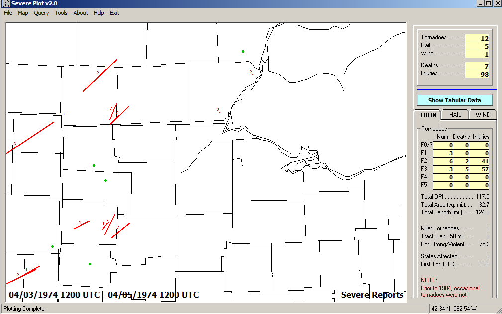
April 3 and 4, 1974 - Super Outbreak of Tornadoes Storm Reports
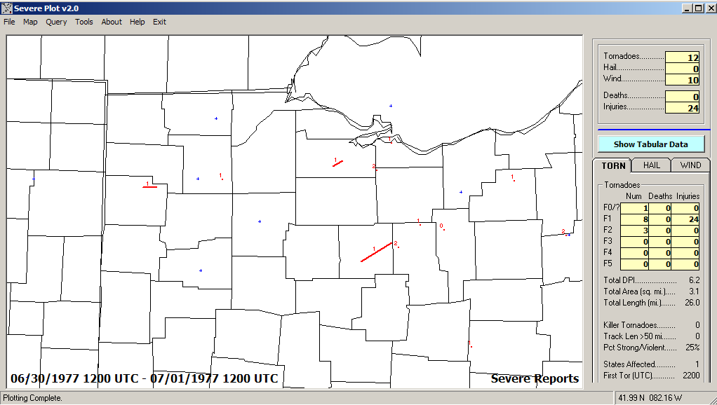
June 30, 1977 - Tornado Outbreak Storm Reports
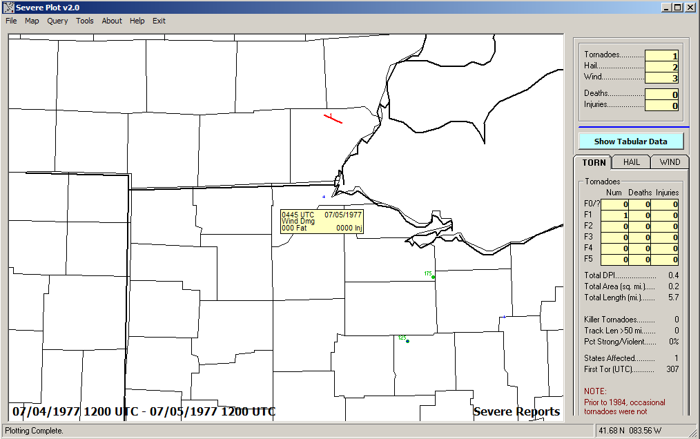
July 4, 1977 - July 4th Derecho of 1977 Storm Reports
1980s
July 5, 1980 - July 4 "More Trees Down" Derecho of 1980 Storm Reports
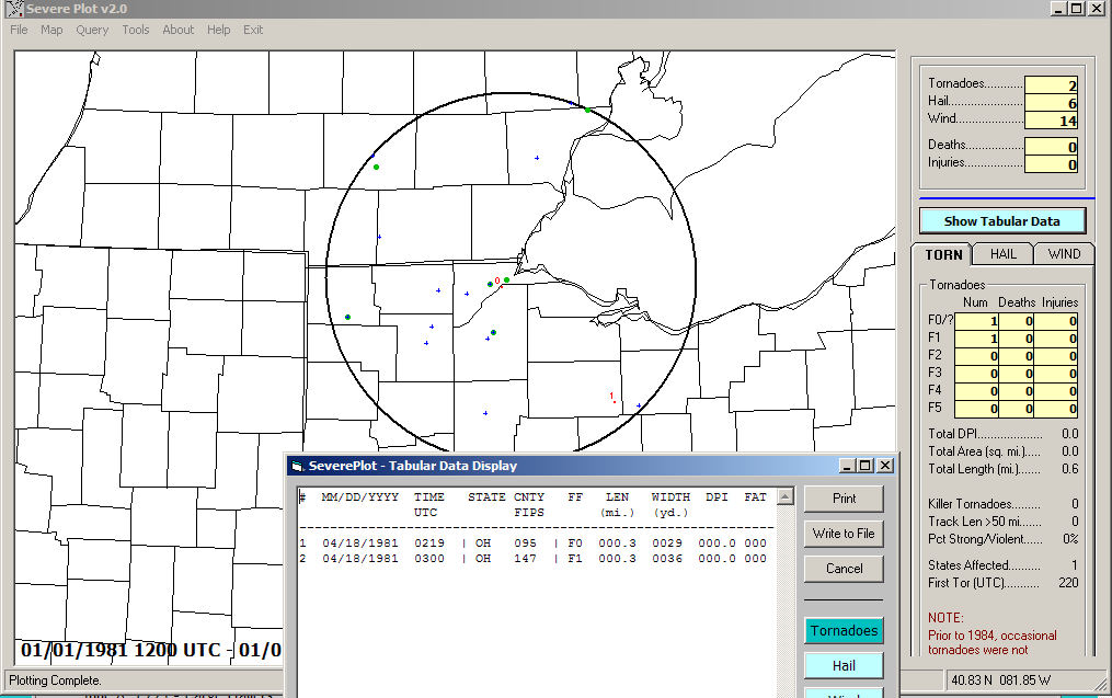
1981 Storm Reports
June 15, 1982 Storm Reports
May 2, 1983 - Tornadoes in Weston (Wood County,) Henry County, Huron
County, Large Hailers Storm Reports
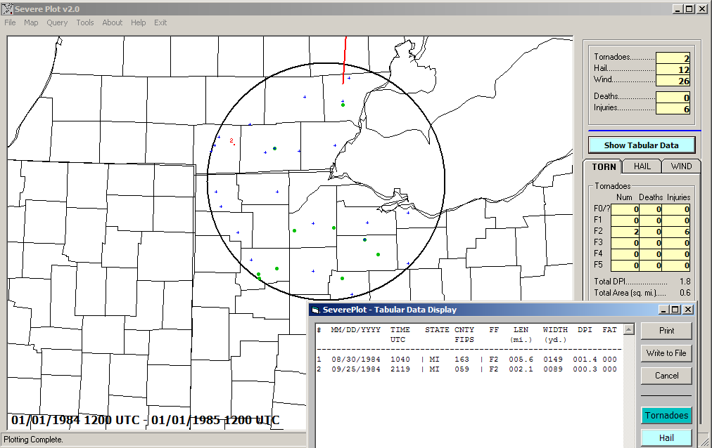
1984 Storm Reports
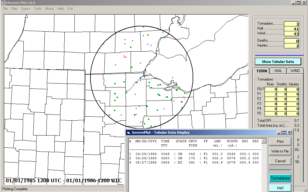
1985 Storm Reports
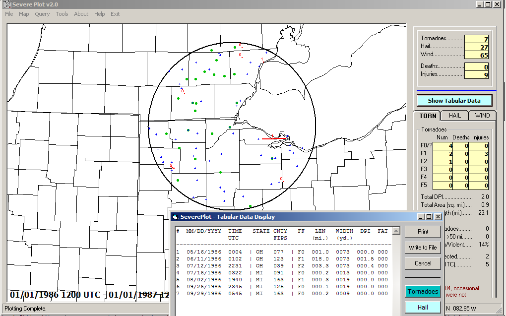
1986 Storm Reports
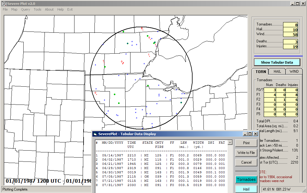
1987 Storm Reports
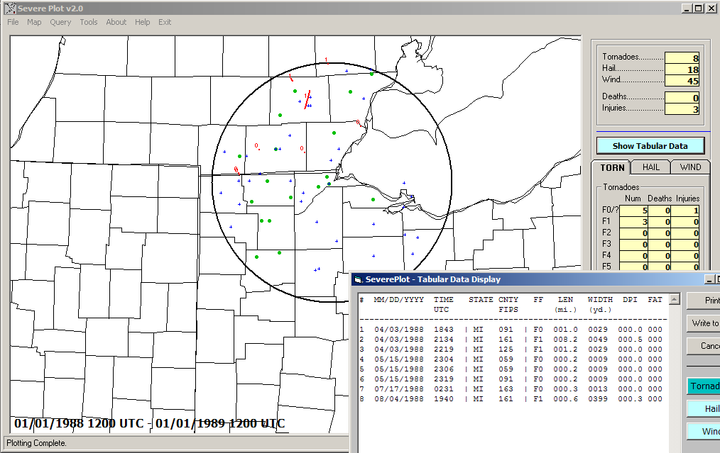
1988 Storm Reports
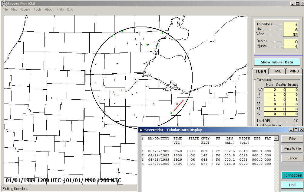
1989 Storm Reports
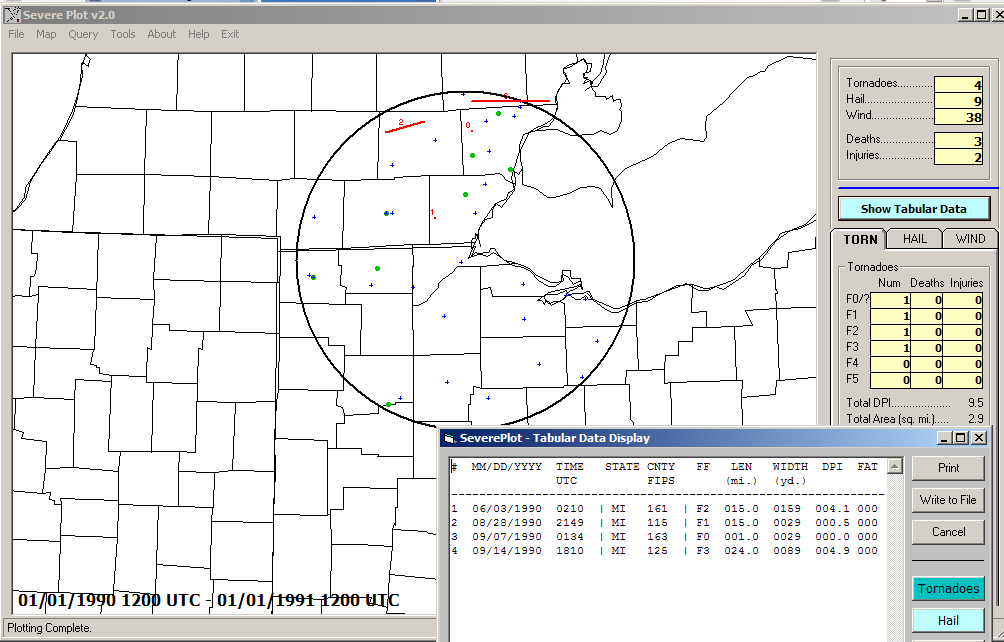
1990 Storm Reports
1991-1994
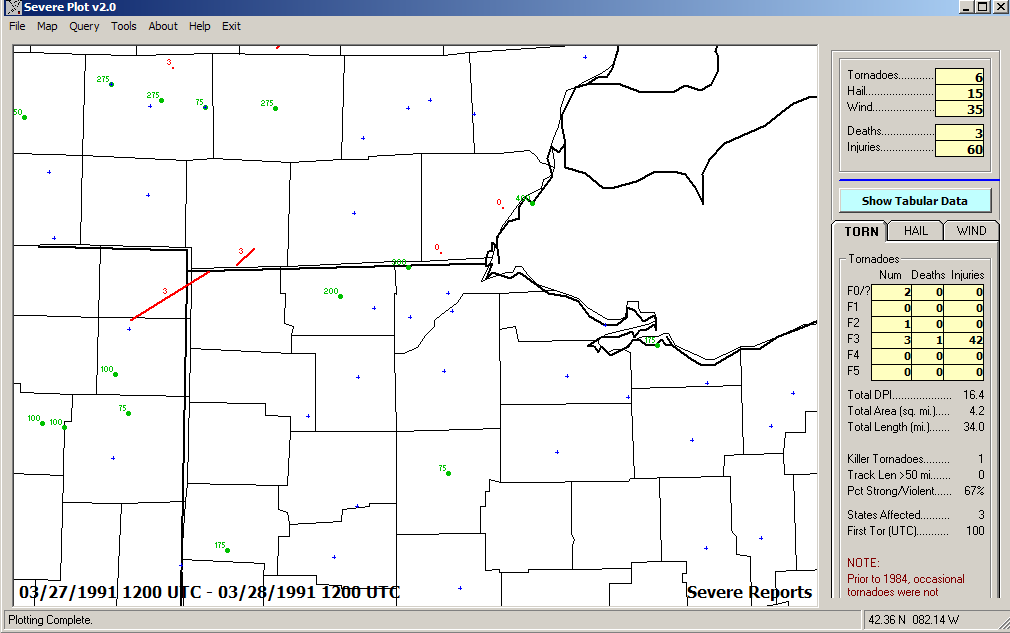
March 27, 1991 - Nettle Lake Tornado (Steuben County/Williams County),
Large Hailers, 5 tornadoes in Michigan Storm Reports
May 17, 1992 Storm Reports
June 17, 1992 Storm Reports
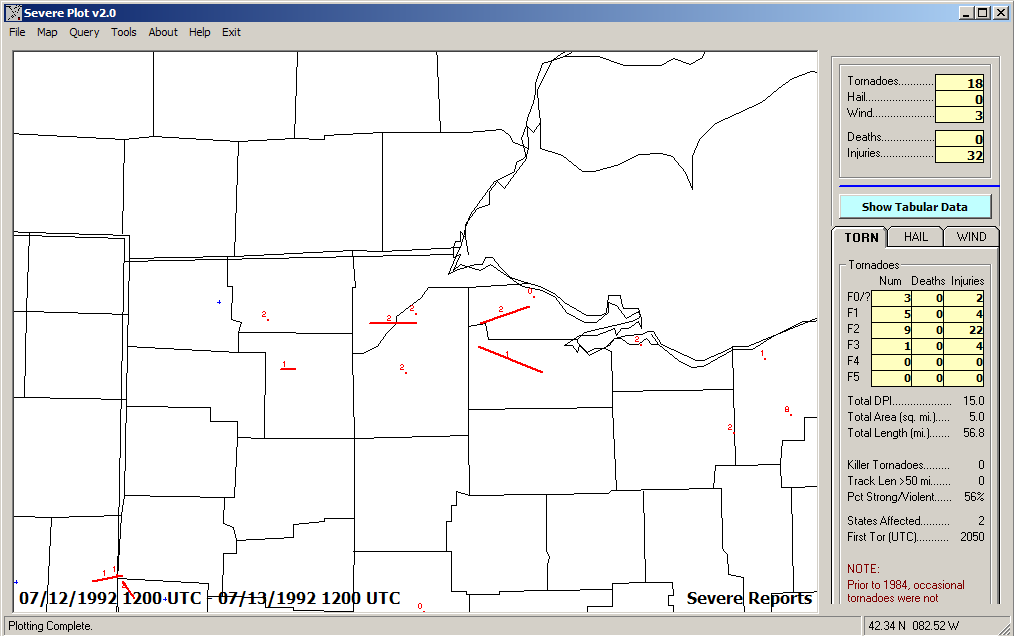
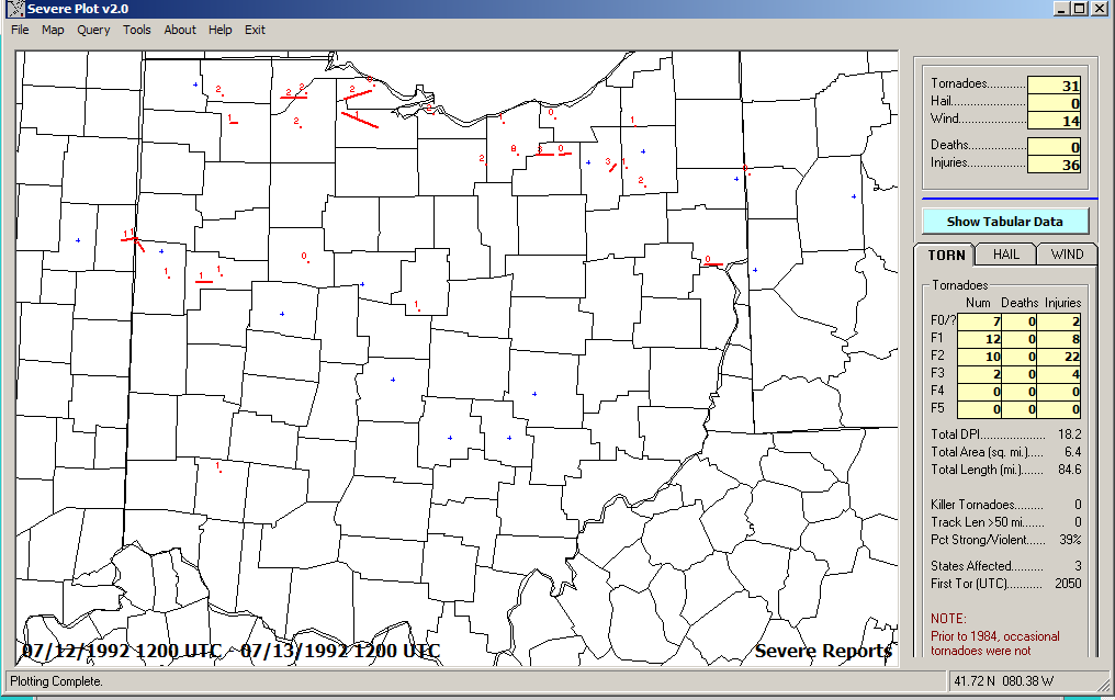
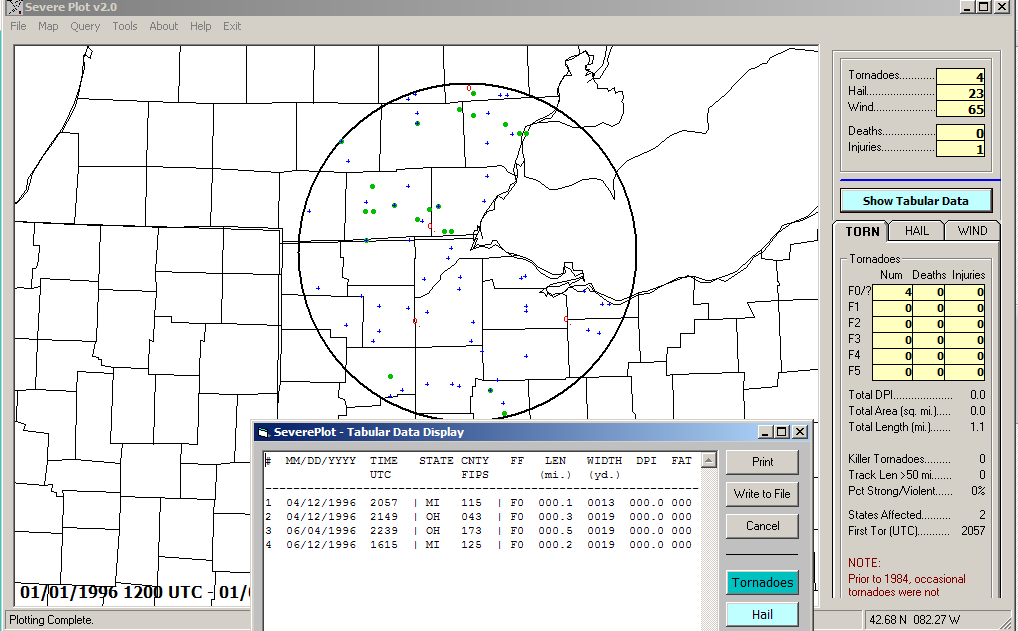
July 12, 1992 - Tornado Outbreak day - a record 28 Tornadoes in Ohio on
a single day! Storm Reports
Storm
Reports-Wider View
July 13, 1992 - Multiple Tornado day Storm Reports
July 14, 1992 - Multiple Tornado day Storm Reports
September 9, 1992 - Tornado in Monroe, tornado near Carey Storm Reports
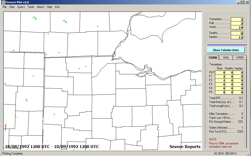
October 8, 1992 Storm Reports
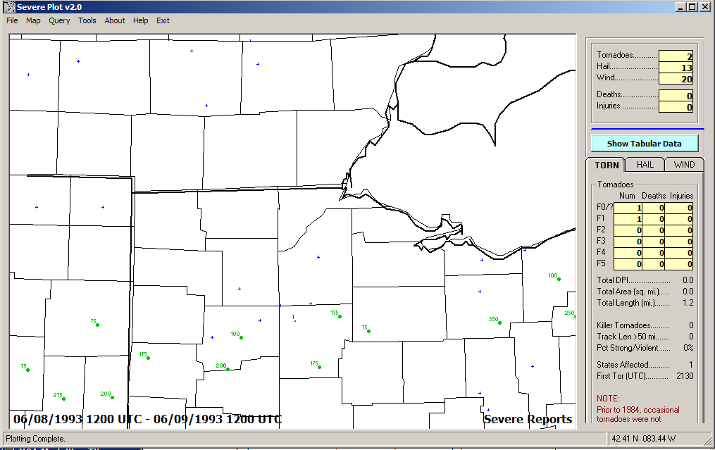
June 8, 1993 - Large Hailers Storm Reports
June 27, 1993 - Large Hailers Storm Reports
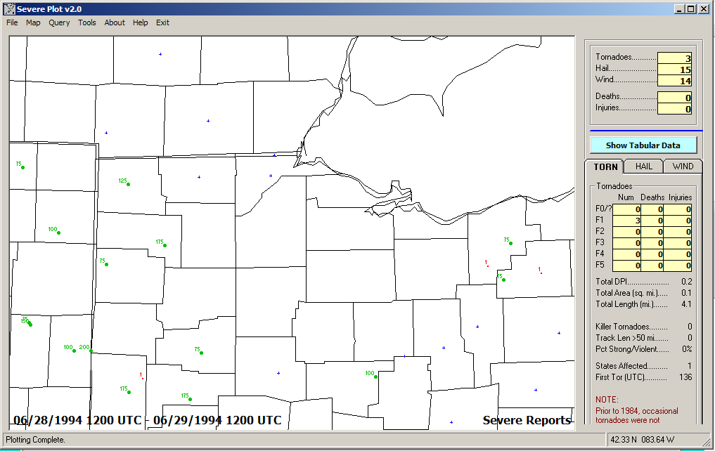
June 28, 1994 - Tornado near Celina (Mercer County) Storm Reports
1995-1999
April 11, 1995 Storm Reports
June 14, 1995 - Large Hail in Toledo area Storm Reports
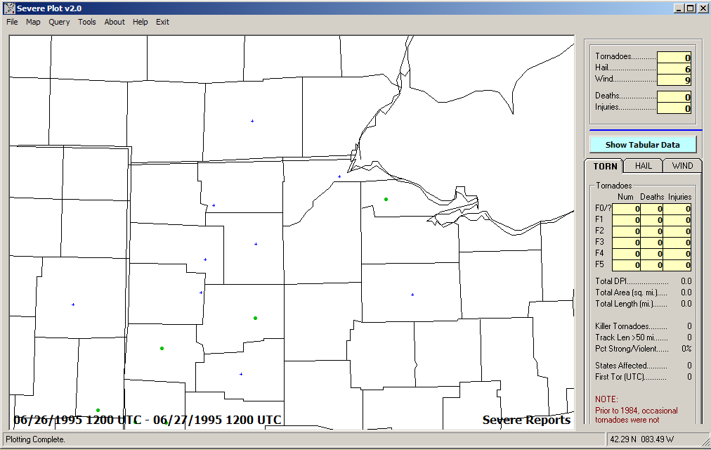
June 26, 1995 Storm Reports
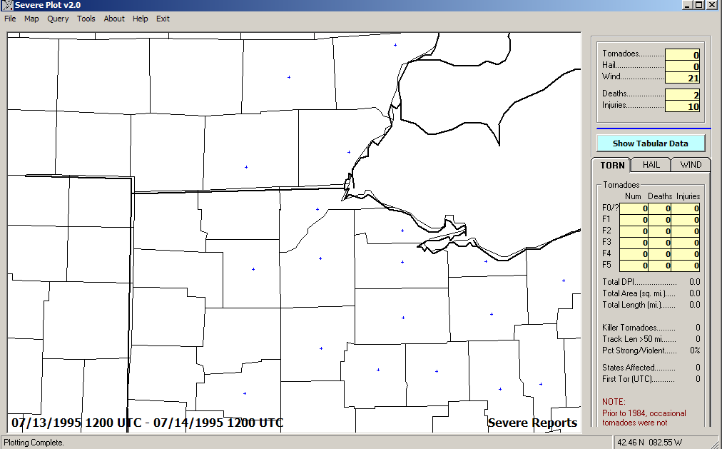
July 13, 1995 - "Right Turn Derecho" Storm Reports
Comparatively, 1996 was fairly low on storm reports 1996 Storm Reports
May 18, 1997 Storm Reports
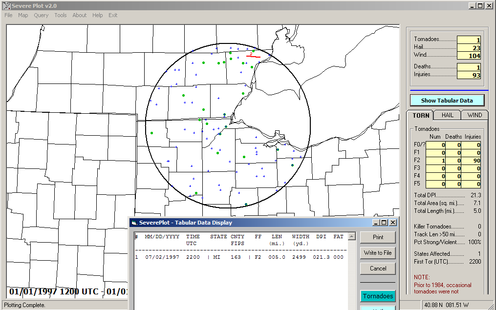
Comparatively, 1997 was fairly low on storm reports, but the Detroit F2
tornado (July 2, 1997) was damaging! 1997 Storm Reports
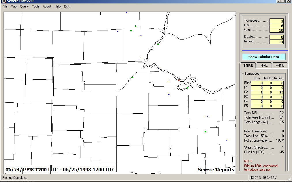
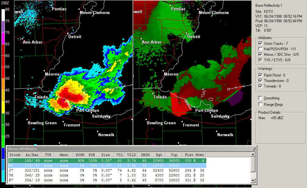
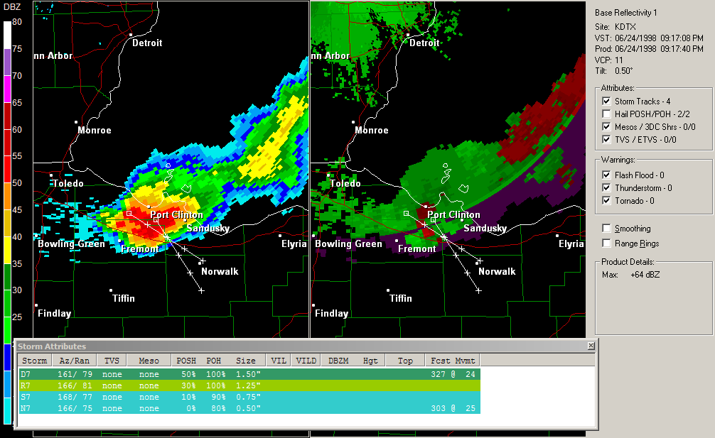
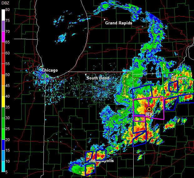
June 24, 1998 - A supercell tracked to the nuclear power plant in Ottawa County, and
there was a tornado near Port Clinton Storm Reports Reflectivity/Storm Relative Velocity Reflectivity/Storm Relative Velocity
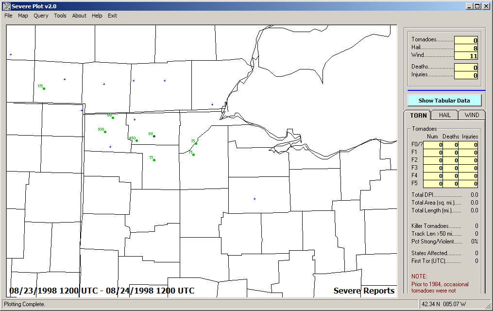
August 24, 1998 #1 - Large Hailers: Early Morning Storm Reports
August 24, 1998 #2 Storm Reports
November 10, 1998 - 100mph wind gust near Huron/Sandusky Storm Reports
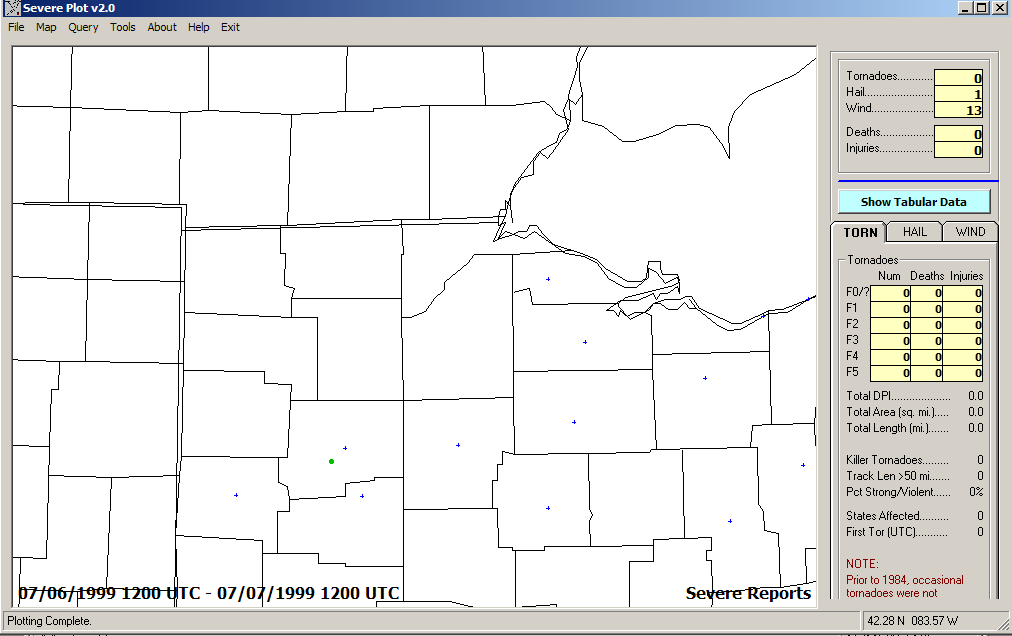
July 6, 1999 Storm Reports
July 9, 1999 -Squall line formed south of Toledo in an WSW-ENE
orientation Storm Reports
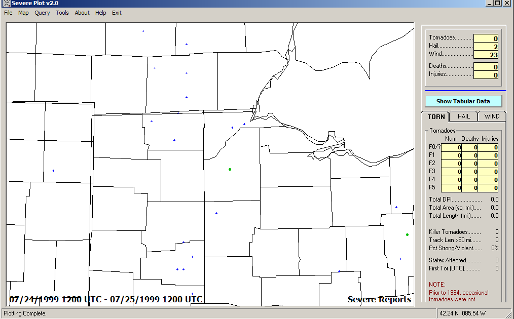
July 24, 1999 Storm Reports
2000
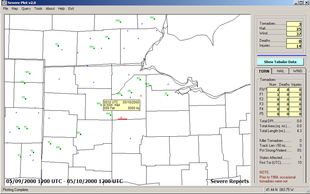
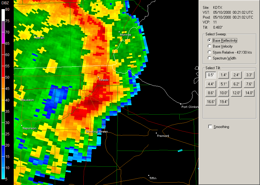
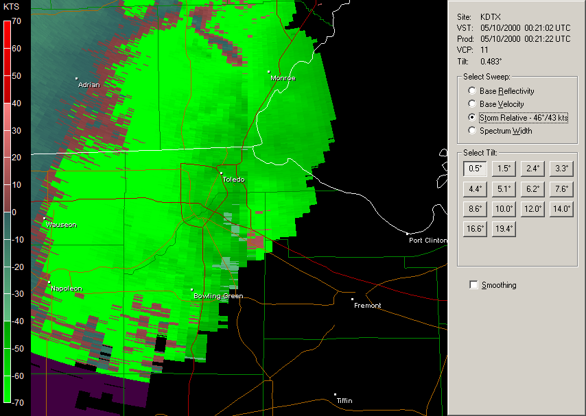
May 9, 2000 - Tornado day, tornado in Sylvania, two tornadoes in Wood
County Storm Reports
Evening
Radar Loop (Reflectivity/Storm Relative Velocity) DTX
base reflectivity DTX
storm relative velocity Afternoon
Radar Loop (Reflectivity/Storm Relative Velocity)
June 14, 2000 - A tornado in Wood County Storm Reports
August 2, 2000 - Large hail in the Toledo area Storm Reports
August 6, 2000 Storm Reports
Radar
2001
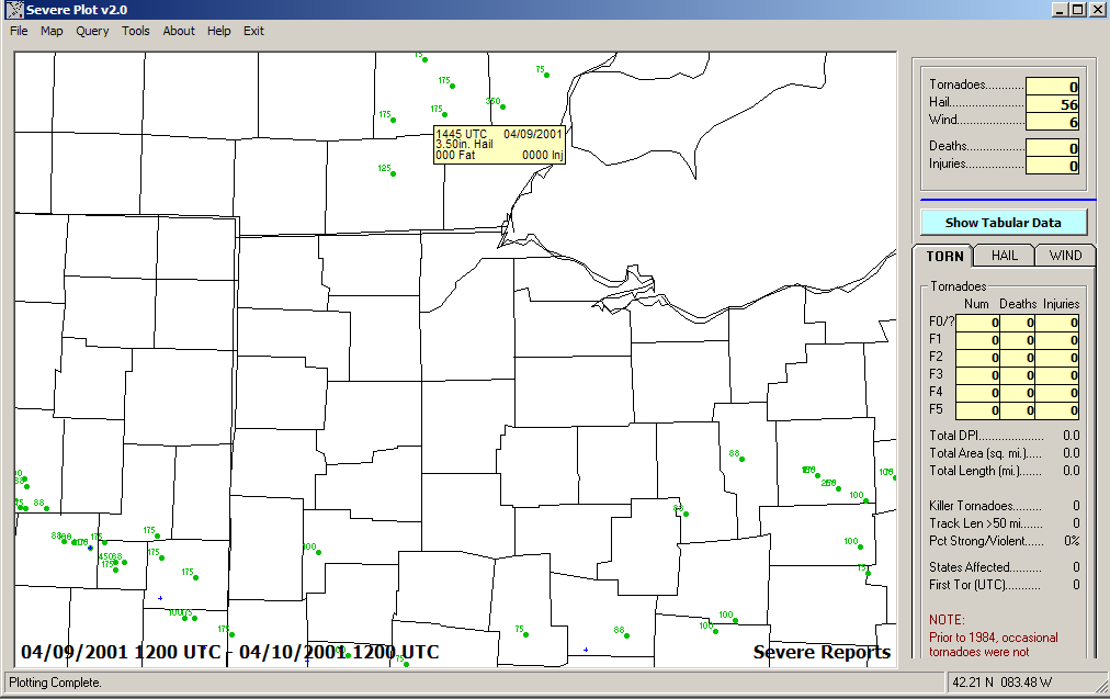
April 9, 2001 - Some large hailers in a few locations Storm Reports
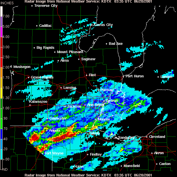
June 19, 2001 - Large hail in the Toledo area Storm Reports
Storm
Total Precip to 11:35PM
July 29, 2001 - Michigan north to south severe storm Storm Reports Radar Loop
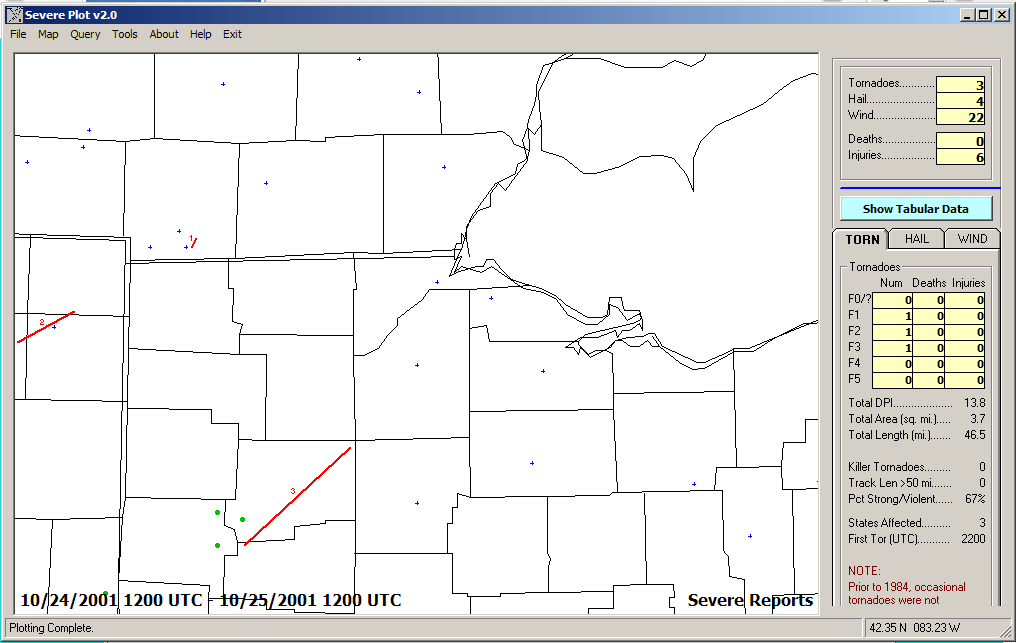
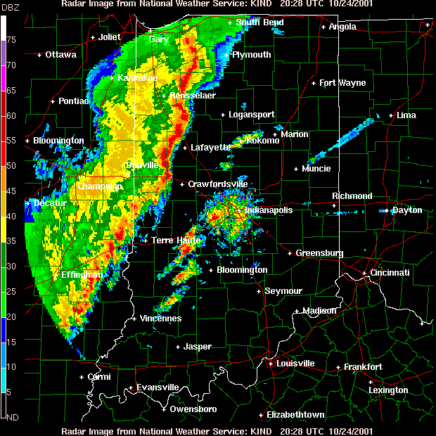
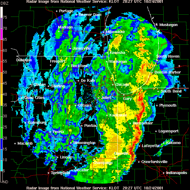
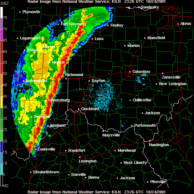
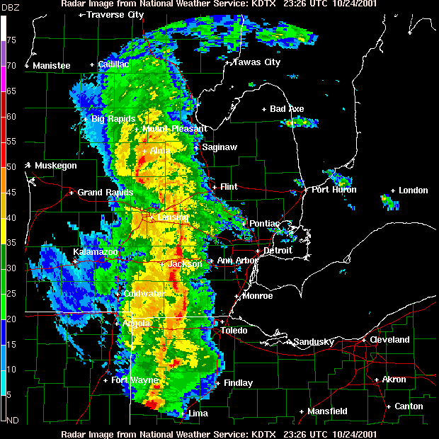
October 24, 2001 - Tornado day, Tornado near Ottawa (Putnam County) ,
tornado north of Pioneer, in Hillsdale County. A multiple-bow squall
line or LEWP developed in Indiana. Storm Reports
radar
loop - Reflectivity/Storm Relative Velocity IND
LOT
ILN
DTX
2002
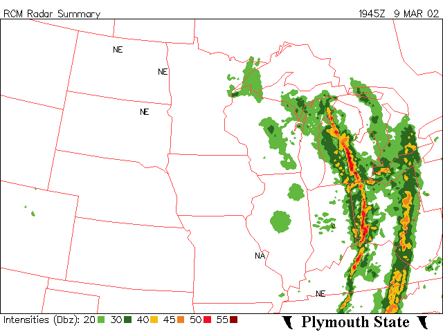
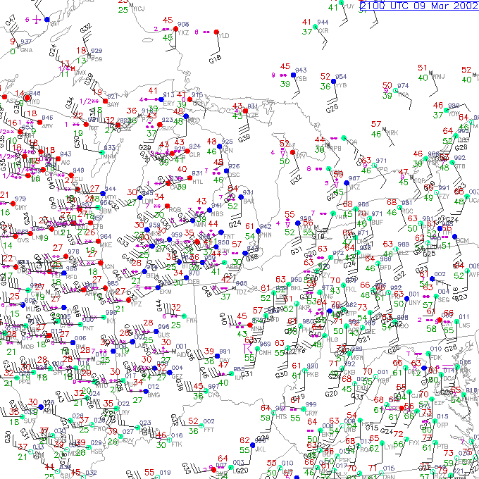
March 9, 2002 - A long low-topped squall line/derecho that was
thunder-less. It was 55 to 60 degrees, then, after the front, the
temperature dropped to the 30's quickly Radar
local
surface weather map at 5:00PM
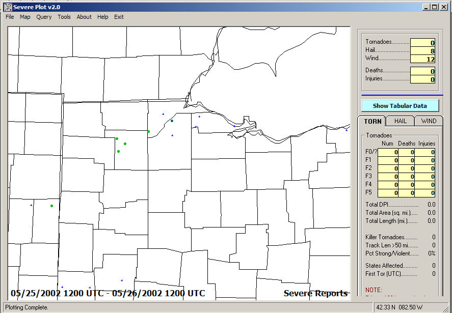
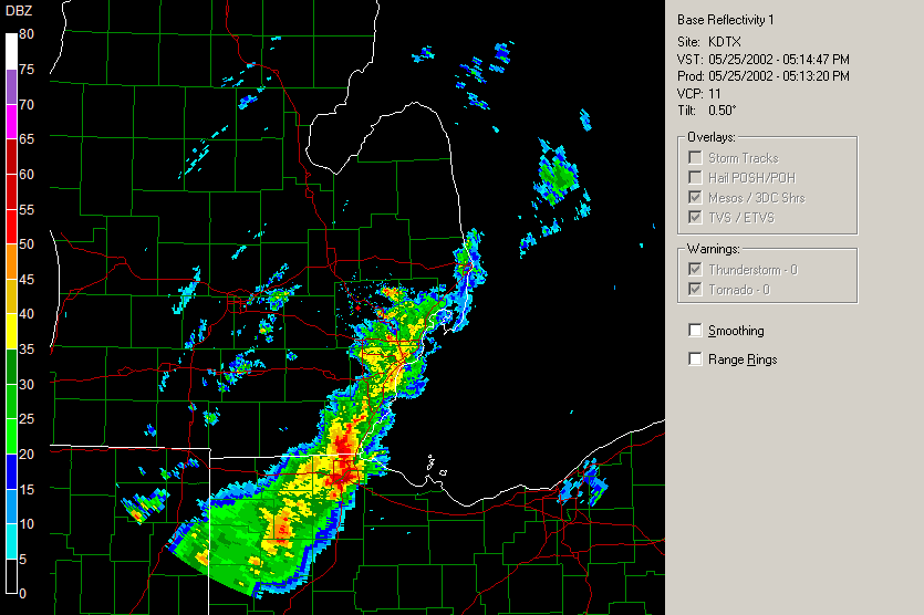
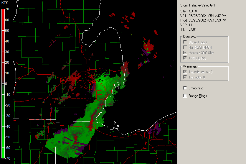
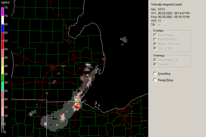
May 25, 2002 - Large Hailers Storm Reports
Radar
Storm
Relative Velocity VIL
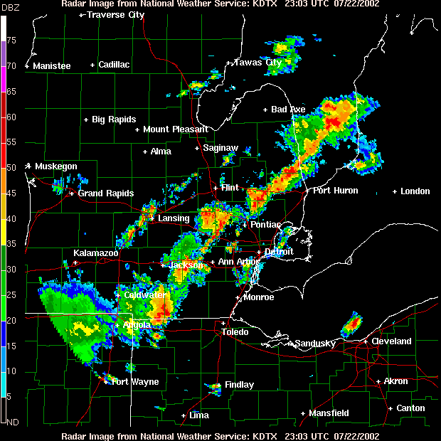
July 22, 2002 Storm
Reports Radar
2003
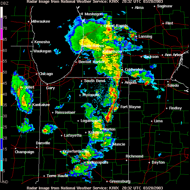
March 20, 2003 - Large Hail in the Toledo area Storm Reports
Radar
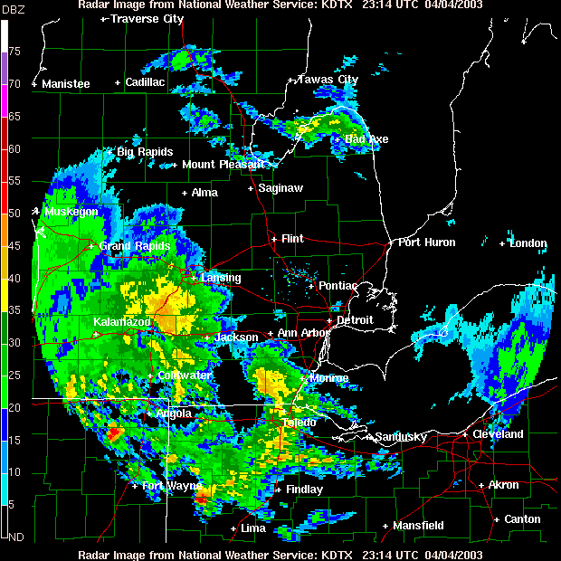
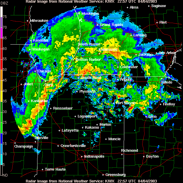
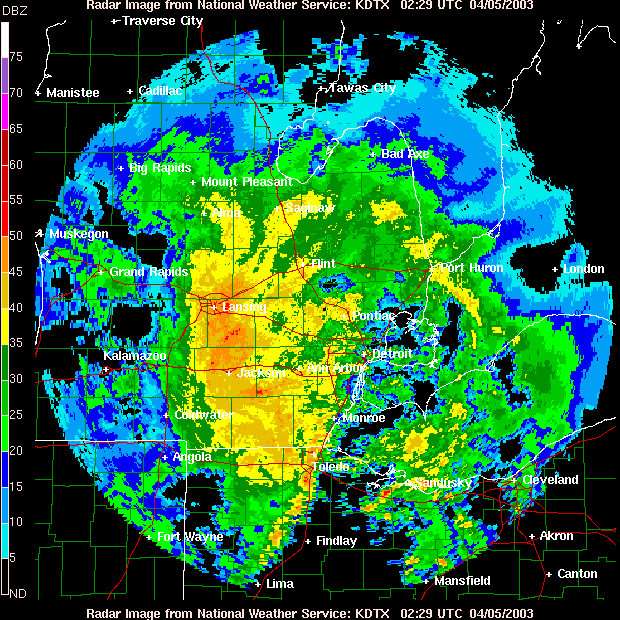
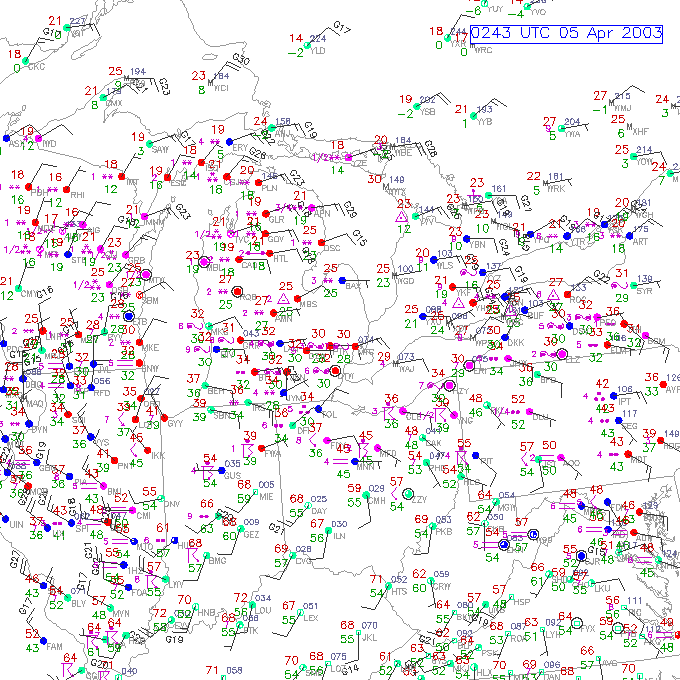
April 4, 2003 - Severe storms hit the area when Toledo was at 34
degrees (F) Storm Reports
DTX
Radar IWX
Radar 9:29PM
DTX Radar 9:00PM
local surface weather
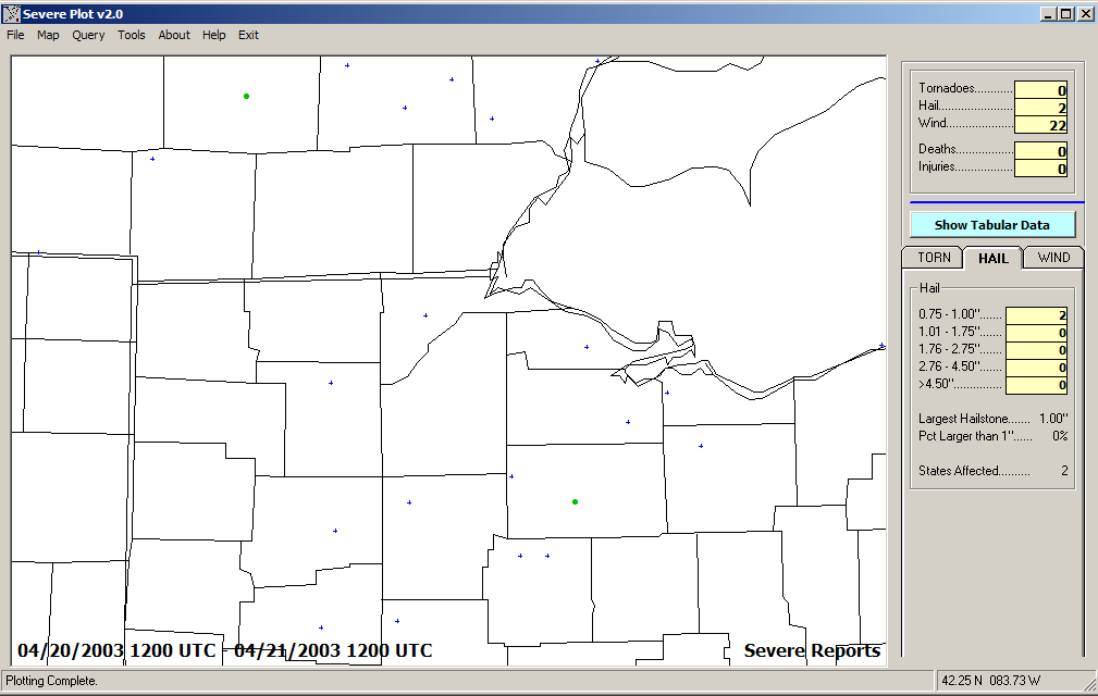
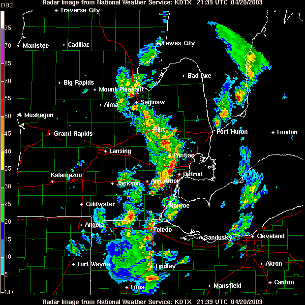
April 20, 2003 - Easter Sunday scattered severe storms Storm Reports
Radar
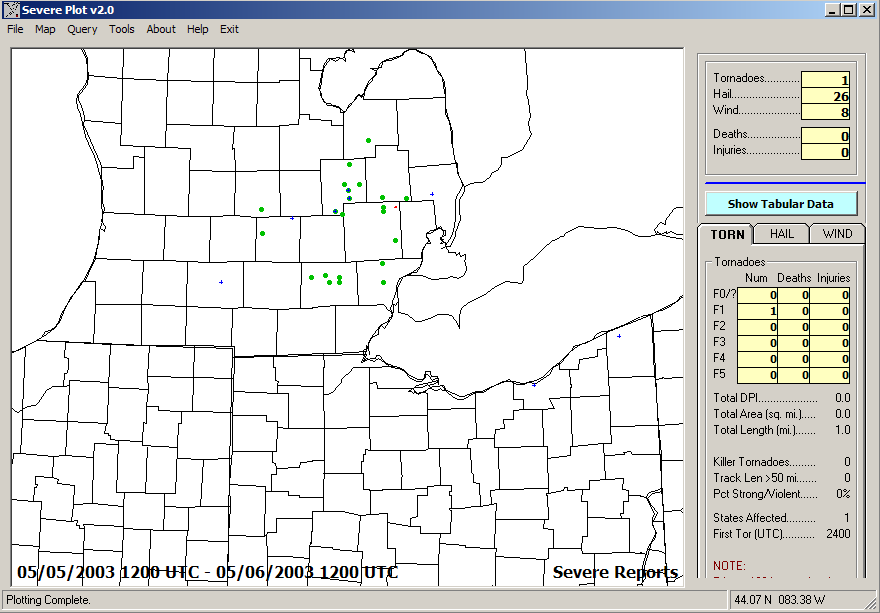
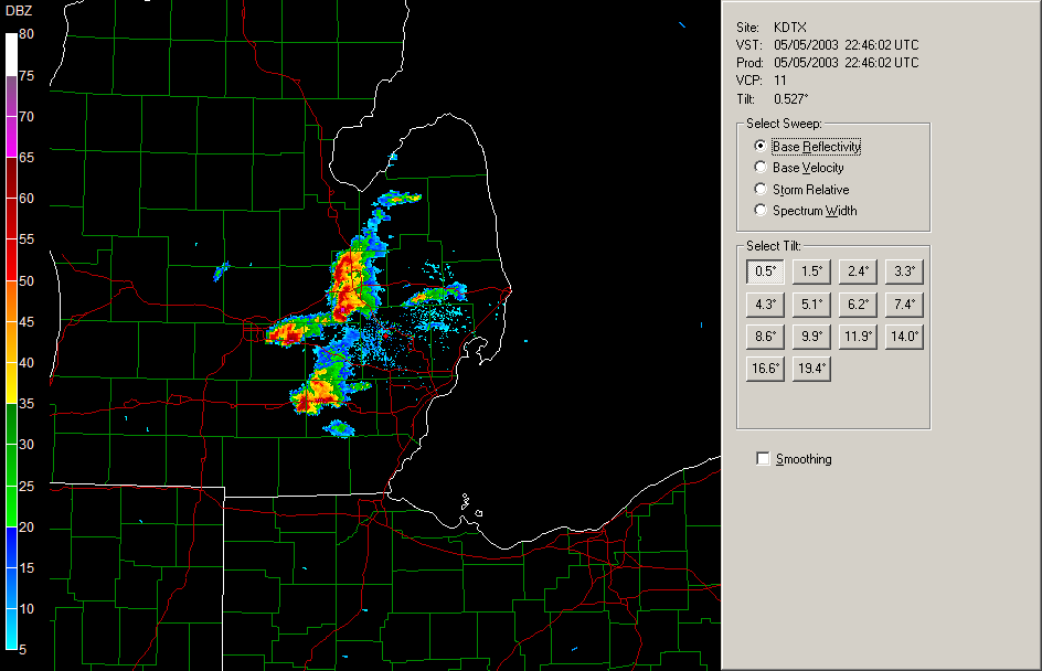
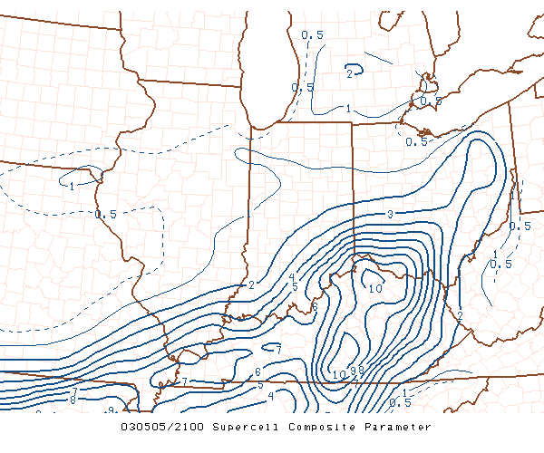
May 5, 2003 - two to four Supercells in SE Michigan Storm Reports
Radar
Supercell
Composite 5:00PM
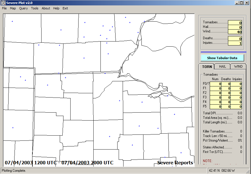
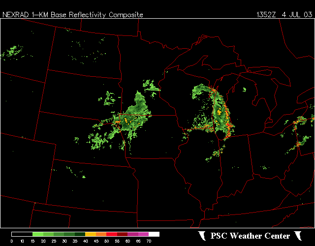
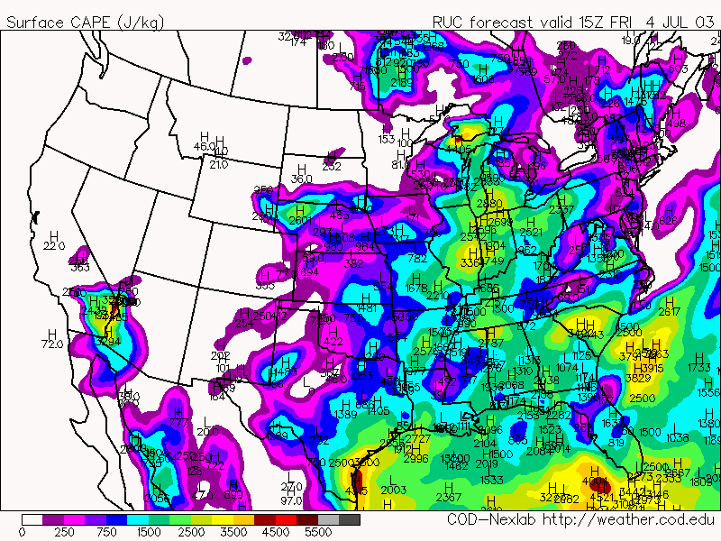
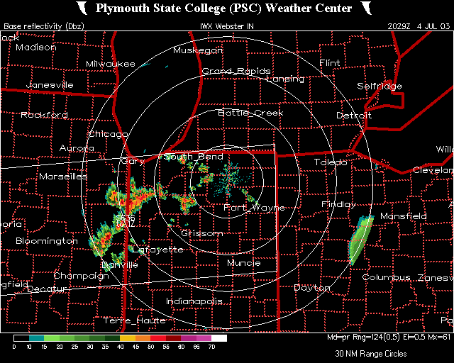
July 4, 2003 #1: Morning-Early afternoon derecho Storm
Reports Radar
Radar
Loop CAPE
at 11:00AM
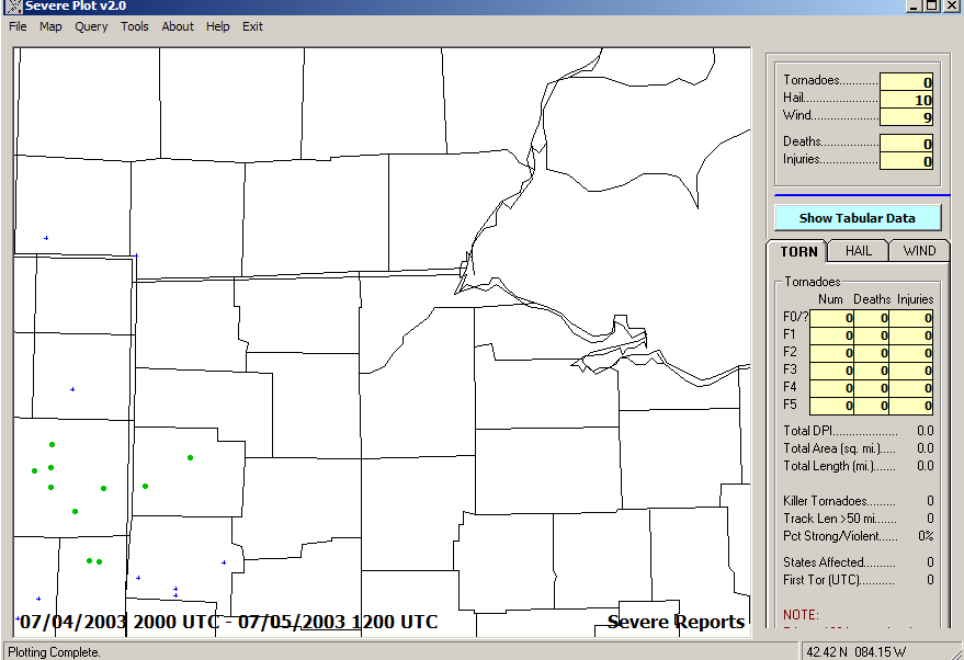
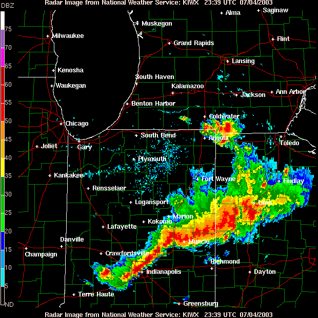
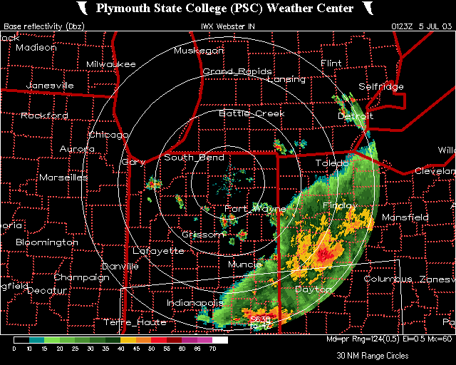
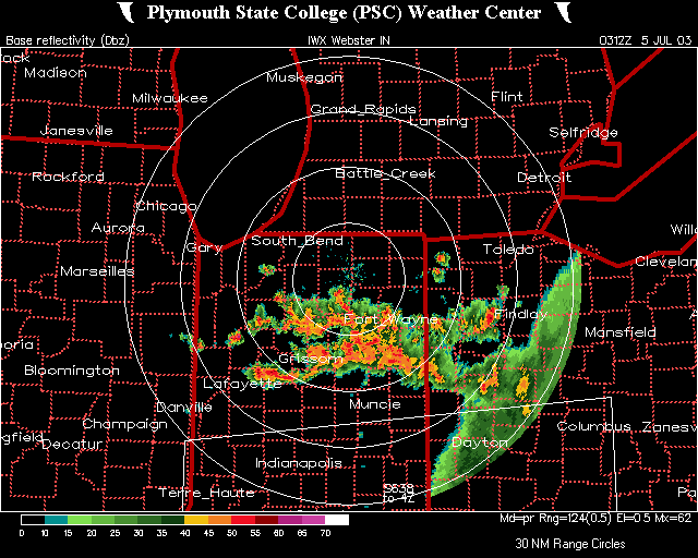
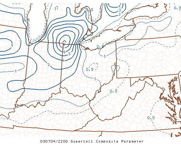
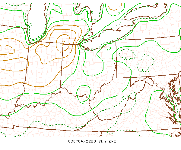
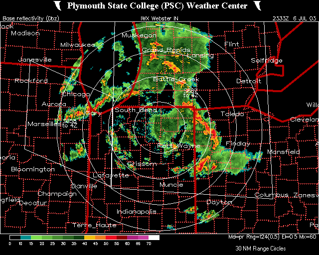
July 4, 2003 #2 and #3: Afternoon and Night - the thunderstorms kept
coming and coming for central and eastern Indiana, and western Ohio.
Storm
Reports Radar
Radar
Radar
Radar
Supercell
Composite 6:00PM Energy-Helicity
Index at 6:00PM
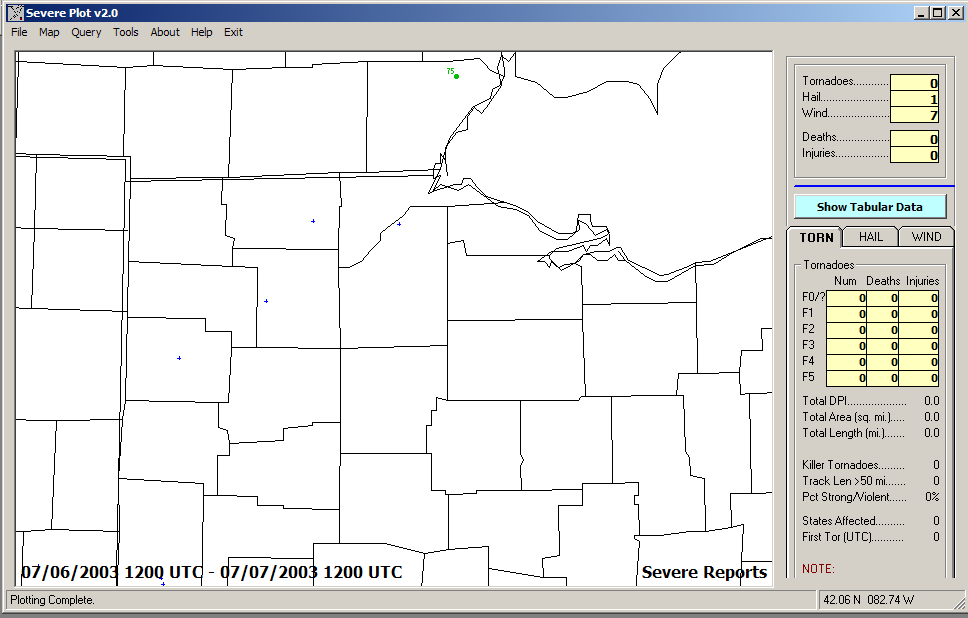
July 6, 2003 - the storm train of July 2003 was still on track Storm Reports
Radar
Radar
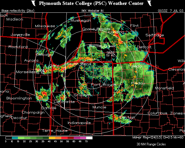
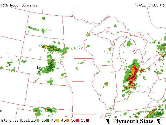
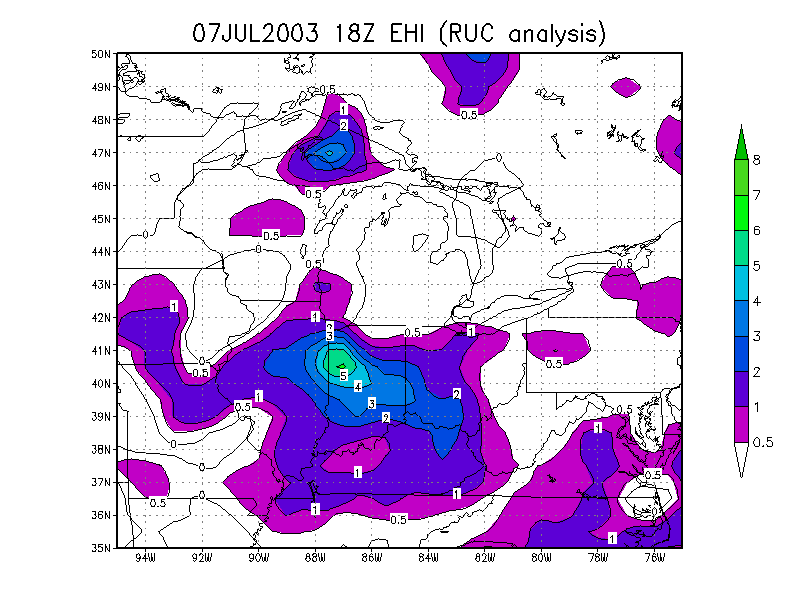
July 7, 2003 - Derecho Storm Reports
Radar
Energy-Helicity
Index
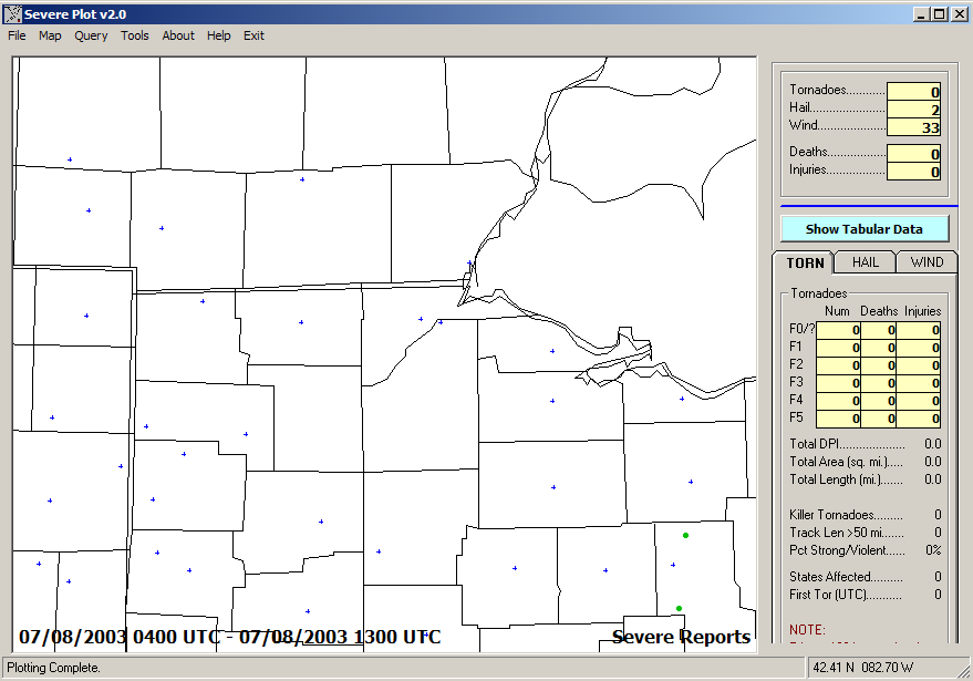
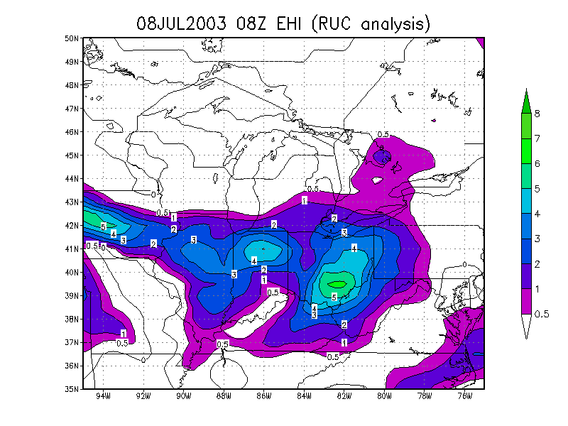
July 8, 2003 #1 - Wind damage: Early Morning Storm
Reports Radar
Loop Energy-Helicity
Index
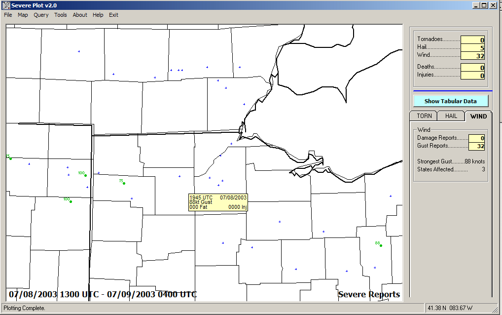
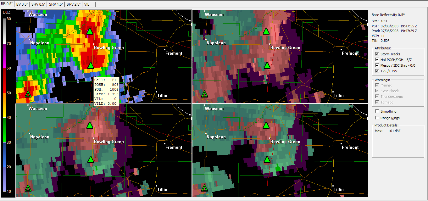
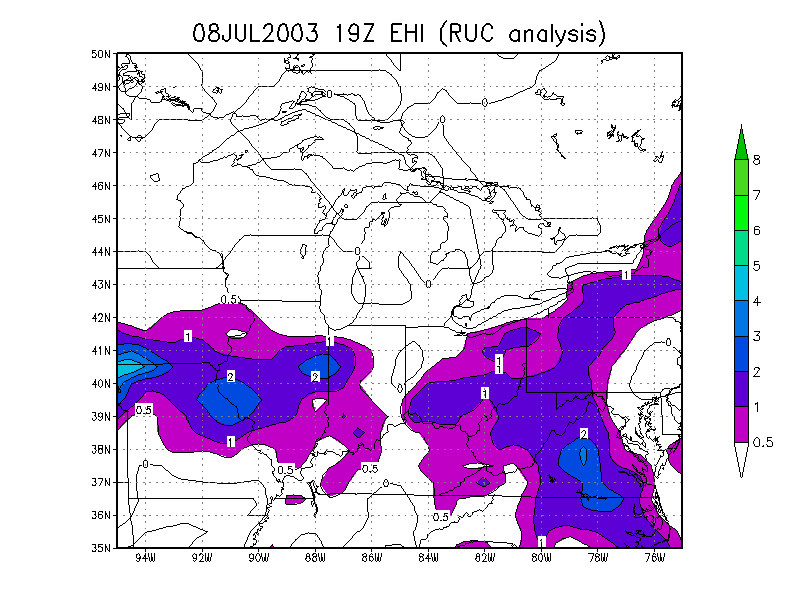
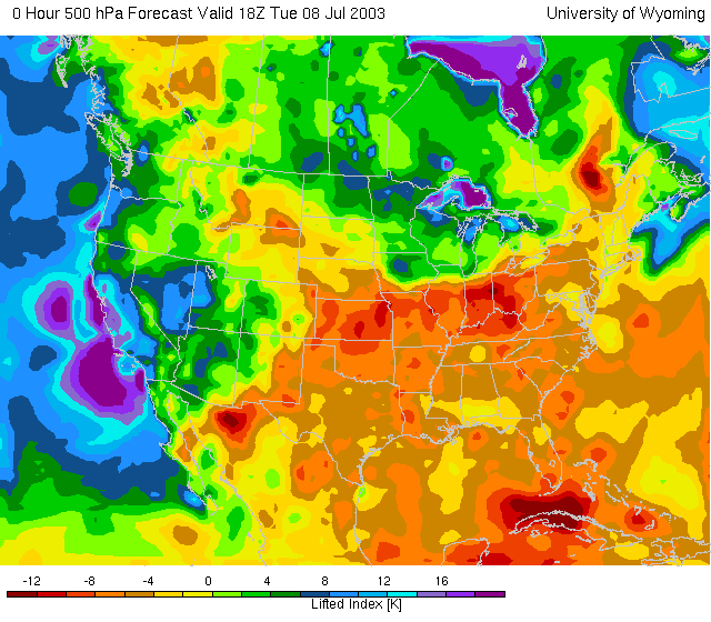
July 8, 2003 #2 - Bowling Green 100mph wind and major tree damage:
Afternoon Storm
Reports
Radar
Loop Radar from 3:47PM Energy-Helicity
Index Lifted
Index
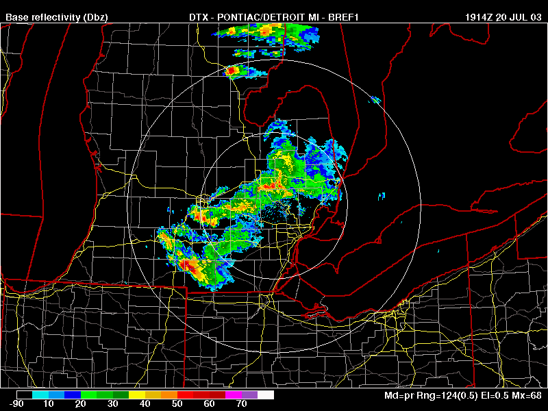
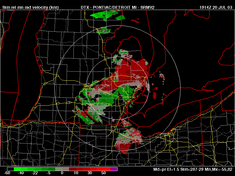
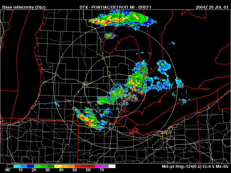
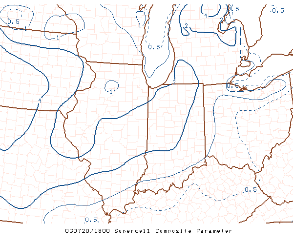
July 20, 2003 #1 - Afternoon - Supercell in Calhoun and Hillsdale
Counties, MI Storm
Reports Radar
Storm
Relative Velocity 2 Radar
2:00PM
Supercell Composite
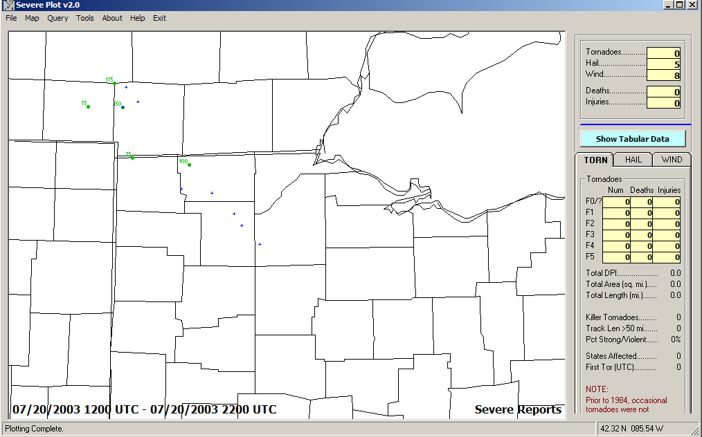
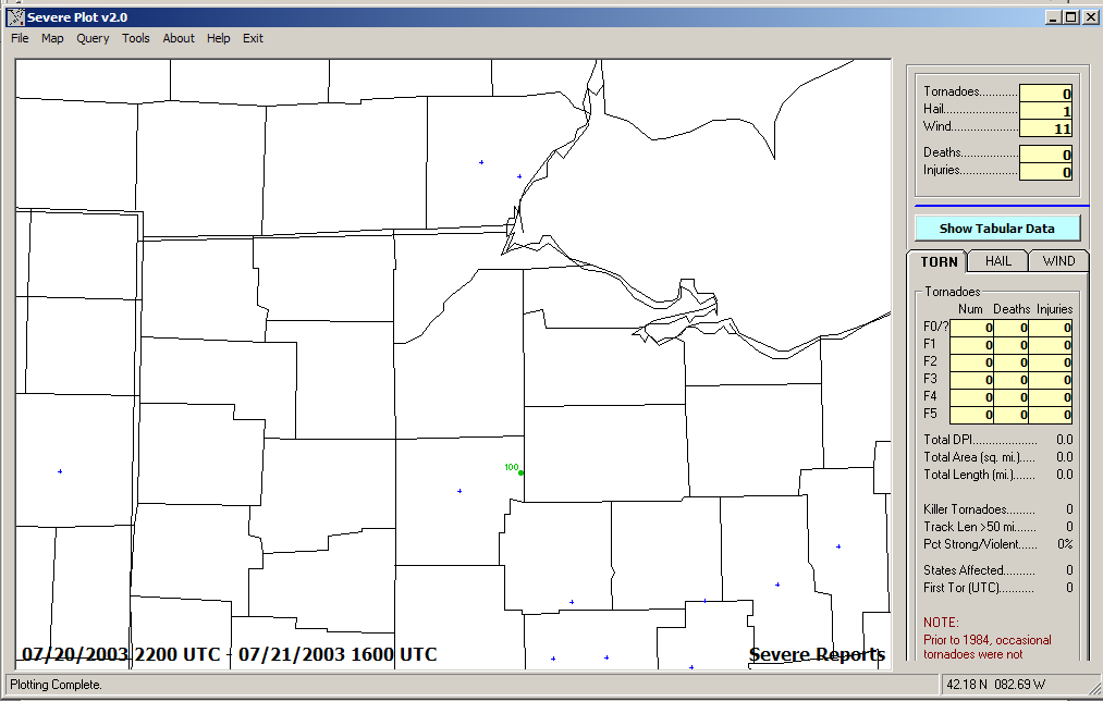
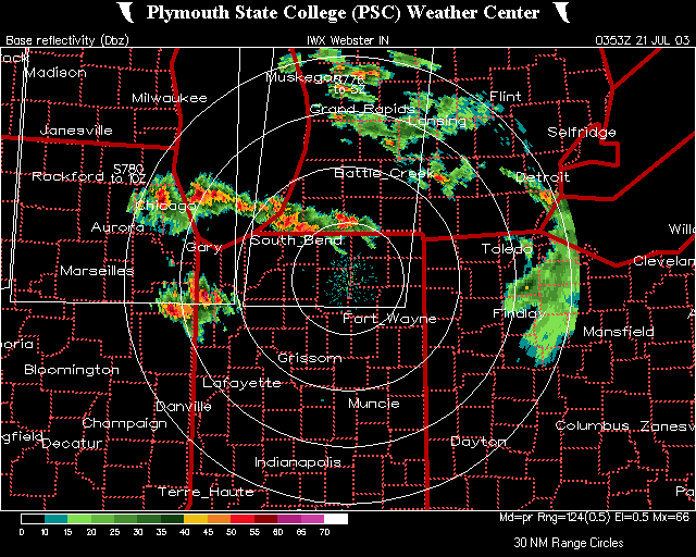
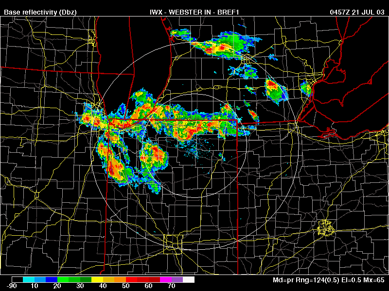
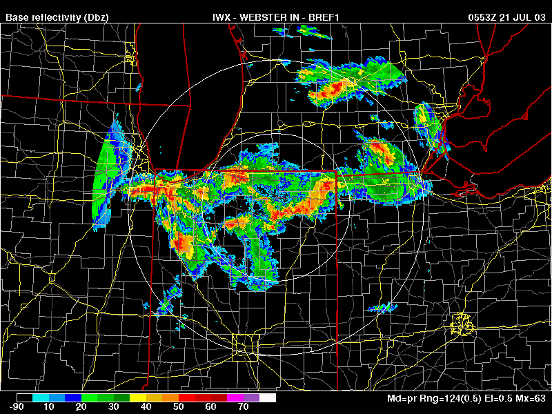
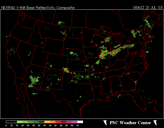
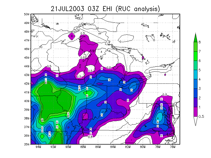
July 20-21, 2003 #2 - Night to Morning - Squall line developed west to
east from Chicago to Toledo, and moved slowly, eventually did some wind
damage Storm Reports
Radar
Radar
Radar
Radar
Composite Energy-Helicity
Index CAPE
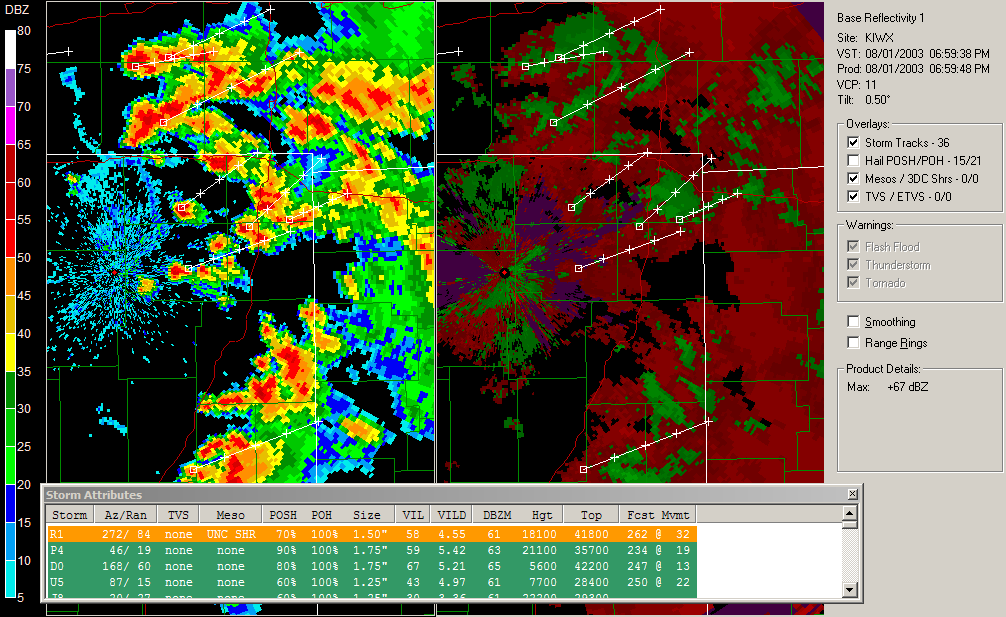
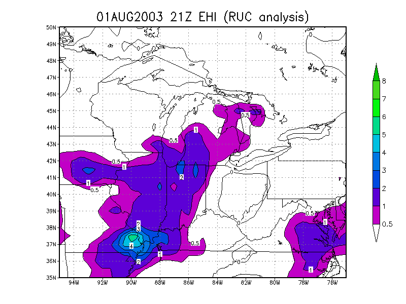
August 1, 2003 - Back-building Mesoscale Convective System/Squall
line Storm
Reports Radar composite
loop Reflectivity/Storm
Relative Velocity zoomed in near Fort Wayne Energy-Helicity
Index
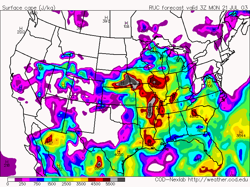
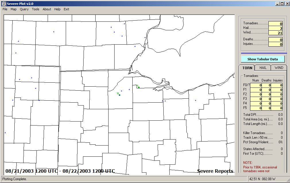
August 21, 2003 - squall line in Michigan weakened as it moved south,
new cells developed Storm Reports
Reflectivity/Storm
Relative Velocity Loop Energy-Helicity
Index
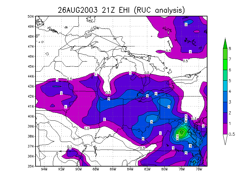
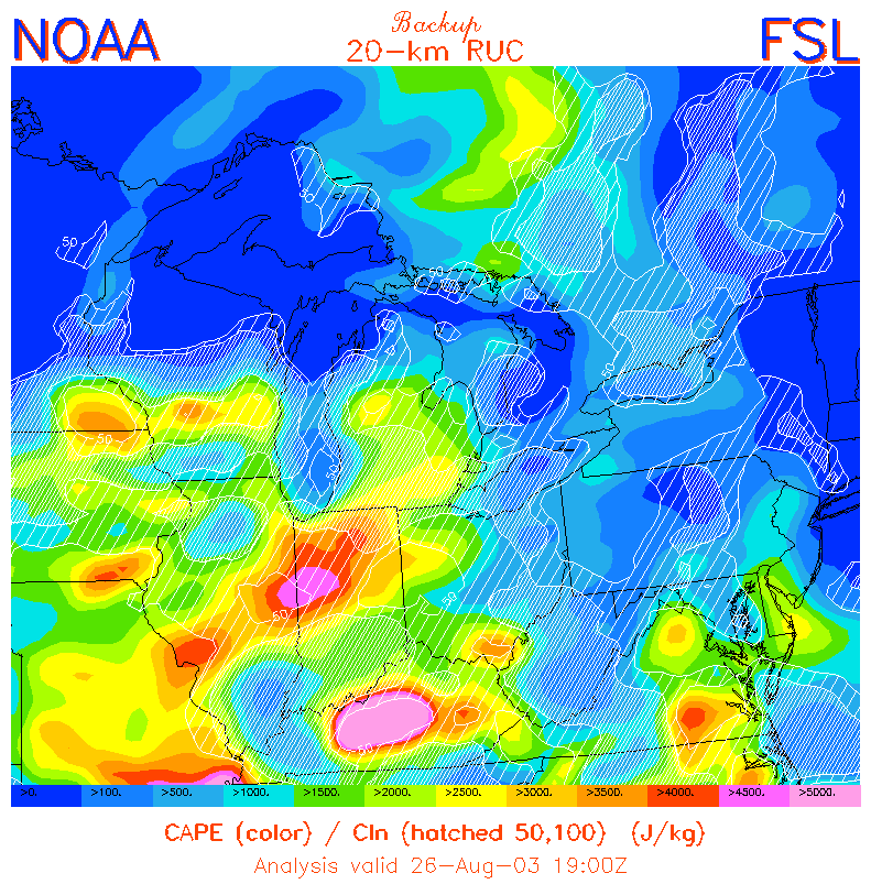
August 26, 2003 - Derecho Storm Reports
Radar
loop Energy-Helicity
Index CAPE
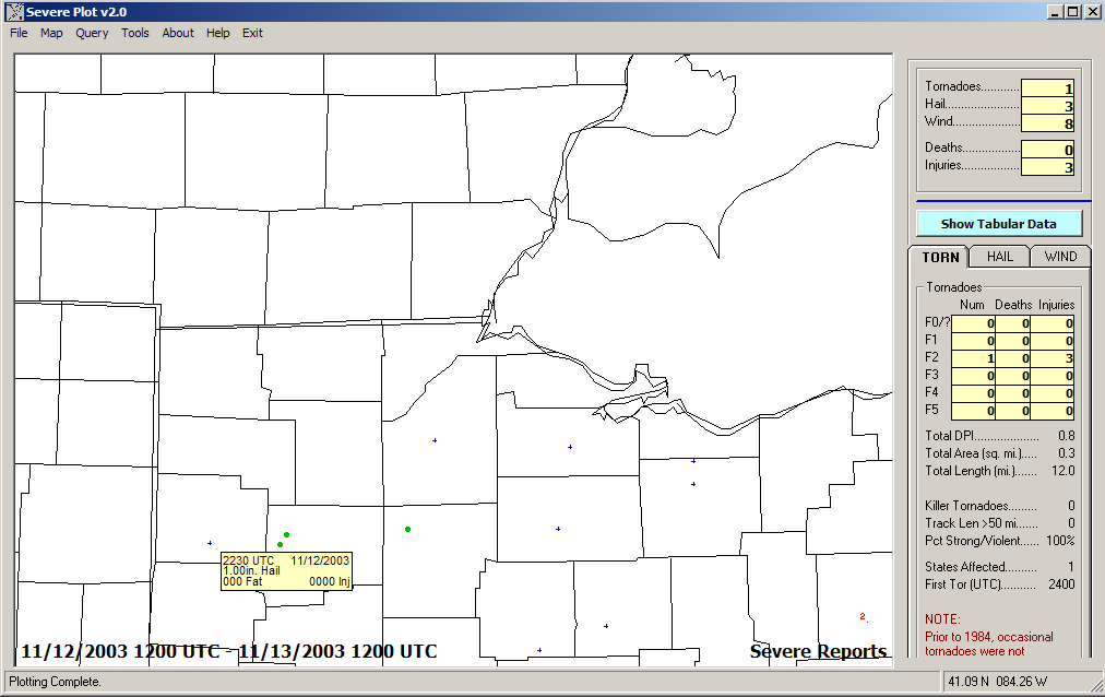
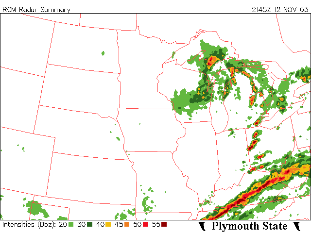
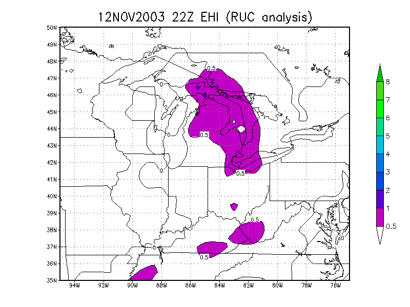
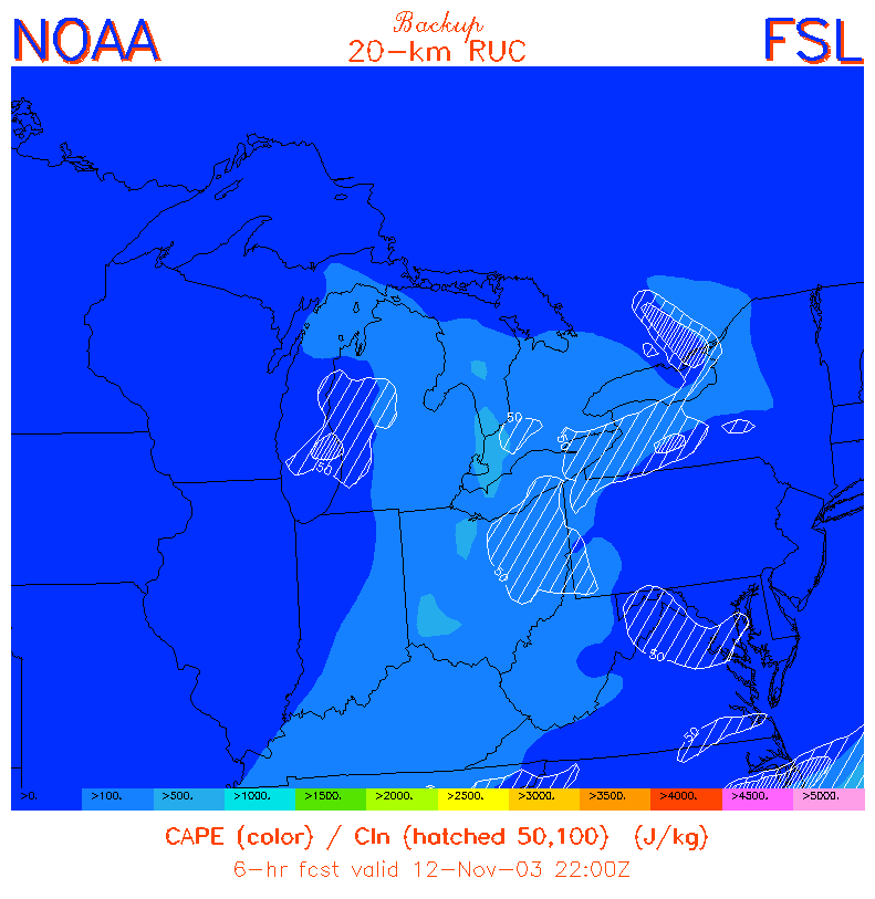
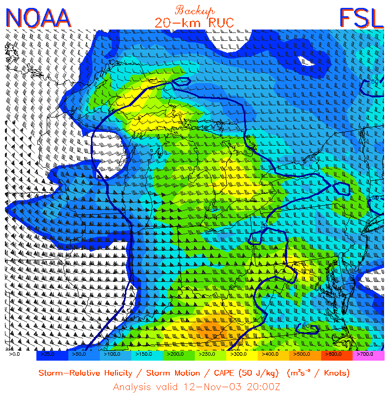
November 12, 2003 - Scattered severe thunderstorms, a tornado in the
Cleveland area Storm Reports
Radar
Energy-Helicity
Index CAPE
Helicity
2004
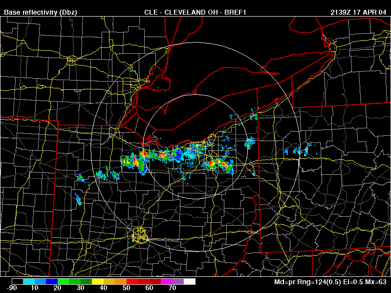
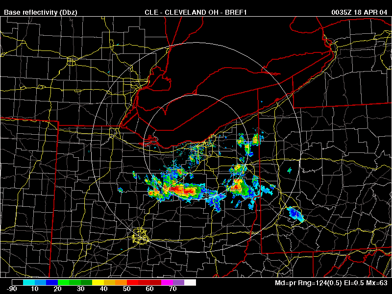
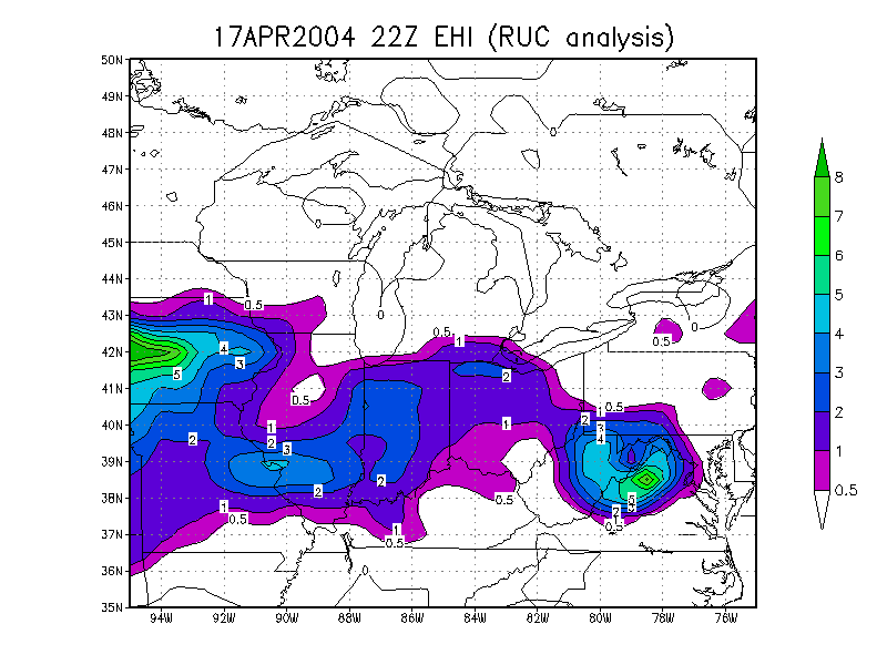
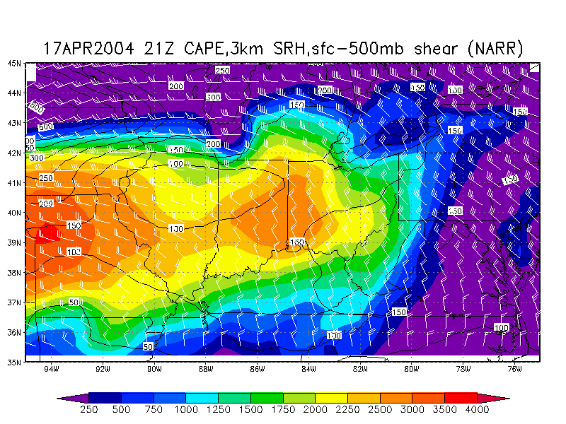
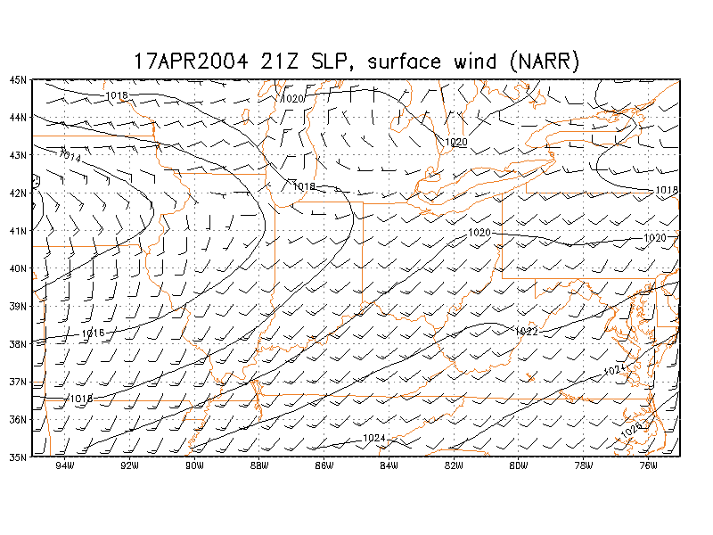
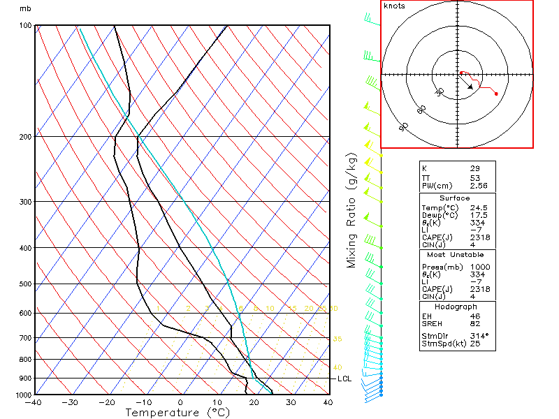
April 17, 2004 Storm Reports
Radar
Radar
Energy-Helicity
Index CAPE/Helicity/Shear Composite (NARR) Surface wind/SLP (NARR) Toledo skew-T (NARR)
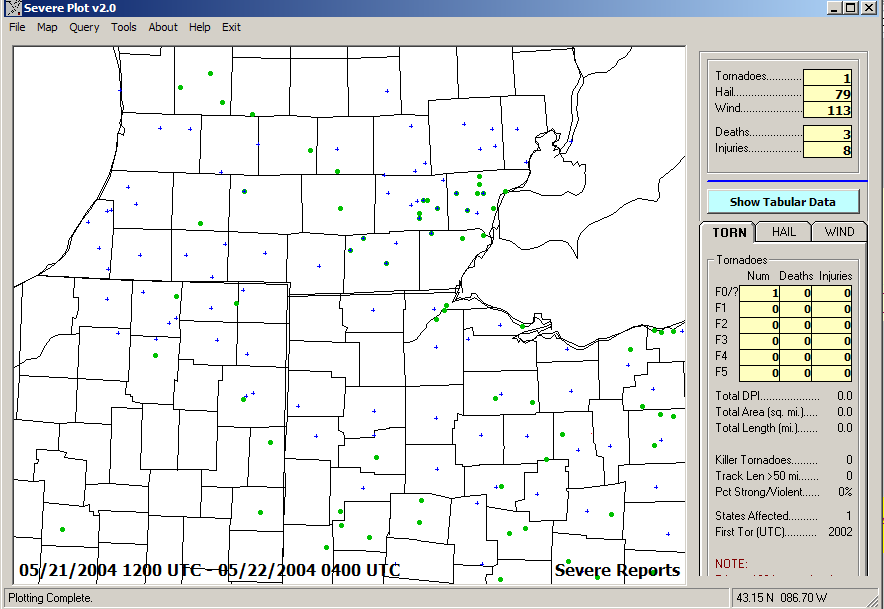
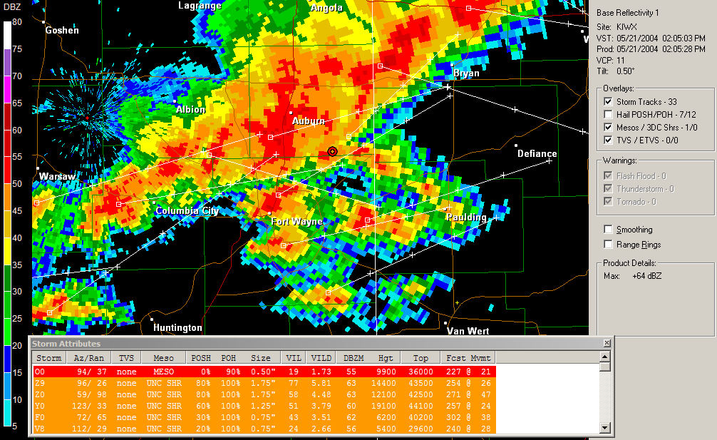
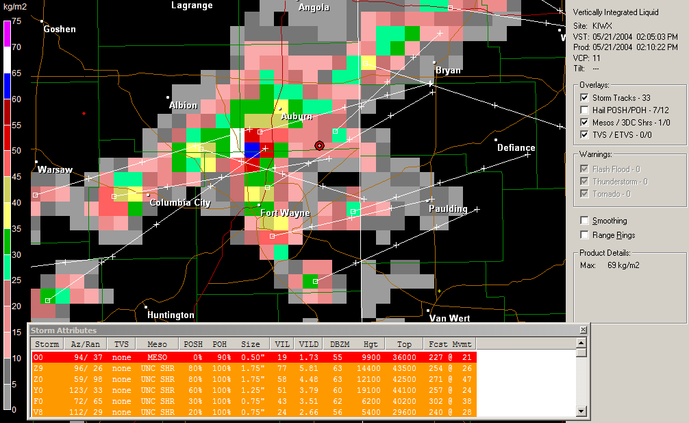
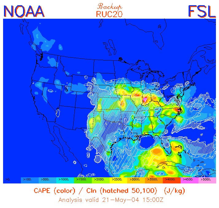
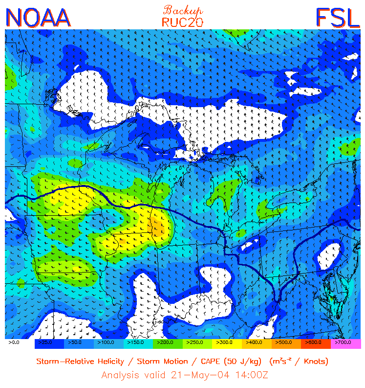
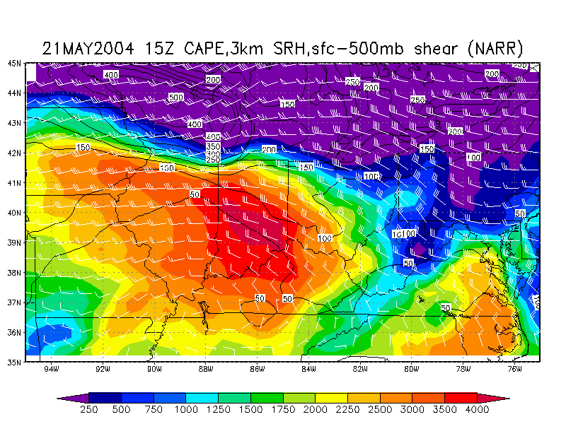
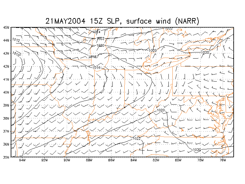
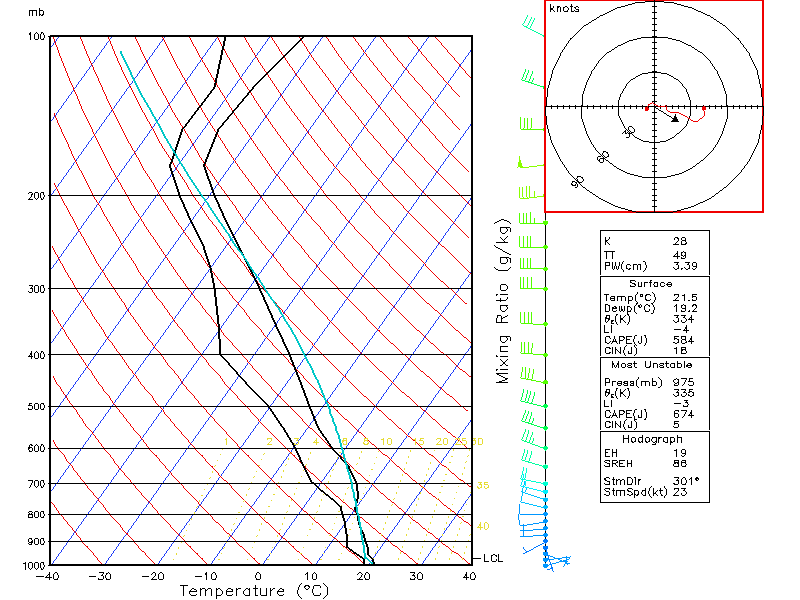
May 21, 2004 - The "Dark-Sky" or "Green-Sky" Derecho Storm Reports
Radar Loop VIL Loop
Reflectivity-zoomed
on Fort Wayne VIL-zoomed
on Fort Wayne Energy-Helicity
Index CAPE
Helicity CAPE/Helicity/Shear Composite (NARR) Surface wind/SLP (NARR) Toledo skew-T (NARR)
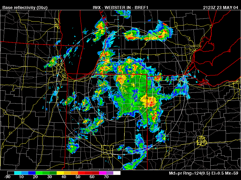
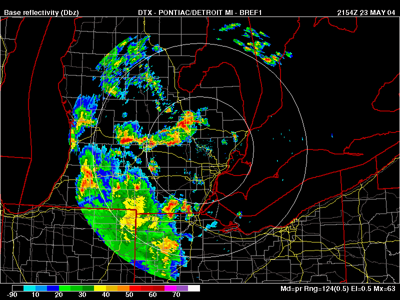
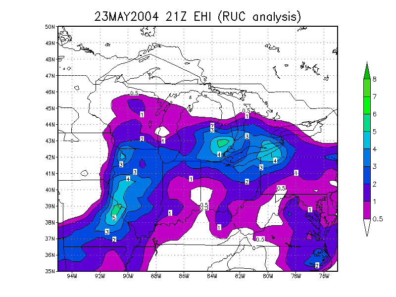
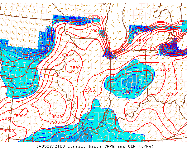
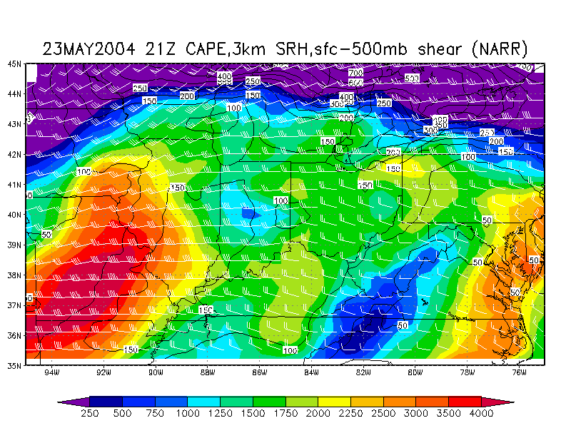
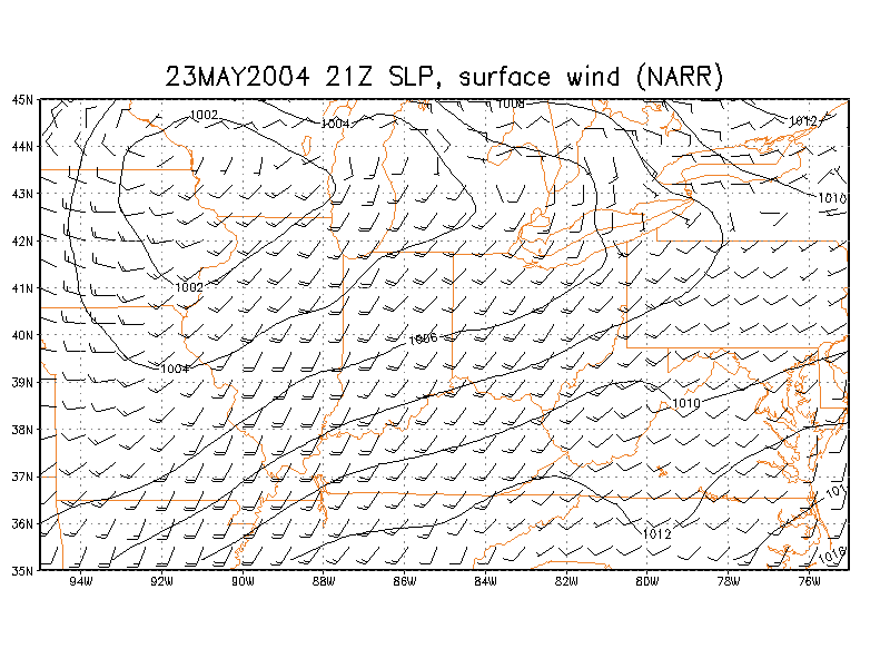
May 23, 2004 - "Thunderstorm" Wind Damage but no thunder near Toledo
Storm
Reports Radar
Radar
Energy-Helicity
Index CAPE CAPE/Helicity/Shear Composite (NARR) Surface wind/SLP (NARR) Toledo skew-T (NARR)
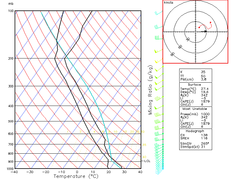
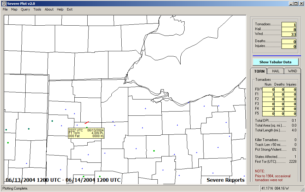
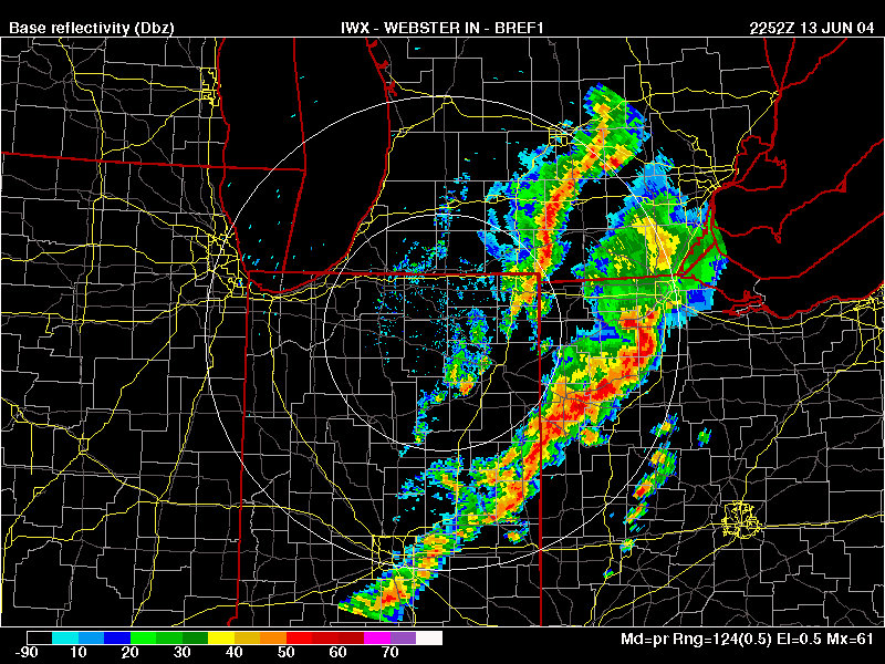
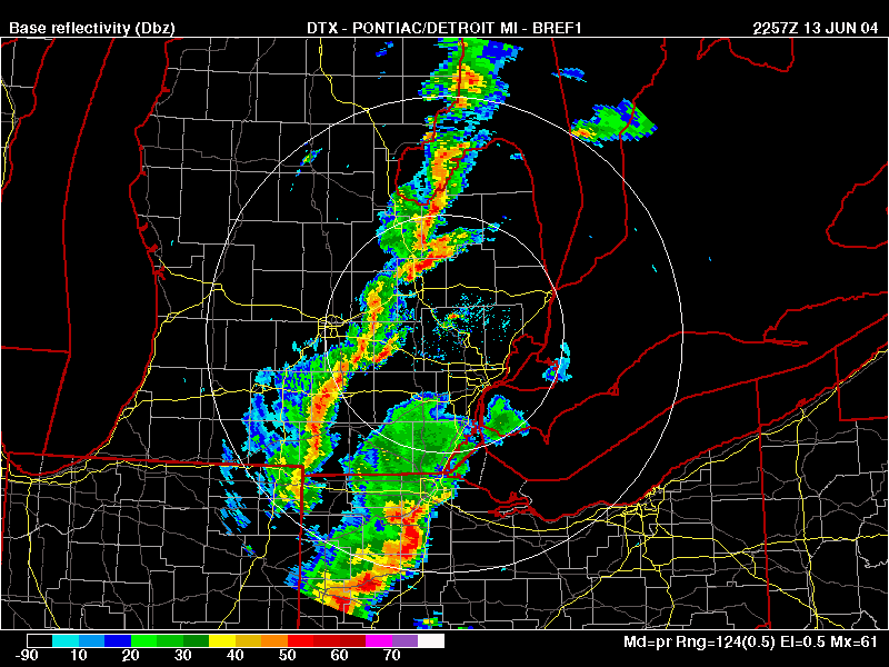
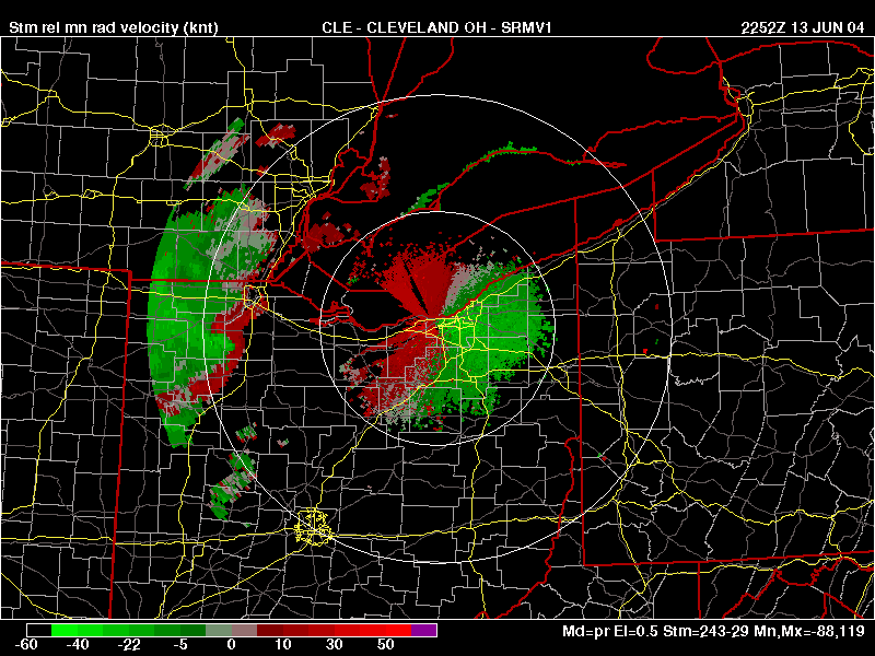
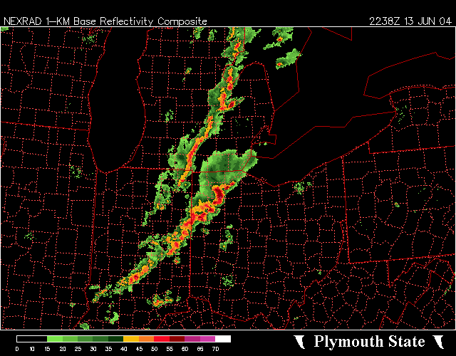
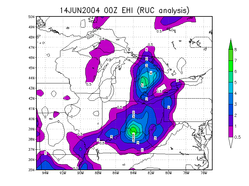
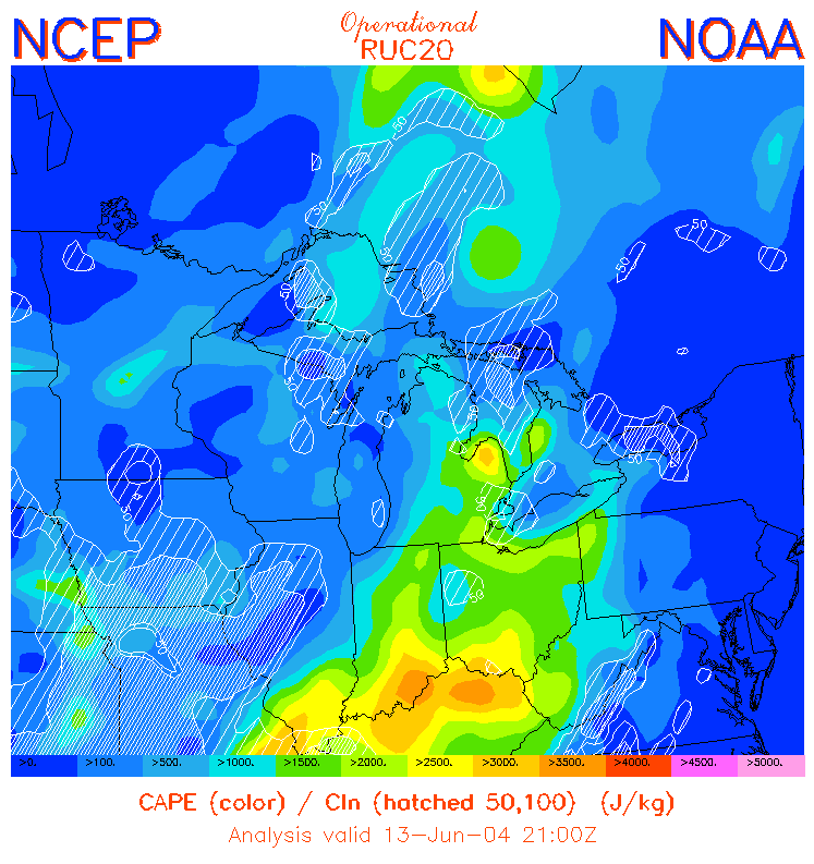
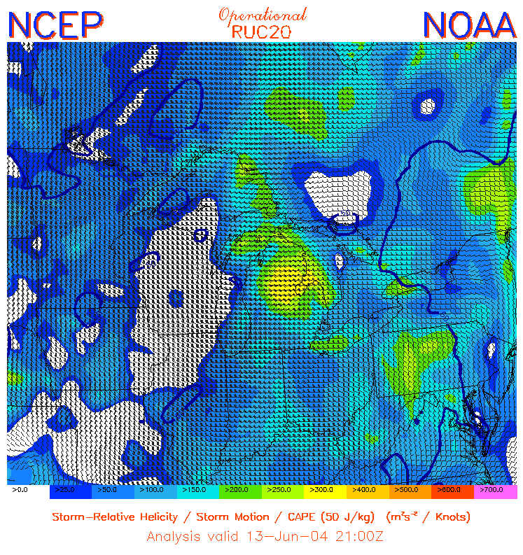
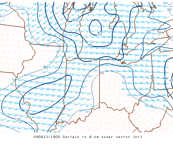
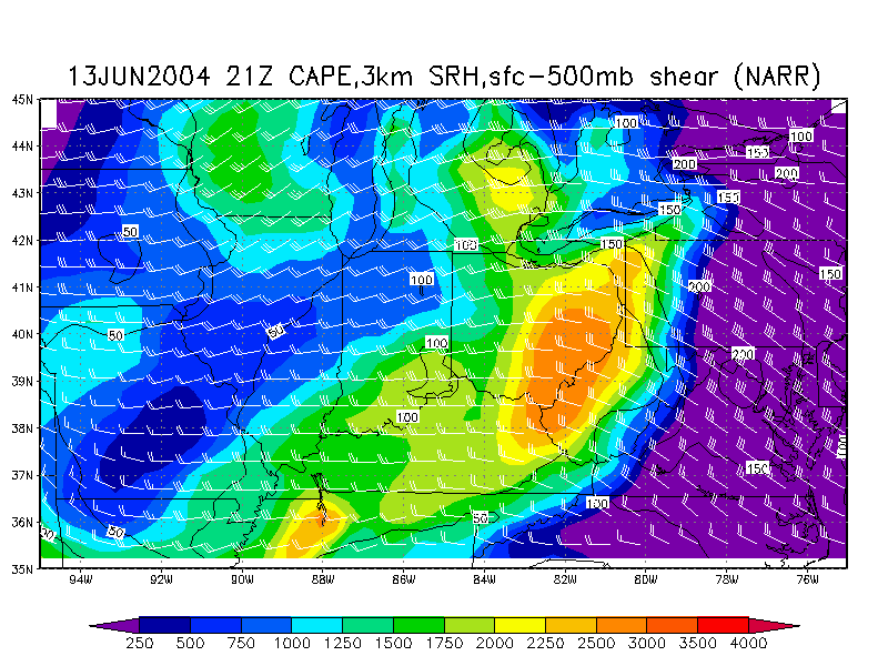
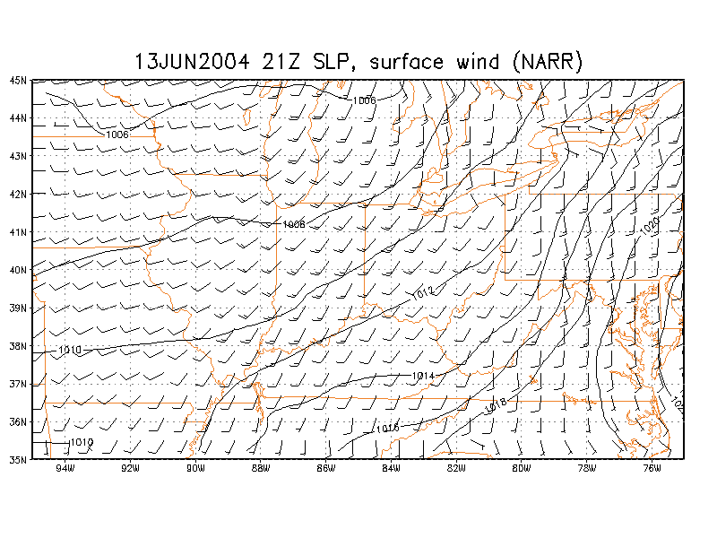
June 13, 2004 - Small bow in squall line/Derecho Storm Reports
IWX
DTX
CLE
Storm Relative Velocity Radar
Composite Energy-Helicity
Index CAPE
Helicity
0-6km
Shear CAPE/Helicity/Shear Composite (NARR) Surface wind/SLP (NARR) Toledo skew-T (NARR) Findlay skew-T (NARR)
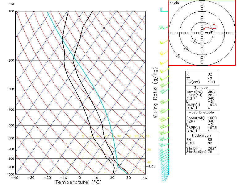
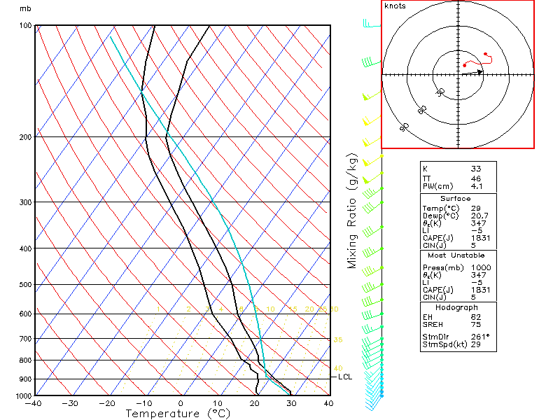
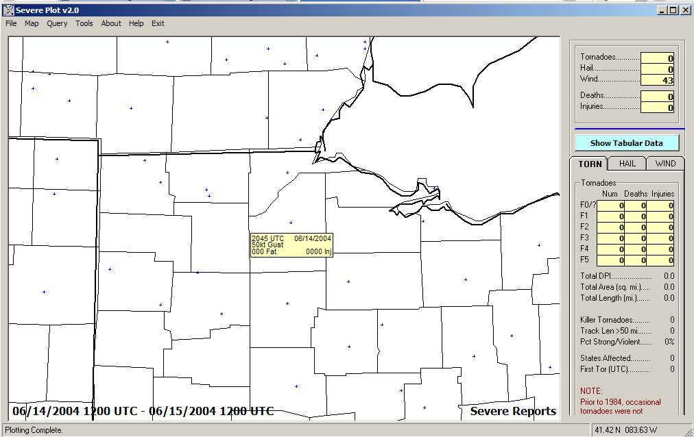
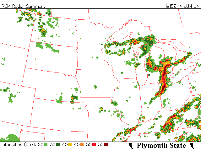
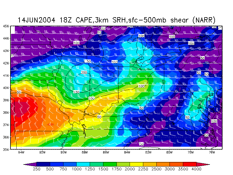
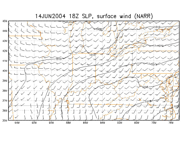
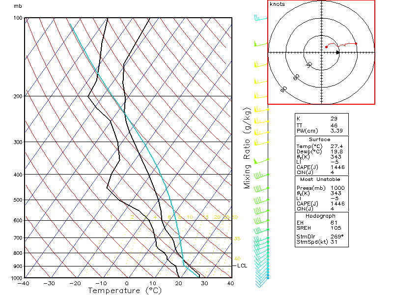
June 14, 2004 - Derecho Storm Reports
Radar
CAPE/Helicity/Shear Composite (NARR) Surface wind/SLP (NARR) Toledo skew-T (NARR)
2005
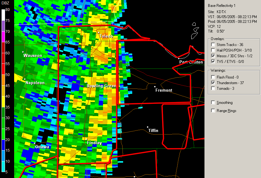
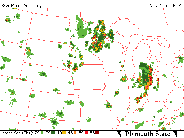
June 5, 2005 - Derecho Storm
Reports Radar at 8:22PM
Radar
- 7:45PM Supercell
Composite 7:00PM 0-6km shear (7:00PM) surface CAPE (7:00PM) surface wind and SLP (7:00PM)
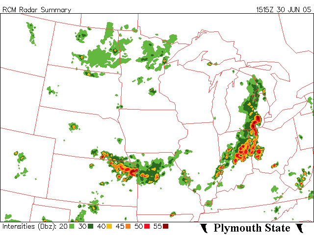
June 30, 2005 - Squall line in the morning, weak supercell in the
evening Storm
Reports Radar
(Morning) Evening Radar
Loop Supercell
Composite (1:00PM) 0-6km shear (1:00PM) surface CAPE (1:00PM) surface wind and SLP (1:00PM) Supercell
Composite (8:00PM) 0-6km shear (8:00PM) surface CAPE (8:00PM) surface wind and SLP (8:00PM)
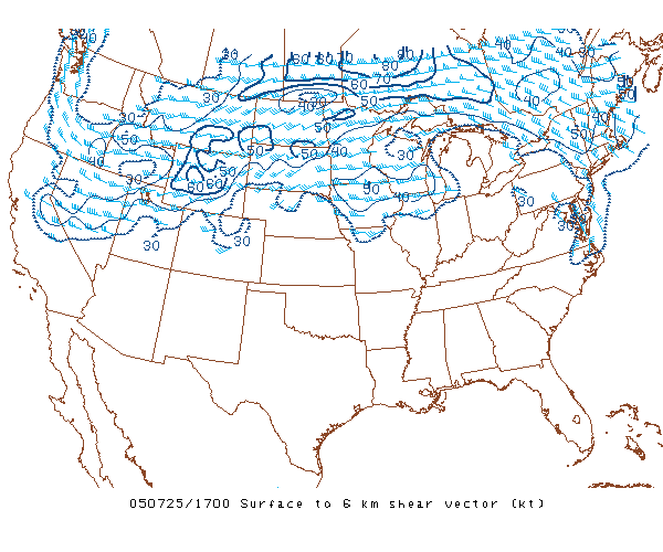
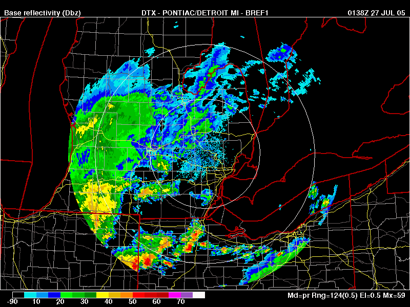
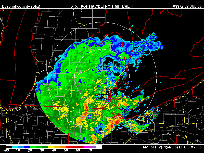
July 25, 2005 - Expanding squall line/Derecho began south and west of
Toledo Storm
Reports Radar
Supercell
Composite (1:00PM) 0-6km shear (1:00PM) surface CAPE (1:00PM) surface wind and SLP (1:00PM)
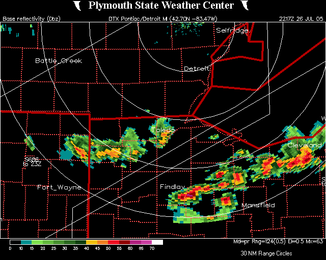
July 26, 2005 Storm
Reports Radar
Radar
Radar
Supercell
Composite at 7:00PM 0-6km shear (7:00PM) surface CAPE (7:00PM) surface wind and SLP (7:00PM)
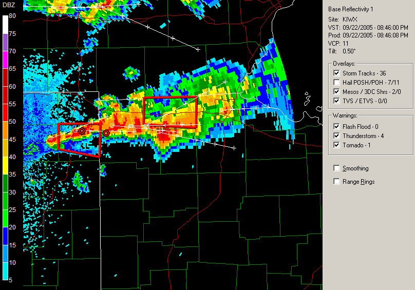
September 22, 2005 - Supercell developed in Branch County/Steuben
County Storm
Reports Radar
Supercell
Composite at 8:00PM 0-6km shear (8:00PM) surface CAPE (8:00PM) surface wind and SLP (8:00PM)
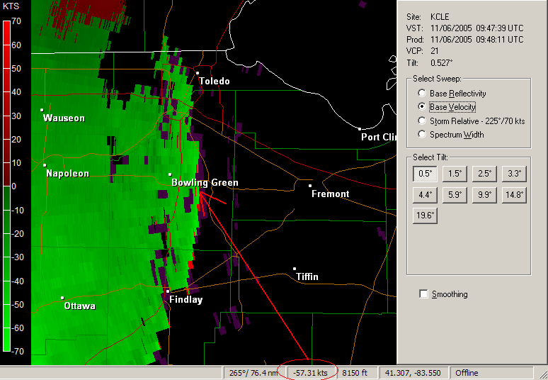
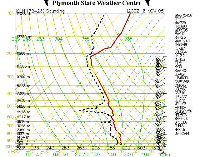
November 6, 2005 Storm Reports Wind damage generally occurred about 4:40AM in the area. Radar (reflec.) Radar (base velocity) Note: 57 knots toward the radar. US surface map at 5:00AM Strong 60-70 knot winds at 850mb over the region. Sounding from Wilmington (ILN) shows weak but measureable CAPE and very strong winds at all levels at 7:00AM - the CAPE is very unusual for a November morning
2006
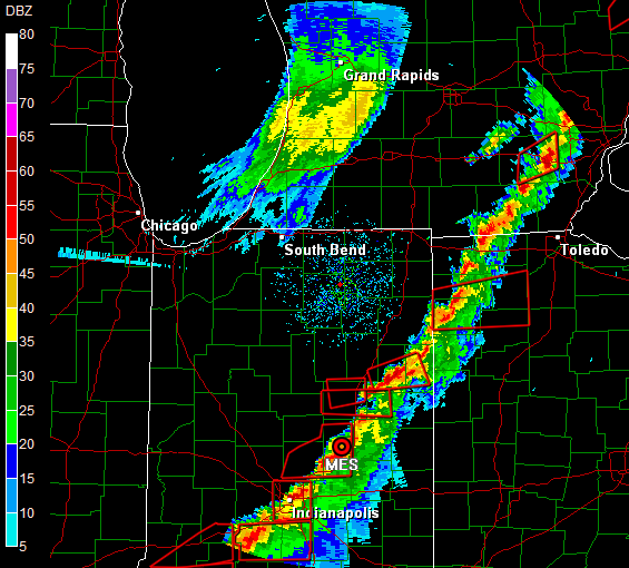
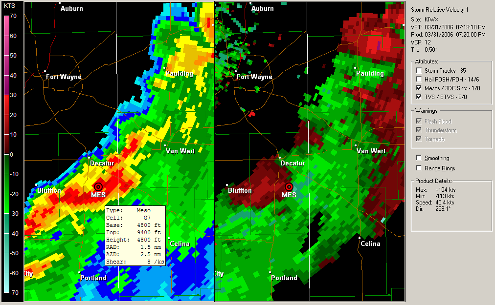
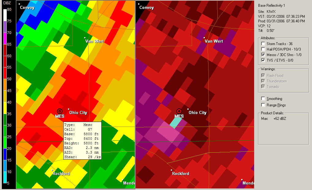
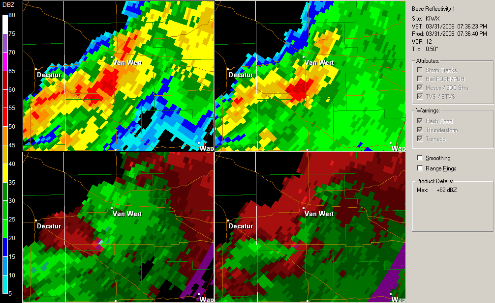
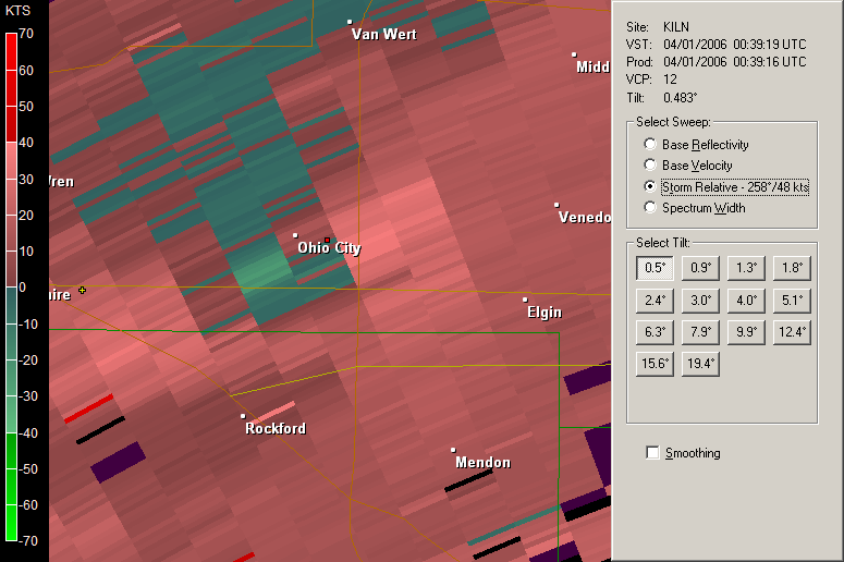
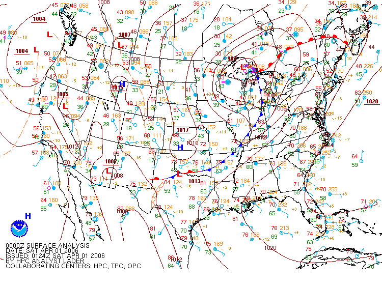
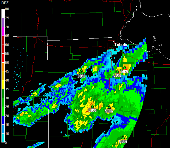
March 31 Storm Reports Some scattered wind damage and hail reports and a tornado at Ohio City, about 5 miles south of Van Wert, at 7:38PM. 7:06PM reflec. 7:19PM reflec./storm relative velocity 7:36PM reflec./base velocity 7:36PM reflec. 1+2/storm relative velocity 1+2 7:39PM storm relative velocity 1 Surface CAPE (7:00PM) MUCAPE (7:00PM) Effective shear (7:00PM) Effective helicity (7:00PM) US Surface (7:00PM)
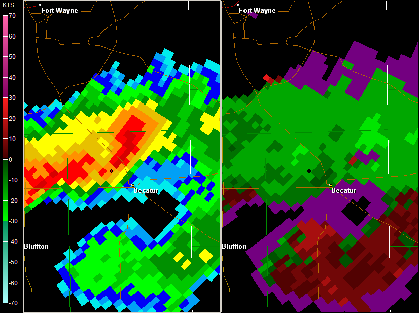
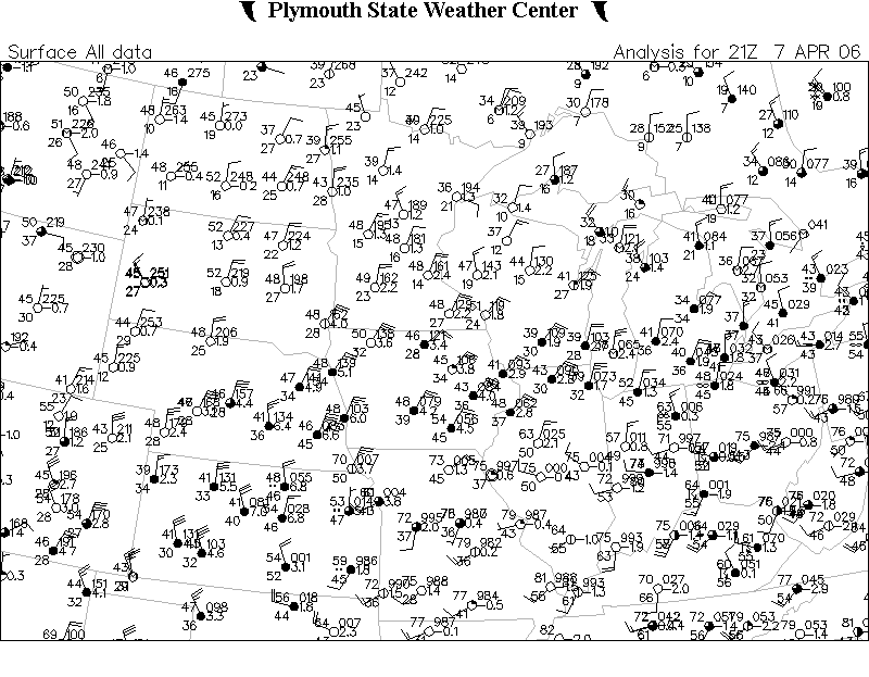
April 7 Storm Reports Some scattered large hail reports and a tornado near the Ohio/Indiana border. 452PM reflec. (Hail in Wood County) 5:13PM reflec. 1/storm relative velocity 1 (Tornado) 5:00PM midwest surface - it was cool with a north wind. Yet, the Supercell Composite, based off the MUCAPE, was above 1 or even 2 near the tornado
April 22 Storm Reports Some scattered large hail reports, one in Sylvania, one north of the border in Petersburg, MI, and a few much later in northern Ohio.
May 25 Storm Reports Everything but the kitchen sink. Something like 50-70 hail and wind reports in western Ohio. Supercell Composite
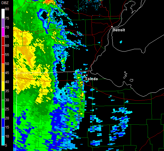
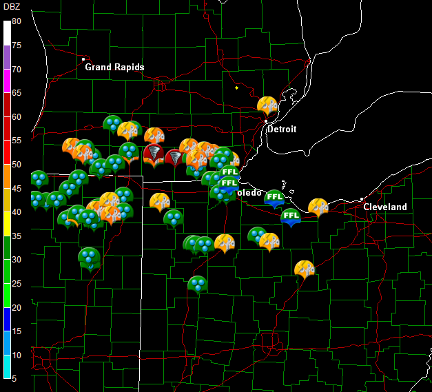
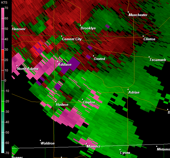
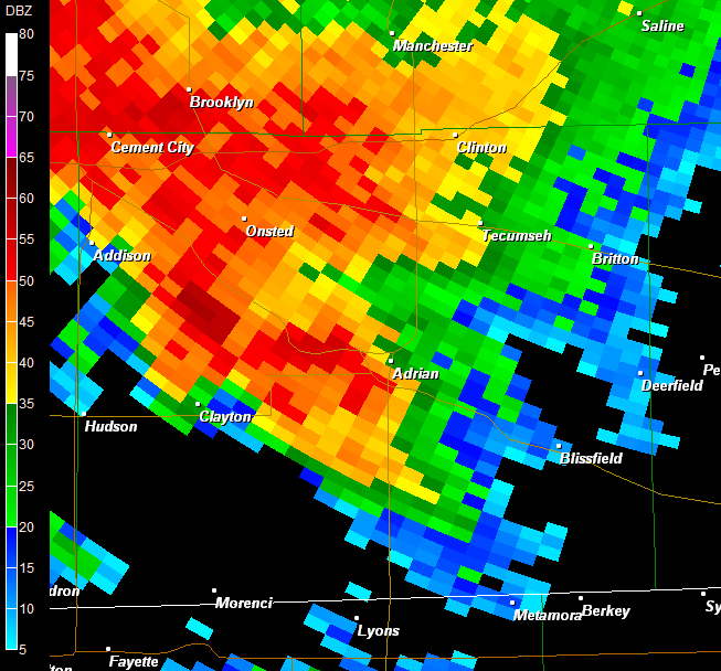
June 21 Storm Reports Prelim storm reports from NW Ohio and SE Michigan 2140z storm relative velocity - only minutes before the tornado report near Addison, MI 2153z reflectivity - minutes after the tornado report near Addison, MI Several reports of golf-ball or larger size hail, a tornado west of Adrian, MI, possible tornado near Lambertville, MI (Toledo suburb) - status on that is still unknown, some reports of significant wind damage, and numerous areas of flash flooding and urban flooding
June 22 Storm Reports Prelim storm reports from Ohio 208pm EDT radar 308pm EDT radar - near the time of the Lima tornado Several reports of wind damage, a tornado and straight line wind damage around Lima, some large hail reports. There was aggravated flooding in Toledo and surrounding areas, numerous areas of flash flooding and urban flooding in north central Ohio, particularly Norwalk.
July 26 Storm Reports
October 2 Strong winds caused one of the two minarets from a local mosque in Perrysburg Township to fall over. (Storm Data)
2007
March 14 Storm Reports some scattered storm reports
May 1 Storm Reports Many hailstorms in the Toledo area
May 15 Storm Reports some wind damage reports
June 3 Storm Reports wind damage in Toledo
June 8 Storm Reports some wind damage reports
June 21 Storm Reports a few wind damage reports
The purpose is to provide high quality information on historical storms
and provide links to weather information.