This page is about storm systems in North America that can be characterized by two or three
upper level lows (or vortices or troughs) that merge together to create a bigger or more
intense storm, sometimes resulting in a snowstorm.
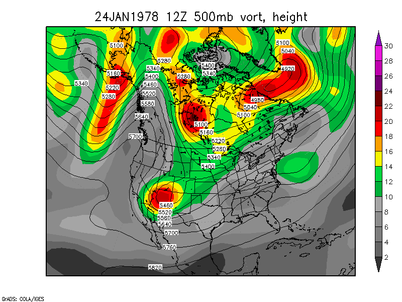
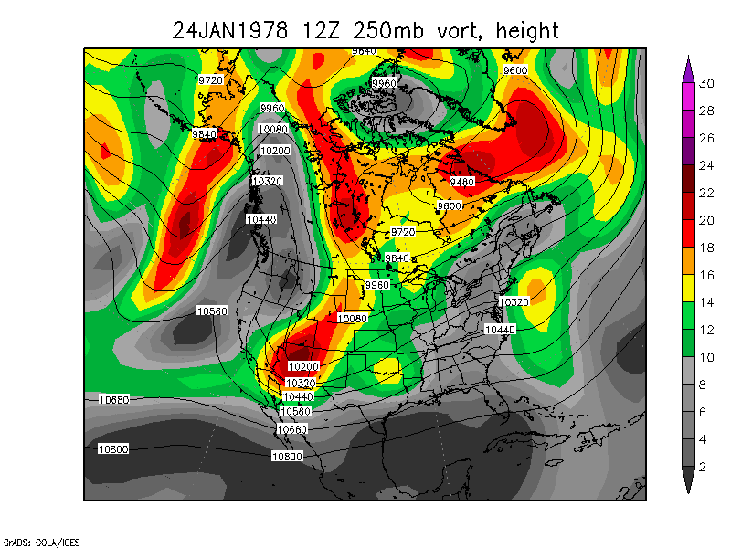
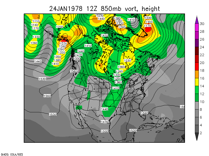
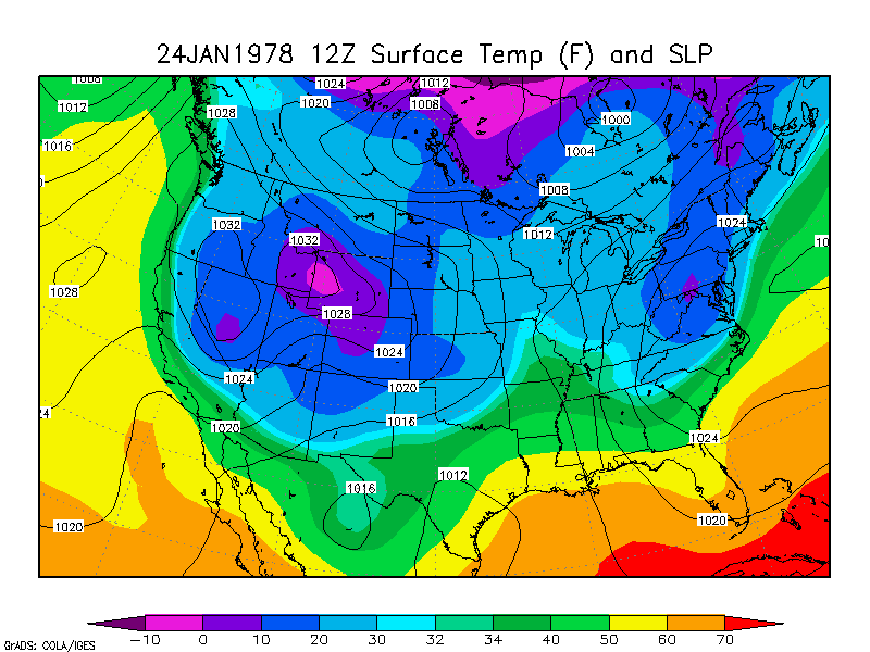
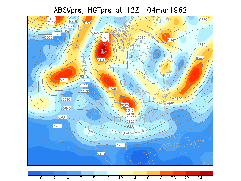
Midwest Blizzard of '78
January 24-27, 1978 250mb loop 850mb loop Surface Temp and SLP
loop
Essentially Two-vort max powerful phasing. Did three branches of the
jet stream phase together You decide: 500mb Wind
Speed Loop (0.2MB) 250mb Wind
Speed Loop (0.2MB)
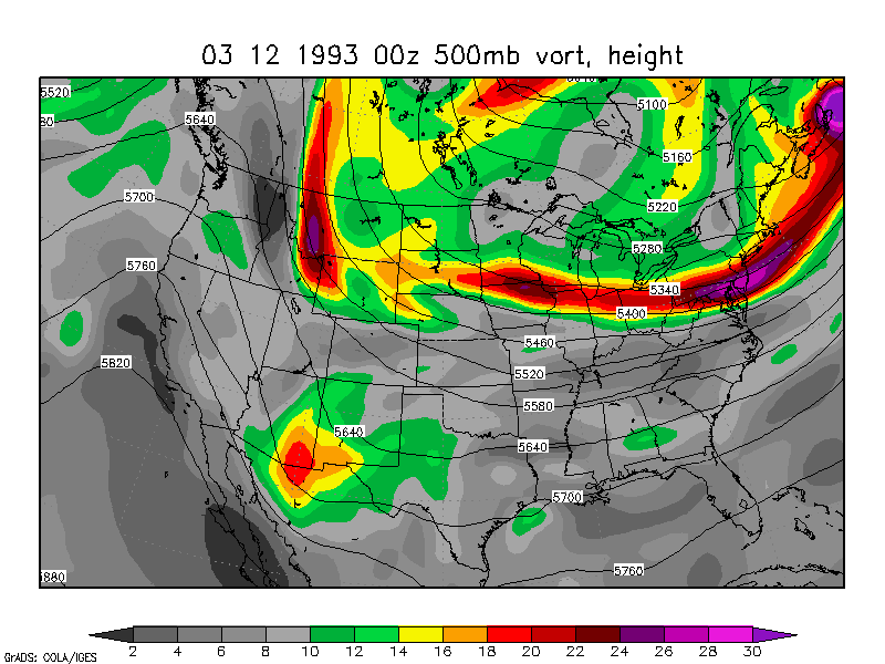
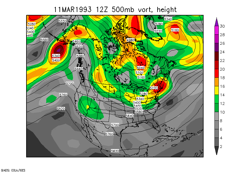
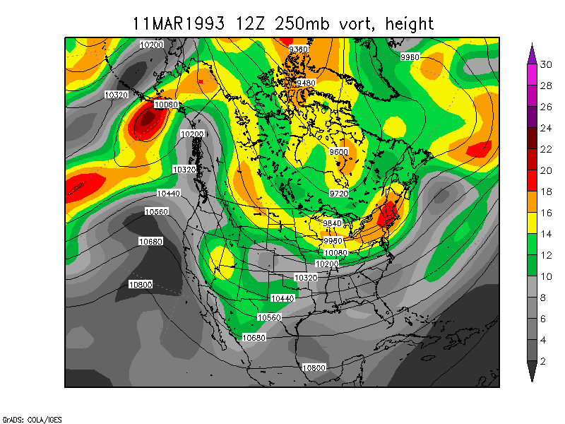
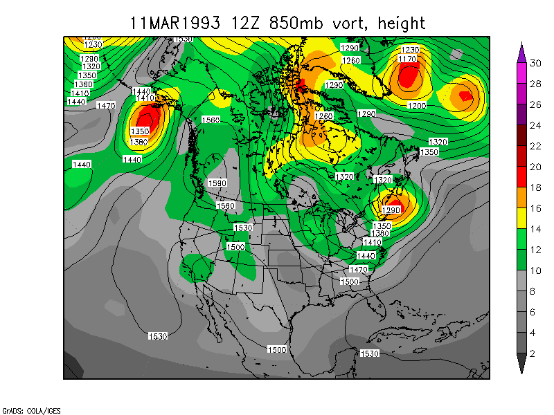
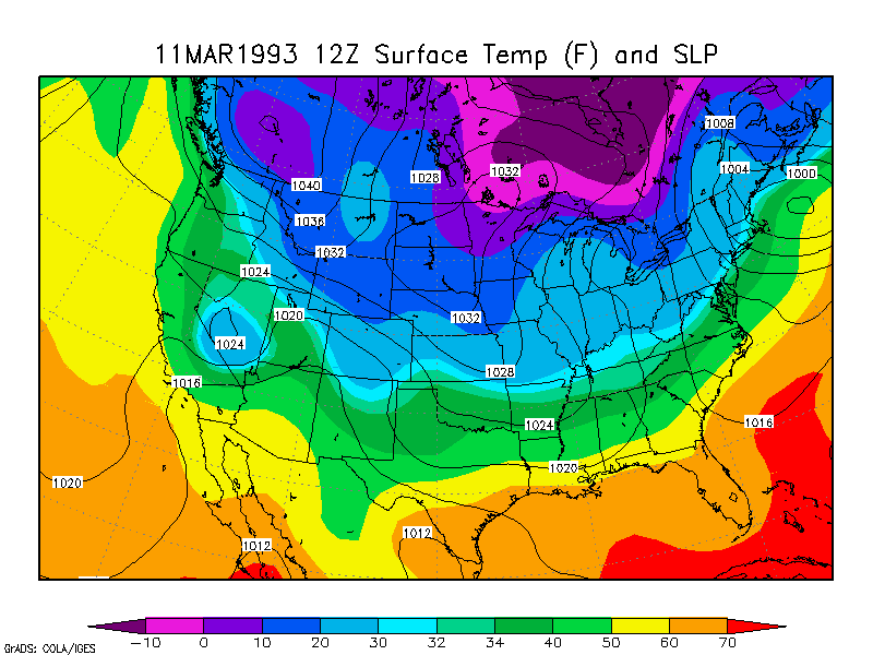
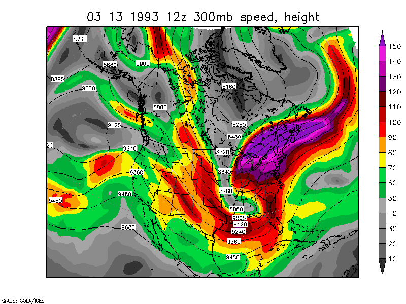
Superstorm East Coast storm.
March 12-14, 1993 NARR animation
NCEP Reanalysis
Animaton 250mb
loop 850mb loop Surface loop
Three-vort max powerful phasing
March 13, 1993 12z
300mb wind speed
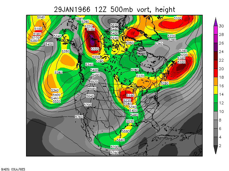
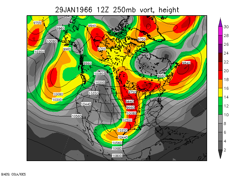
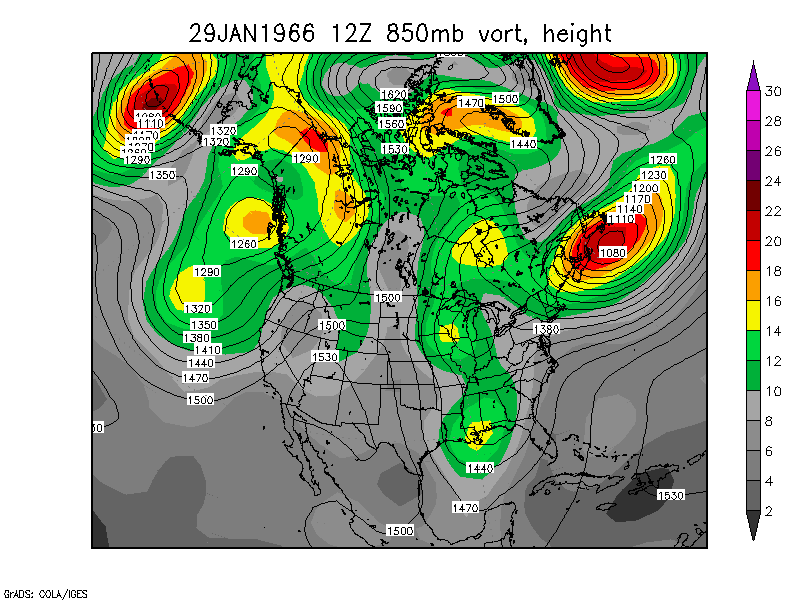
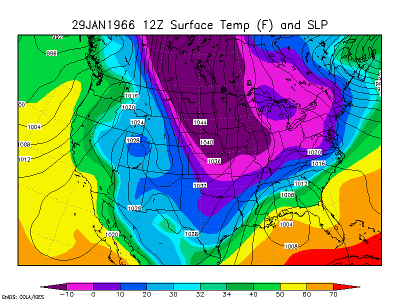
Washington Blizzard of '66 East Coast
Storm - Two-vort max powerful phasing
January 28-31, 1966 250mb loop 850mb loop Surface Temp and SLP
loop
Did three branches of the jet stream phase together? 500mb Wind
Speed Loop (0.2MB) 250mb Wind
Speed Loop (0.2MB)
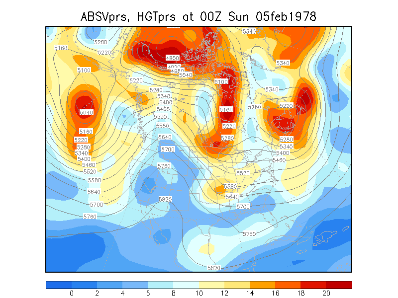
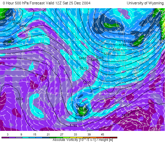
Northeast Blizzard of '78: East Coast
Storm. I think this at least partly had phasing. It's
interesting to note the surface low did a small loop near Cape Cod and Long
Island. February 5-8, 1978
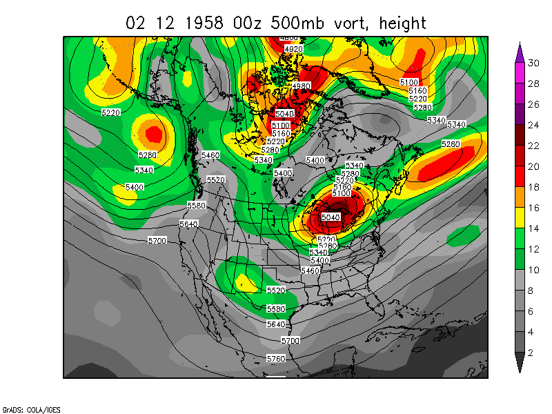
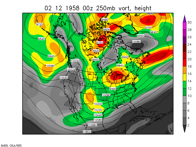
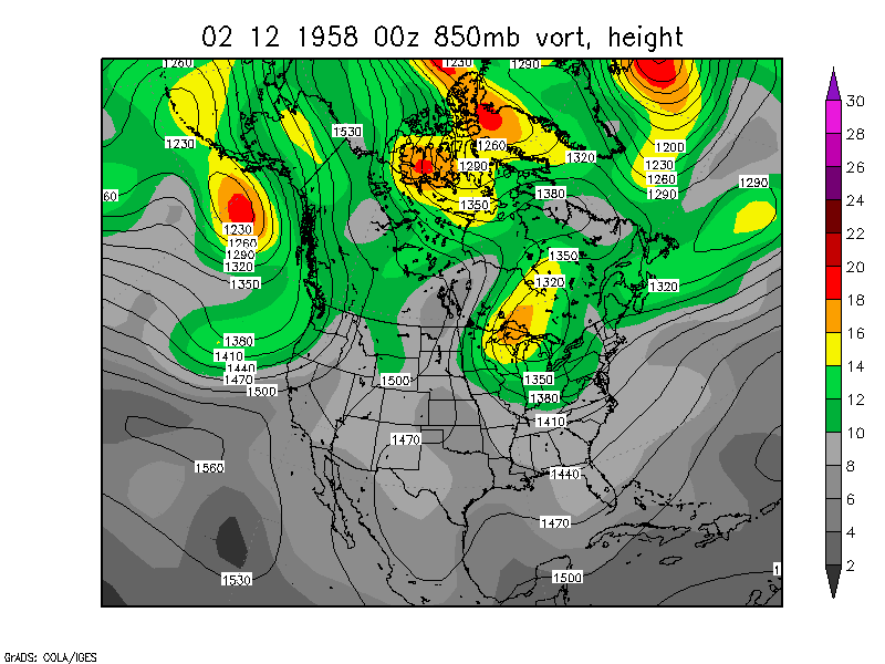
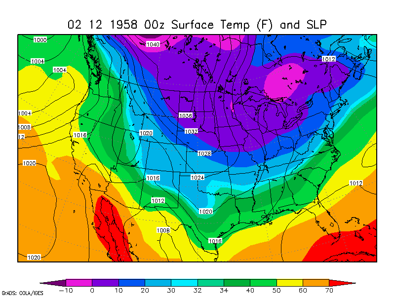
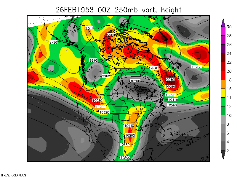
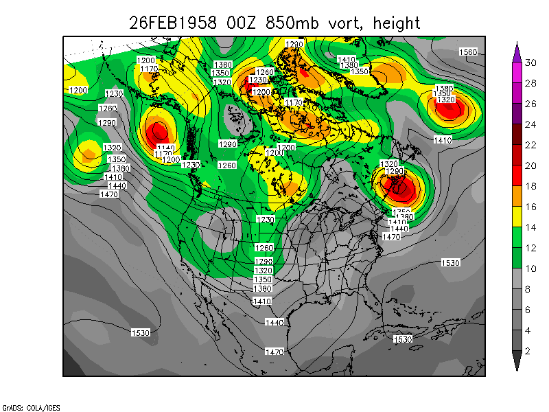
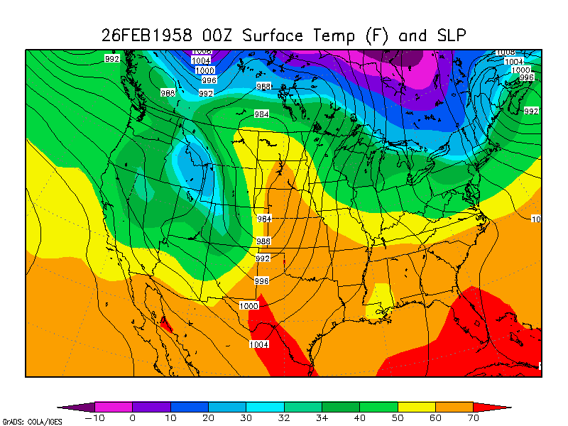
February 1958 East Coast Snowstorm.
This loop is 7 days long - you can see one storm develop offshore and
phase with the polar vortex and then move to Newfoundland before the
February 16-17 storm (the real snowstorm.) This looks like it just
might be Three-vort max phasing on February 16-17. 500mb loop of February 12-19,
1958 250mb loop 850mb loop surface temp and SLP loop
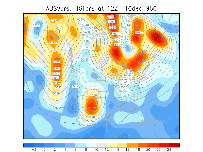
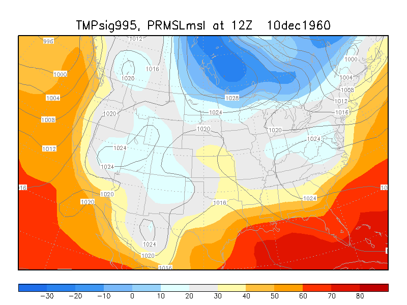
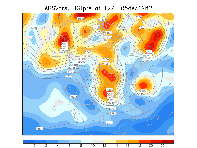
December 1960 East Coast Snowstorm.
This seems to be pretty good Two-vort max phasing. 500mb loop of December 10-13,
1960 Surface loop
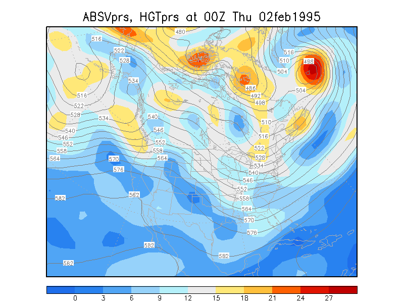
February 1995 East Coast Snowstorm.
500mb loop of February 2-4,1995
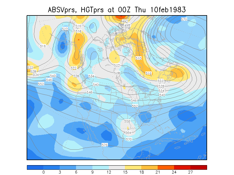
February 1983 East Coast Snowstorm.
500mb loop of February 10-13,
1983
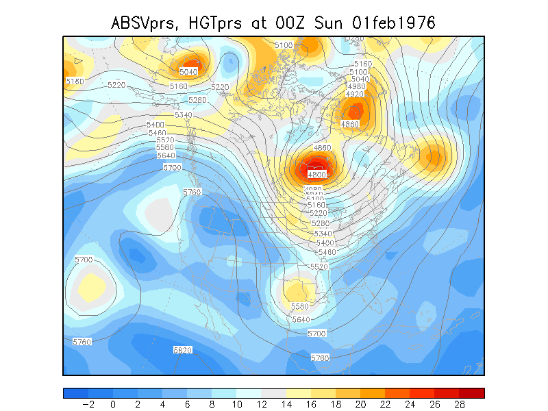
Other Strong Phasing Storms
Nearly a three-vort max phasing resulted in a 944mb low in
Quebec February 1-3,
1976
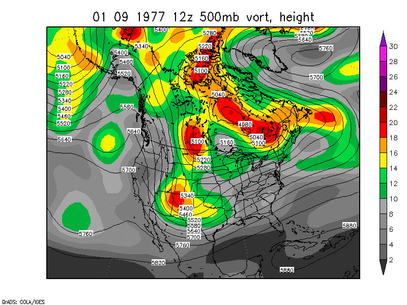
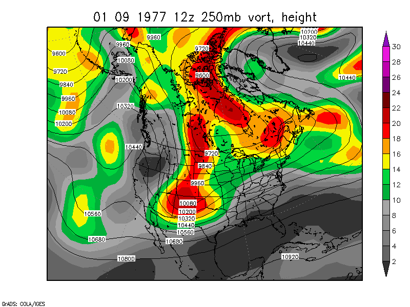
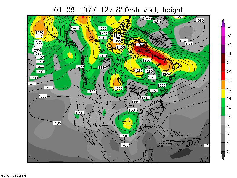
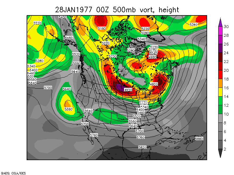
Two-vort max powerful phasing -snowstorm for Toledo, Indiana,
Ohio, Kentucky, others. January 9-11, 1977 250mb loop 850mb loop Surface temp and SLP
loop
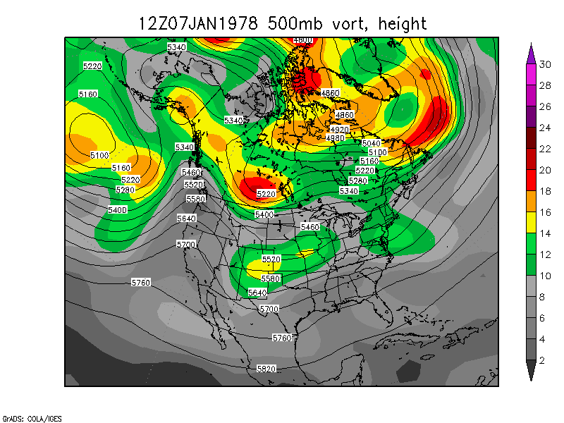
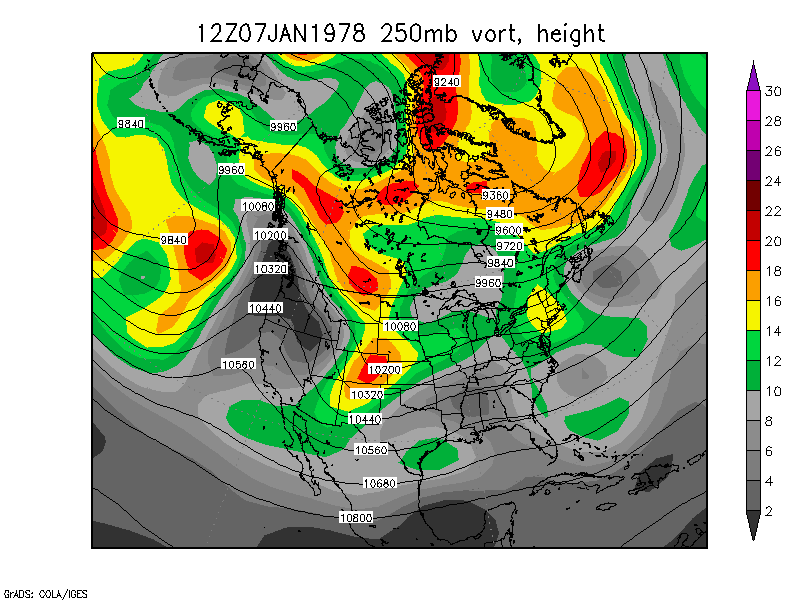
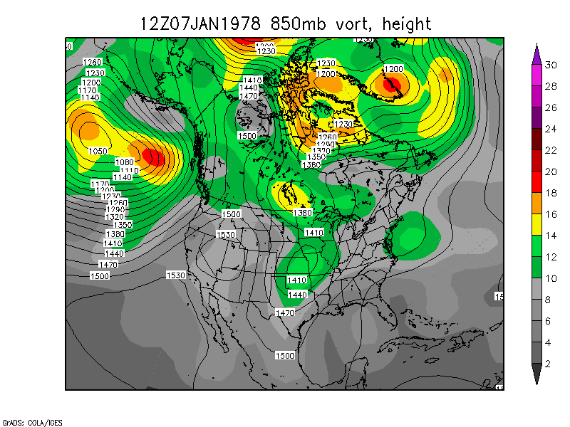
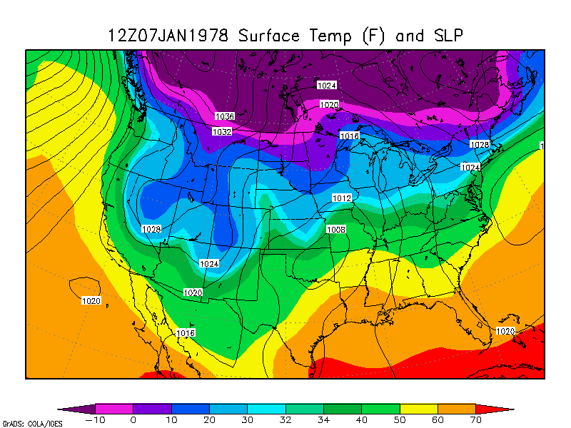
Three-vort max phasing January 7-10, 1978 250mb loop 850mb loop Surface temp and SLP loop
This storm is also mentioned in Dean and Bosart (1996) and resulted
in a surface low of 964mb in Quebec.
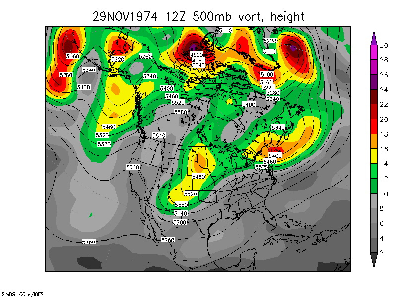
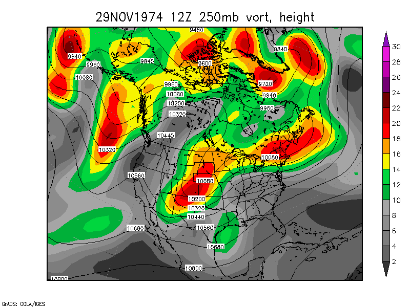
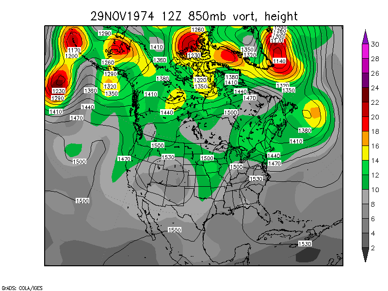
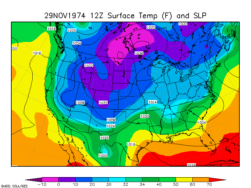
Detroit Snowstorm of 1974
November 29 to December
3, 1974 250mb
loop 850mb loop
Surface loop
Two-vort max phasing in the Plains occurred before the Great Lakes
snowstorm
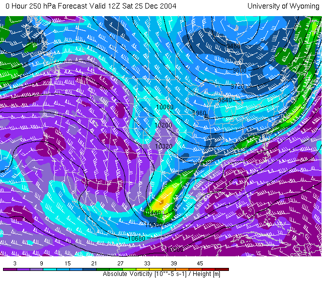
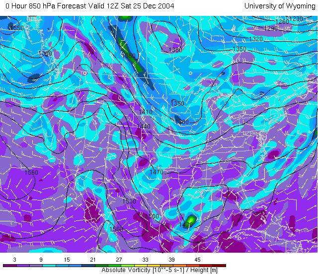
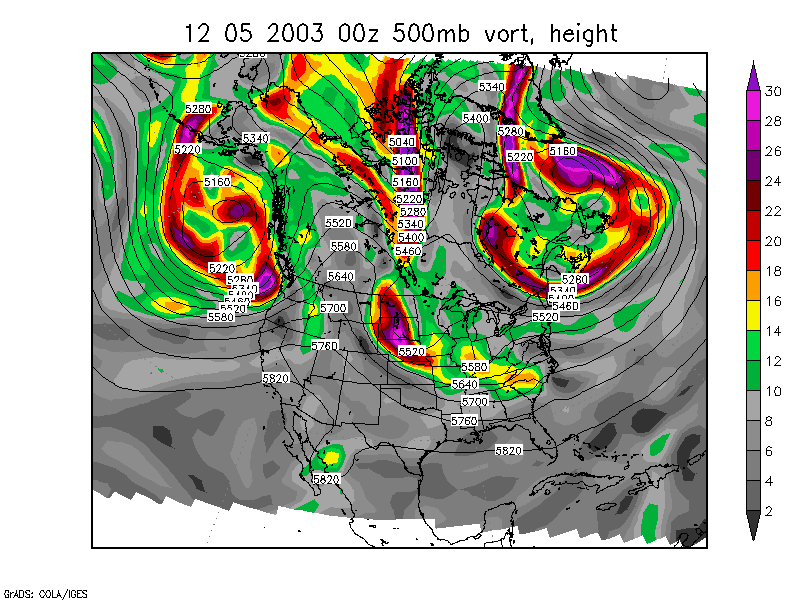
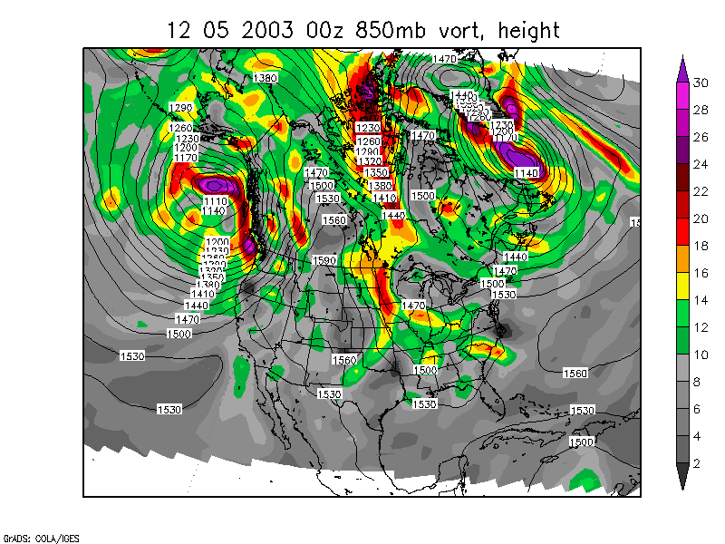
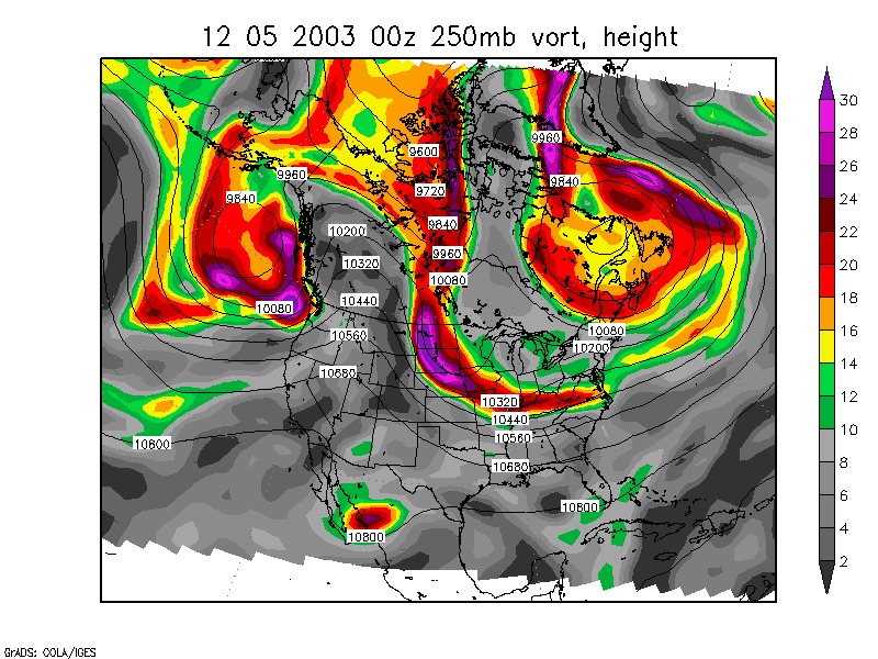
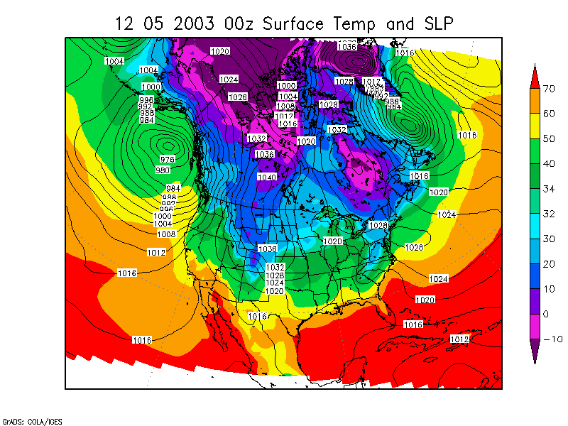
offshore to Halifax NS February 19,
2004
offshore to Cape Cod/Halifax NS December 26, 2004 250mb vorticity animation
850mb vorticity
animation
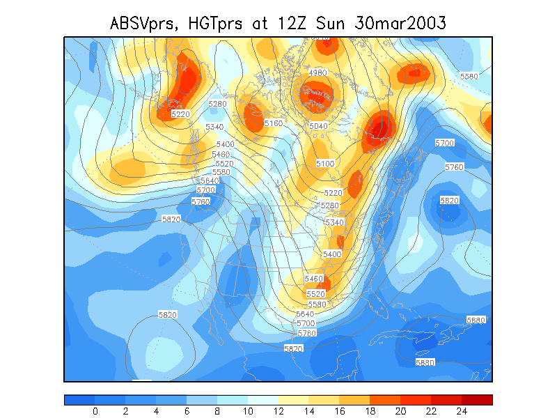
- Appalachians snowstorm March 30 - April 1,
2003
- New England storm December 5-8, 2003 (GFS 0
hour) 850mb
Animation 250mb
Animation Surface
Animation
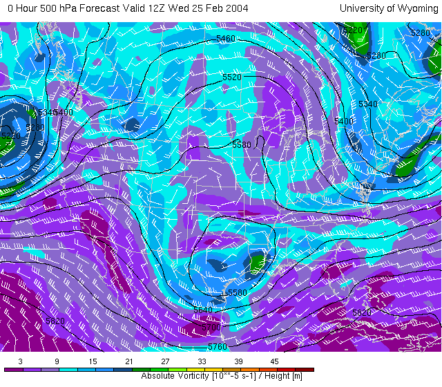
- Some less intense phasing in the Charlotte Snowstorm February 25 - 27, 2004
This was complicated, but I think it counts as phasing and a TROWAL
in the Northeast US and southeast Canada.
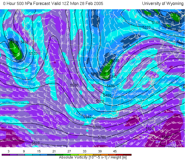
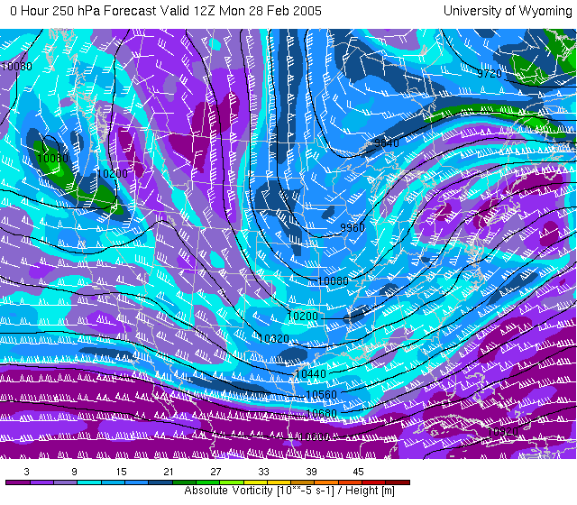
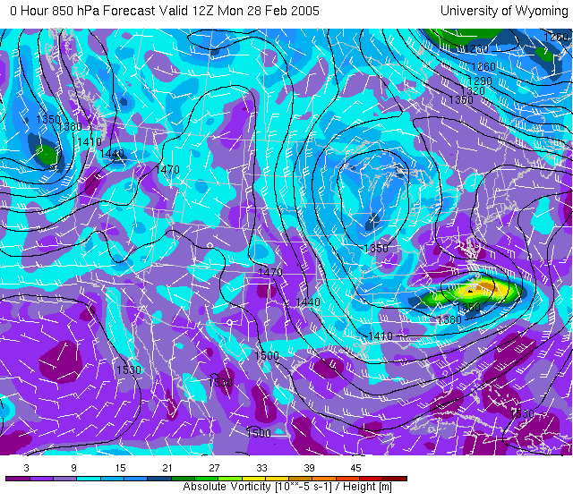
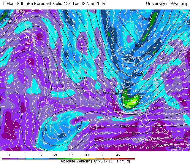
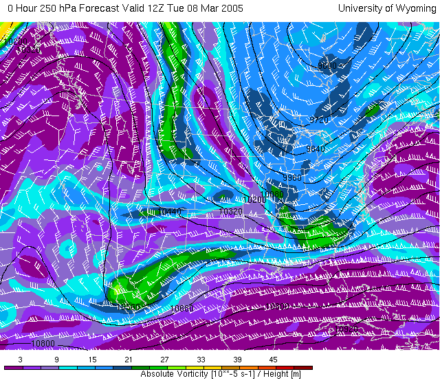
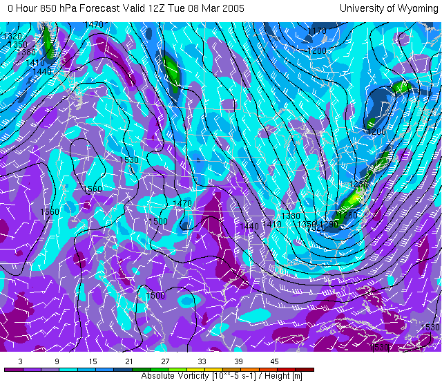
February 28 - March 3, 2005
250mb vorticity
animation 850mb
vorticity animation
Some type of phasing and surface low possibly in the 940's (mb) range
offshore from Maine
March 8-10, 2005 250mb vorticity
animation 850mb
vorticity animation
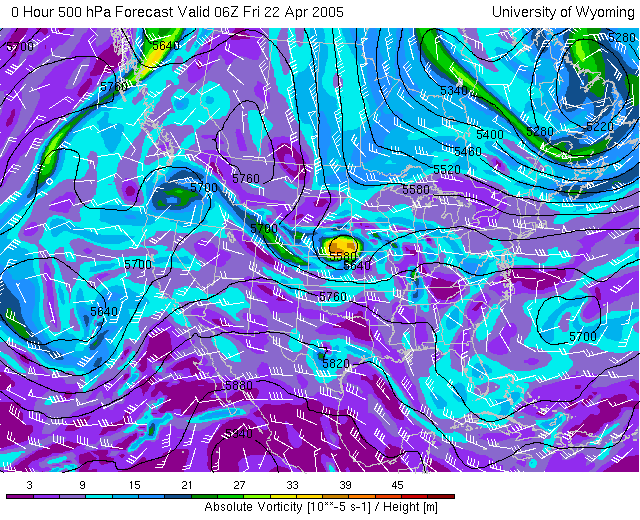
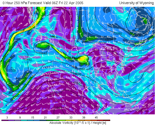
April 24, 2005 Great Lakes
snowstorm, TROWAL 250mb vorticity
animation
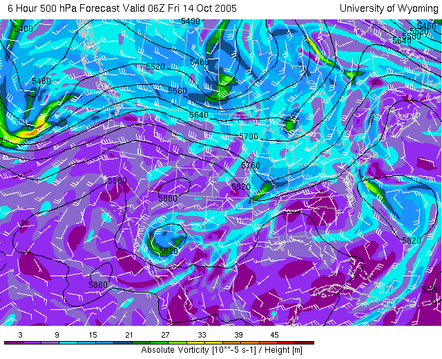
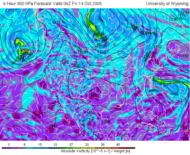
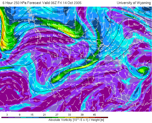
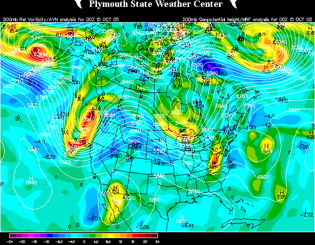
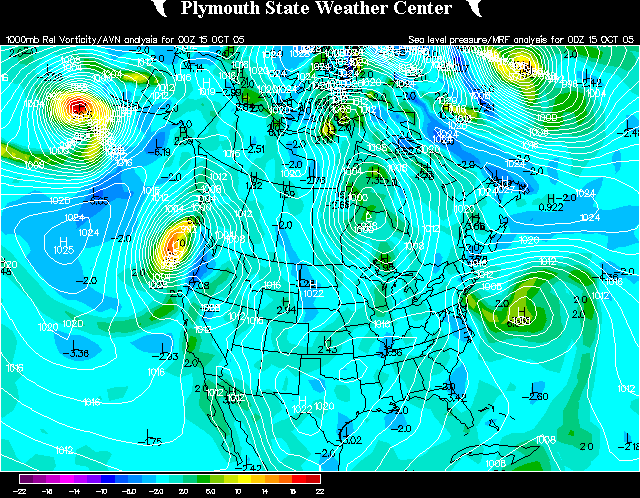
October 14-16, 2005 - New
England Floods/Non-named subtropical low 850mb vorticity loop 250mb vorticity loop
another 500mb
loop 1000mb
vorticity/ Sea level pressure loop
Most of the flooding occurred before these two storm systems really
phased together. You might even argue for 3 different vort maxes
getting involved.
December
13-16, 2005 500mb vorticity loop 850mb
vorticity loop 850mb wind
speed loop 250mb vorticity loop
Surface
Analysis loop
Two upper vort maxes sort of combined in the Great Plains, then a
upper vort max/surface low generated on the Gulf Coast and moved
northeast, sort of merging with the other low .
January
12-15, 2006 500mb vorticity loop 850mb
vorticity loop 850mb wind
speed loop 250mb
vorticity loop Surface
Analysis loop Tropopause
Pressure
Strong trough amplification and slow phasing, mostly a rain storm,
but a pretty good snow storm for a small portion of Massachusetts and
New York, with some snowfall in eastern New York, New Jersey and New
England.
January
30-February 1, 2006 500mb vorticity loop 850mb
vorticity loop 850mb wind
speed loop 250mb
vorticity loop Surface
Analysis loop Tropopause
Pressure
Strong trough amplification, development of a strong ocean storm,
possibly considered a bomb.
February
3-5, 2006 "Super Bowl Snowstorm" 500mb vorticity loop 850mb
vorticity loop 850mb wind
speed loop 250mb
vorticity loop Surface
Analysis loop Tropopause
Pressure
Strong trough amplification, development of a strong low that tracked
through eastern Kentucky, Ohio, and southern Ontario, possibly
considered a phasing system. The storm dumped several inches of snow
north of Detroit in the Thumb of Michigan, one day before the Super
Bowl, and also hit areas north and east of Lake Huron, like Sudbury,
Ontario, pretty hard.
April
2-9, 2006 500mb loop Surface
loop Two consecutive large scale phasing systems. On April 3-4,
the cold upper low over Hudson Bay joined into a storm system moving
through the Midwest and Mid-Atlantic, forming two noreaster type
lows. On April 7-8 (and 9th) another cold upper low in northern
Ontario acted as a crusher for the storm system that moved from the
Plains to the Tennesee Valley to the Southeast.
May 2006
500mb loop Incredible 15-day loop.
October
27-29 2006 500mb loop Ohio Valley/Northeast storm amplification.
November
14-16 2006 500mb loop Oklahoma/Tennessee Valley/Ohio Valley storm
amplification.
March 7-9, 2008 - snowstorm from Texas to the Ohio Valley to Canada. Phasing of upper troughs
occurred in the Ohio Valley area (loop to be added later)
Other storms with phasing
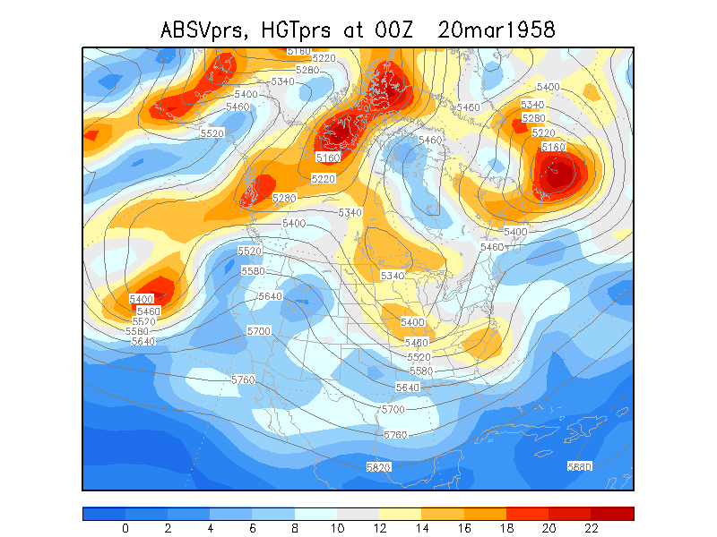
March '58 East Coast storm. You decide if this is
phasing or not. March
18-23, 1958
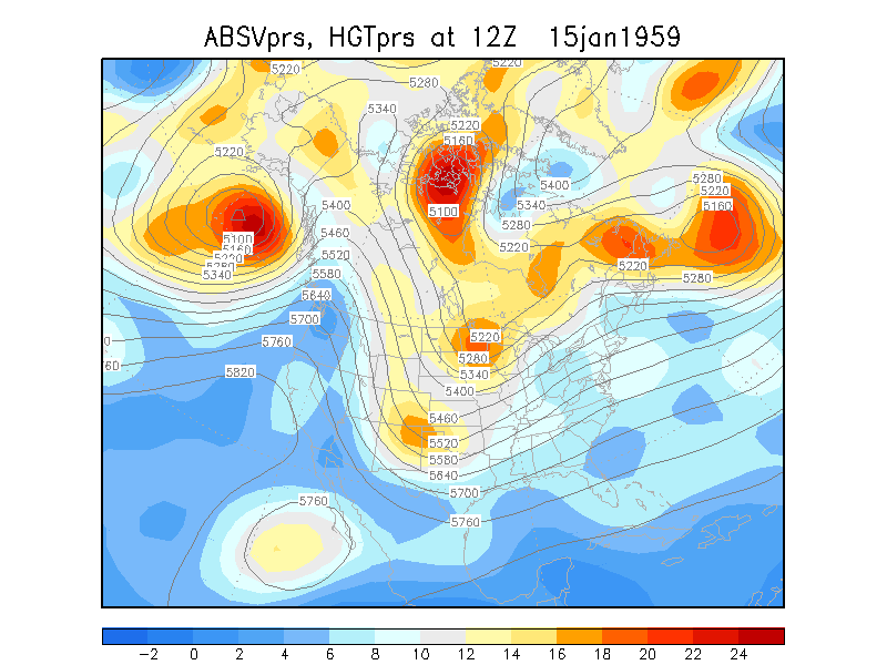
- OH Floods of 1959, ended up as a 976mb () low pressure in Quebec January 15-17, 1959
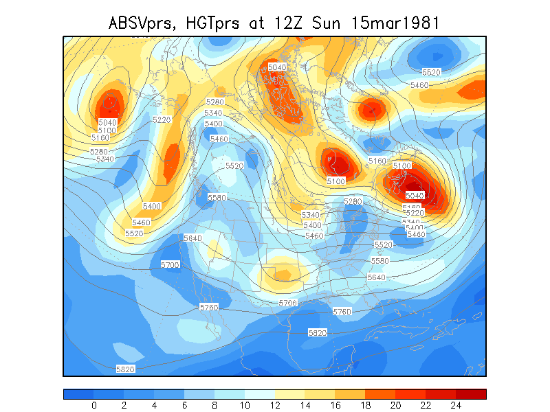
- Ash Wednesday Storm. You decide if this is phasing or not. March 4-6, 1962
- It looks like this one really changed a lot in 24 hours March 5-7, 1965
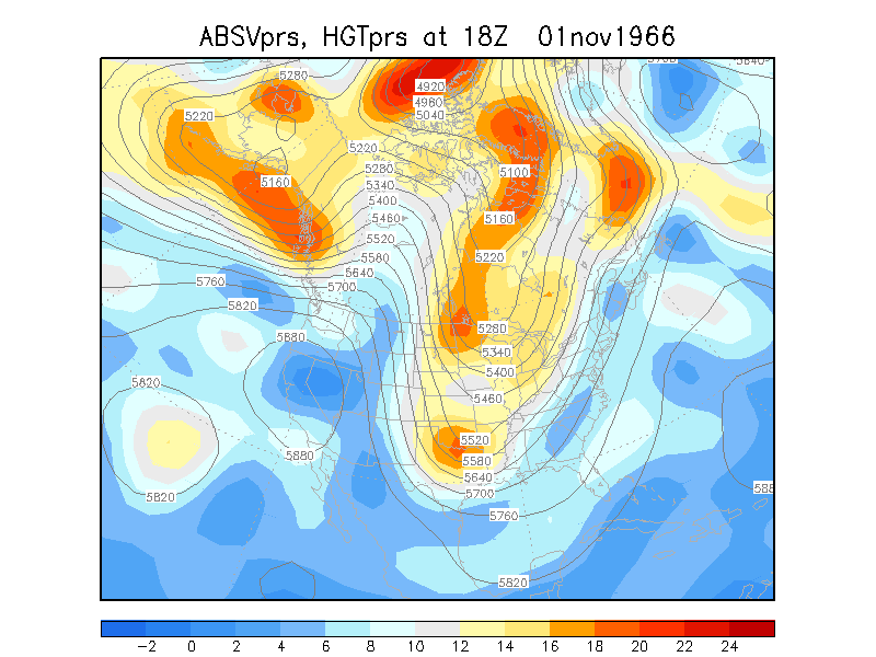
- Snowstorm for Toledo, Indiana, Kentucky November 1-4, 1966
- Snowstorm for Toledo and Detroit March 21-23, 1968 500mb Vort
250mb
Vort 850mb Vort
Surface
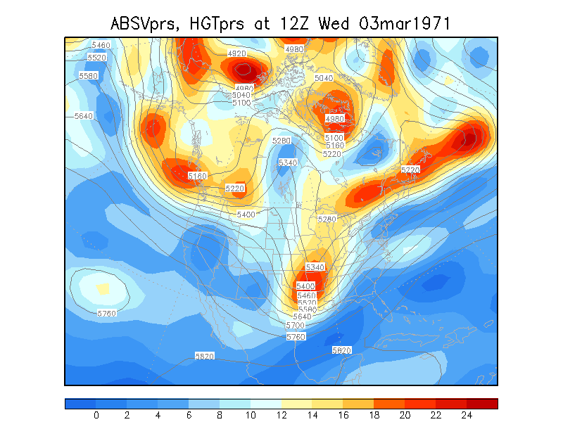
- Interior East Coast/New England Storm March 3-5, 1971
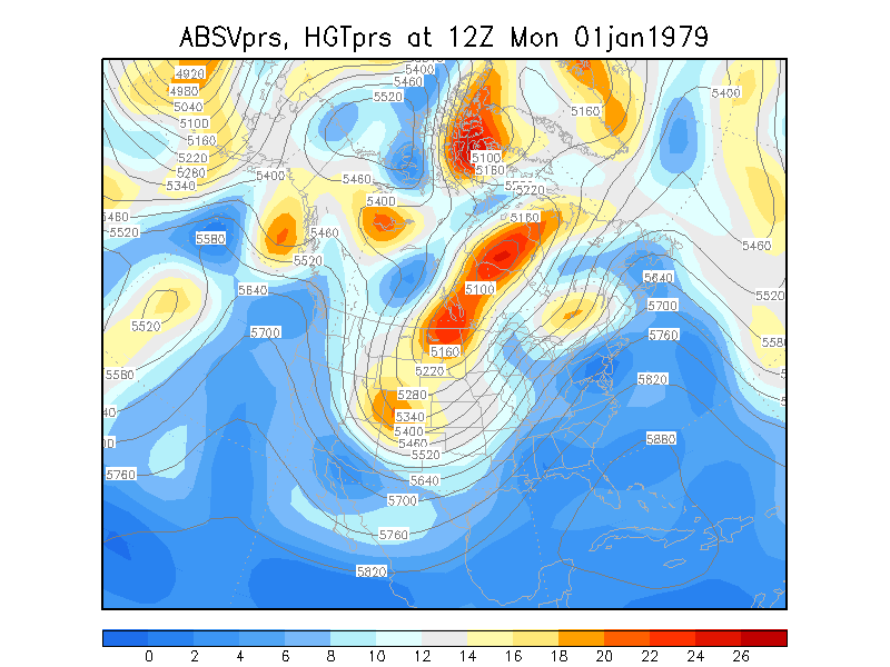
- Strong trough amplification after a New Year's Eve snowstorm in the
Chicago area January 1-3,
1979
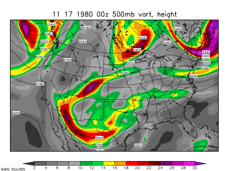
- Storm system studied by Lai and Bosart (1988) November 17-18, 1980
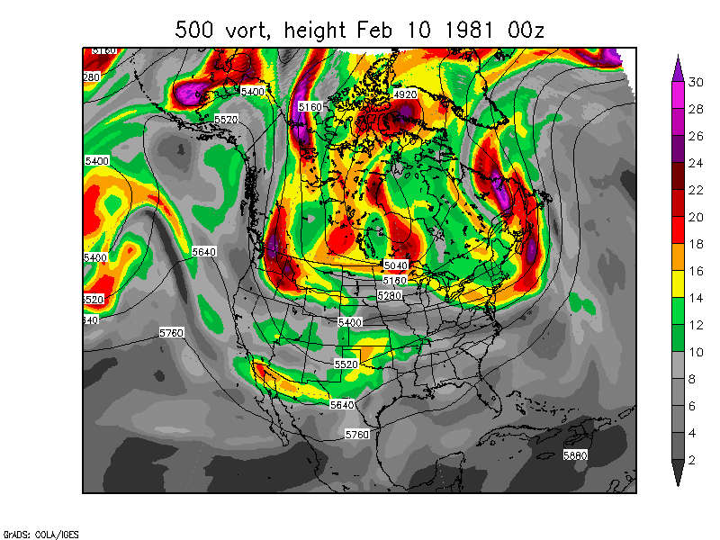
- Snowstorm for Toledo and Detroit on February 10, 1981 February 10-12, 1981
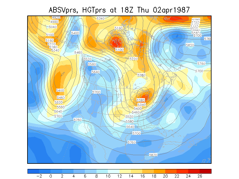
- Snowstorm for Akron and Columbus April 2-4, 1987
- January 24-26, 1988 - this is exactly 10 years after the midwest
blizzard. Loop
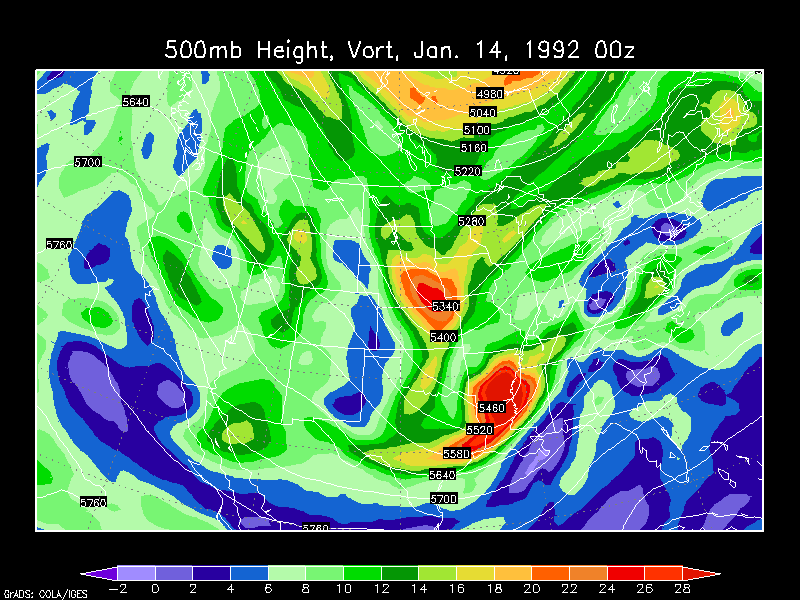
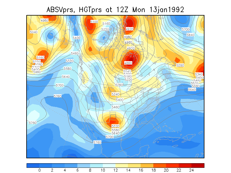
- Snowstorm for Toledo and Detroit January 14, 1992 NARR
Animation January 14,
1992 NCEP Reanalysis Animation
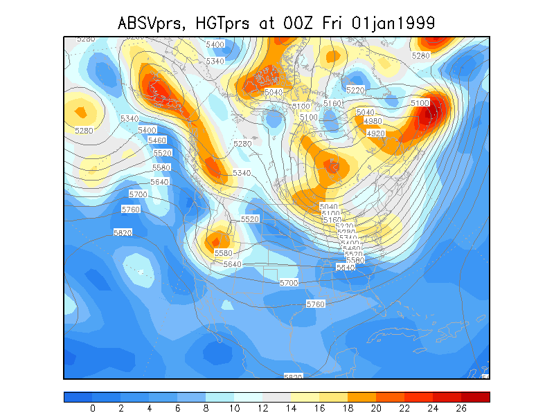
- Midwest snowstorm January
1-3, 1999
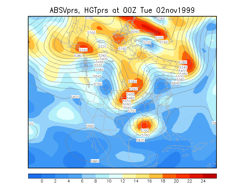
- Storm system studied by Strahl and Smith (2001) November 2-4, 1999
- Infamous snowstorm of 2001 March 4-6,
2001
Some storms listed in Bosart and Gaza (1990)
note: Bosart and Gaza did not consider phasing over the
Atlantic Ocean except for one instance
February 1-3, 1976 as mentioned above
January 9-11, 1977 as mentioned above
January 8-10, 1978 as mentioned above
- January 25-26, 1978 as mentioned above
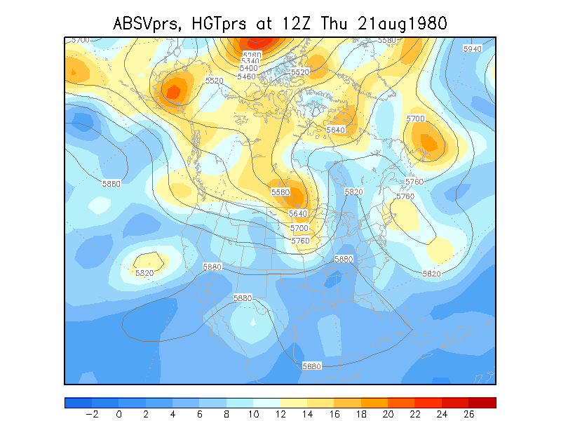
-central Canada August
21-22, 1980
- Northern New England January 6-8, 1981
- phasing in the Ohio Valley, the surface low bombed east of VA/MD
and ended up at 955mb somewhere in the North Atlantic March 15-17, 1981
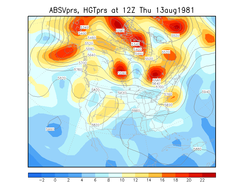
- eastern Quebec August
13-14, 1981
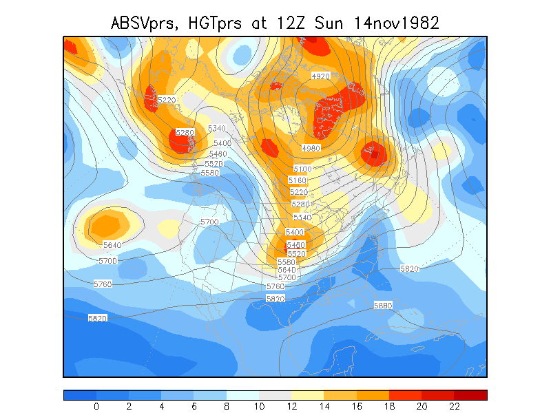
November 14-16, 1982
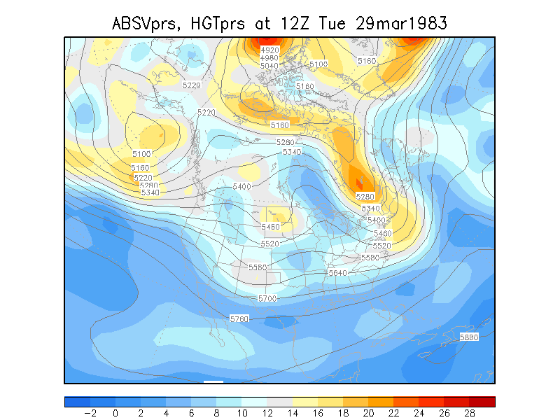
- Maine/New Brunswick March 29-30, 1983
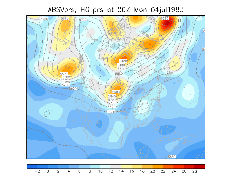
- Hudson Bay July 4-5,
1983
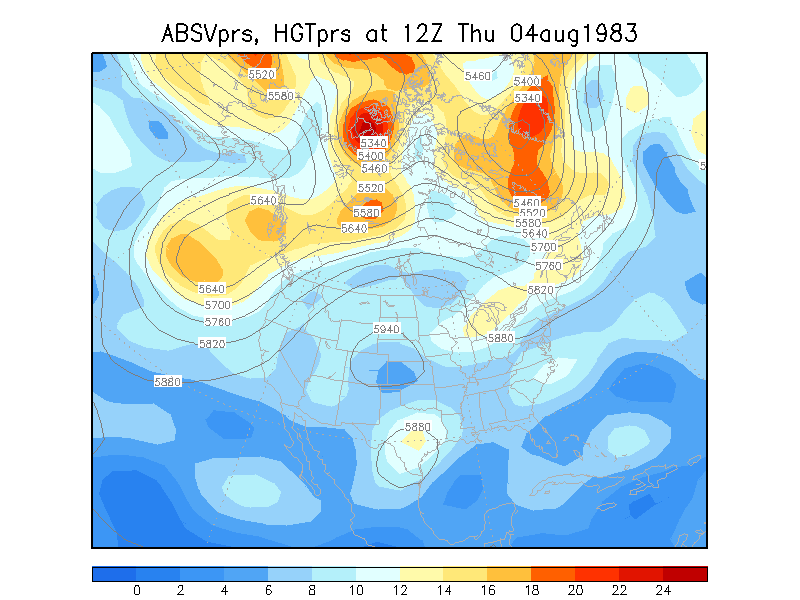
- Northern Canada August
4-5, 1983
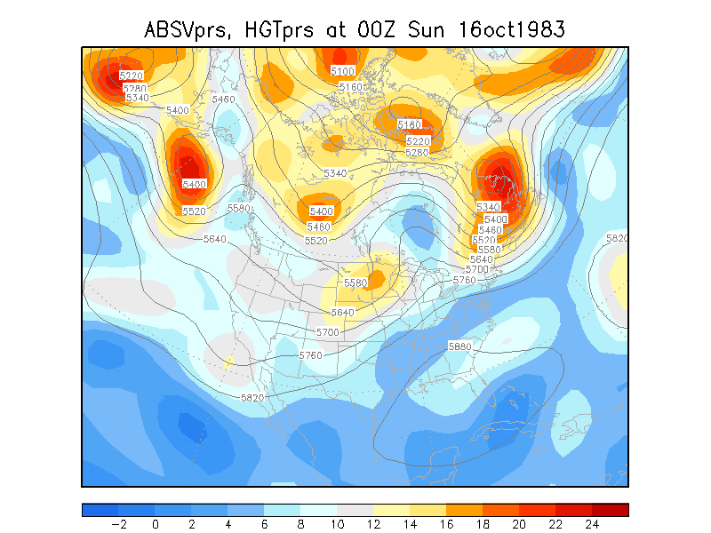
- central Canada October
16-17, 1983
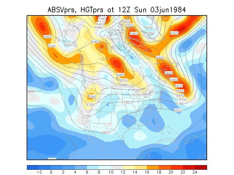
- offshore from Nova Scotia June 3-4, 1984
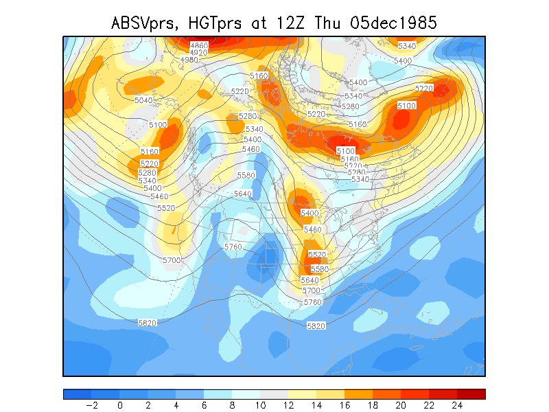
December 5-6, 1985
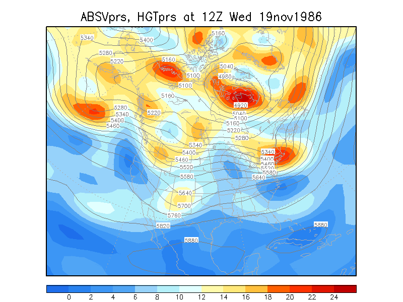
November 19-21, 1986
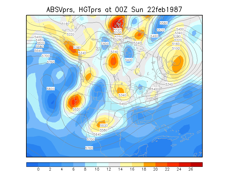
February 22-24, 1987 -
East Coast snowstorm
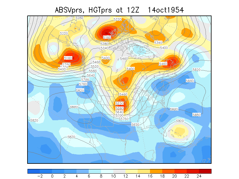
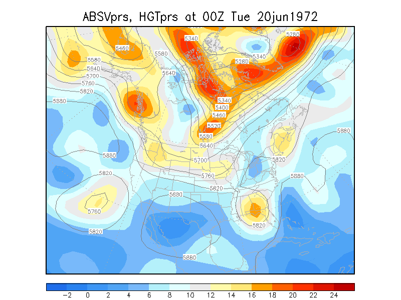
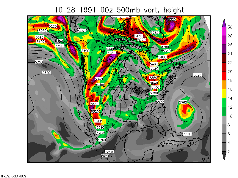
Tropical - Extratropical Connections
October 14-18, 1954: Hurricane Hazel
June 20-24, 1972: Hurricane Agnes
October 28 - November 2, 1991 :
the "Perfect Storm"
(Hurricane Grace, Extratropical Storm, Hurricane #8) not only this,
but look at the upper level trough that moves through the
Plains/Midwest on November 1 !
Dean and Bosart (1996) did a climatology of trough mergers and
fractures in the Northern Hemisphere. One interesting thing to note
is that they decide to categorize trough mergers (phasing) as either
a "classic" type or a "vortex merger" type. The "vortex merger" type
is where two or more vort maxes rotate around each other and interact
inside a larger closed upper low. The "classic" merger is best shown
by all of the examples from Bosart and Gaza (1990)
Examples of Vortex Mergers (not specifically mentioned in the
paper)
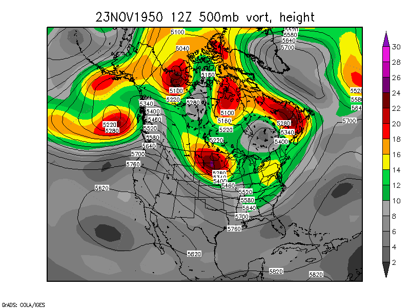
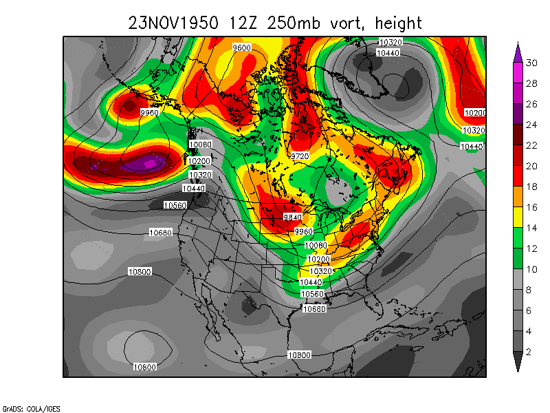
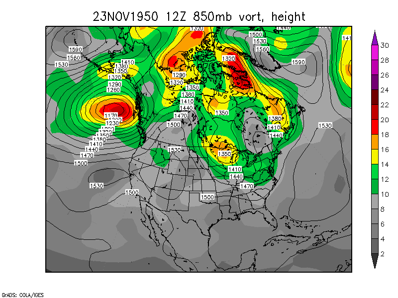
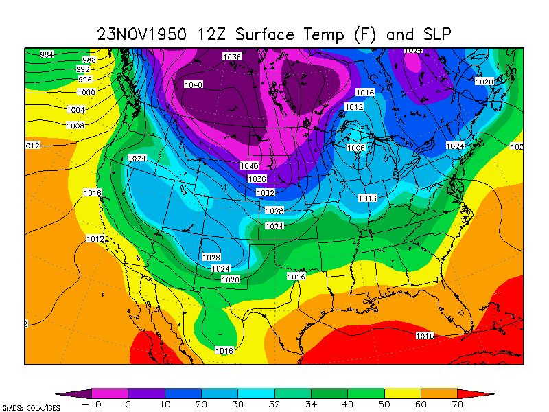
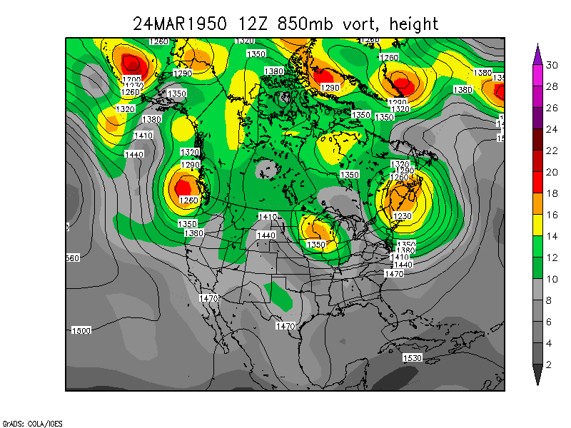
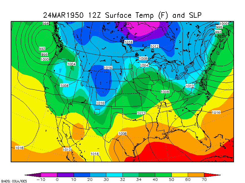
"Snow Bowl" of 1950:
November 23 to 27, 1950 250mb loop 850mb loop Surface temp and SLP
loop
The surface low moved through Manitoba, MN, and Lake Superior. Then
it re-generated a new surface low on the cold front in NC/VA and
rotated it north to PA and west to OH, in a loop, and northward to
Ontario.
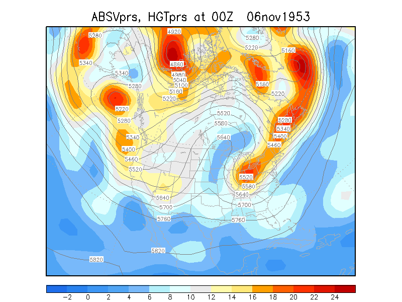
November 6-8, 1953
-Eastern Ohio snowstorm December 5-7, 1962
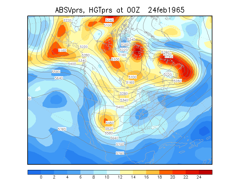
-You have just got to watch this 12-day loop. Cut off lows! February 24 - March 7,
1965
- The storm that sunk the lake freighter Daniel
J. Morrell Daniel
J. Morrell picture on Lake Huron Wikipedia article on Daniel J. Morrell
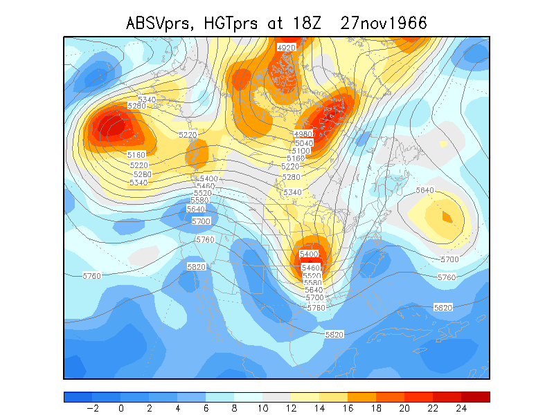
November 27-30, 1966
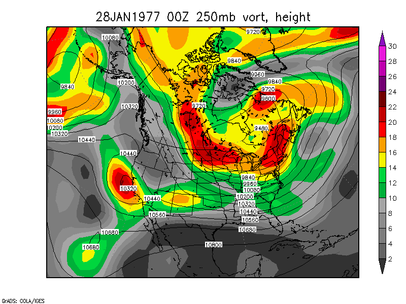
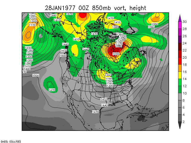
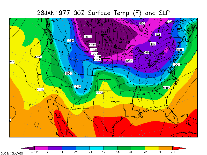
Buffalo Blizzard of 1977:
January 28-29, 1977 250mb loop 850mb loop Surface loop
Three vort maxes rotated around each other in Eastern Canada. The
southern one caused the snow, lake effect snow, and blizzard
conditions in the Great Lakes, especially Buffalo and Watertown.
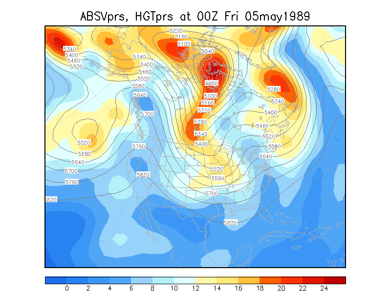
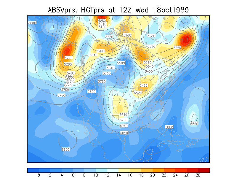
May 5-7 1989 :
late(est) season snow in Toledo
October 18-21 1989 :
early season snow in IN and IL
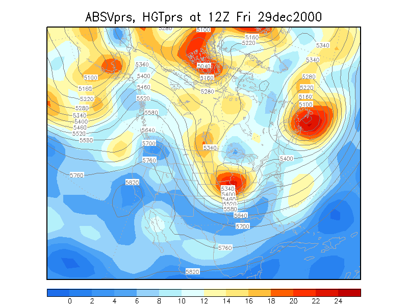
Millennium Snowstorm: East Coast Storm December 29 to 31,
2000
NWS
- North Platte NE page on blizzards and case studies
References
Robert S. Gaza and Lance F. Bosart "Trough Merger Characteristics
over North America," Wea. Forecasting Vol. 5 No. 2 (1990) pp.
314-331
Chung-Chieng Lai and Lance F. Bosart "A Case Study of Trough Merger
In Split Westerly Flow," Mon. Wea. Rev. Vol. 116, No. 10,
(1988) pp. 1838-1856.
Jennifer L. S. Strahl and Phillip J. Smith "A Diagnostic Study of an
Explosively Deepening Extratropical Cyclone and and Associated
500-hPa Trough Merger," Mon. Wea. Rev. Vol. 129 No. 9 (2001)
pp. 2310-2328
Devin B. Dean and Lance F. Bosart, "Northern Hemisphere 500-hPa
Trough Merger and Fracture: A Climatology and Case Study," Mon.
Wea. Rev. Vol. 124 No. 12 (1996) pp. 2644-2671
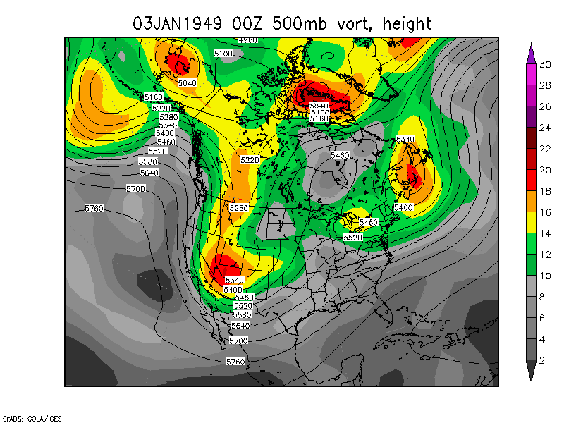
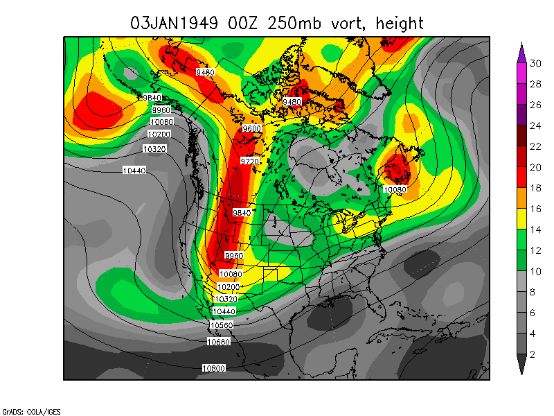
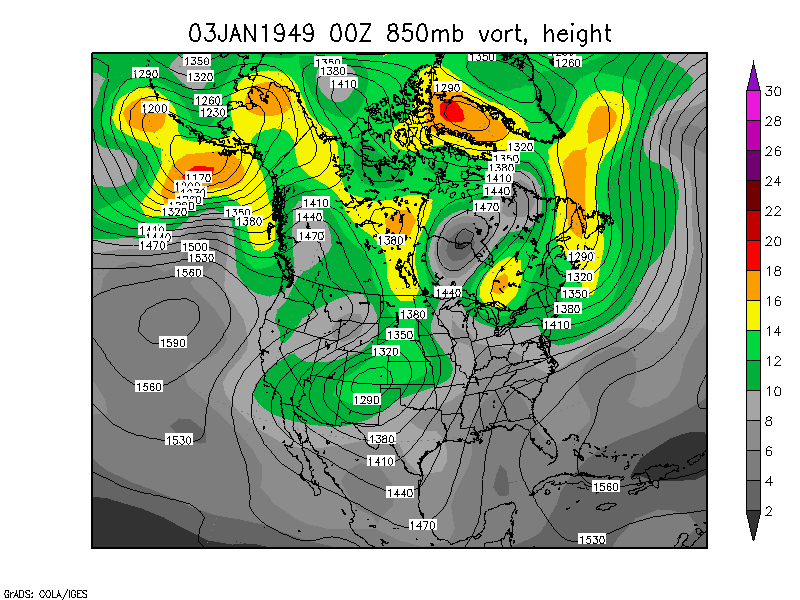
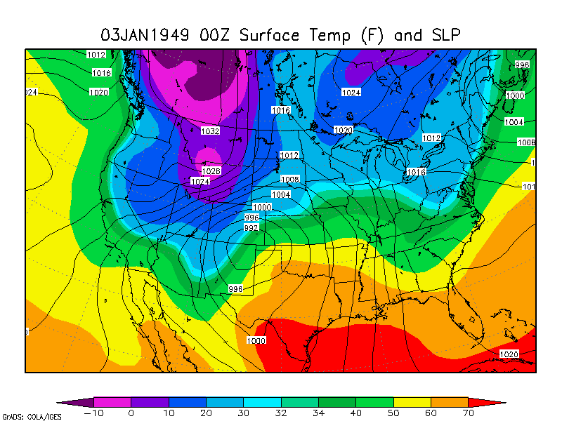
Several of these storms involved two-vort max phasing, although the
airflow interaction with the Rocky Mountains complicates things.
Plains Blizzard of 1949,
January 3-5, 1949 250mb
loop 850mb loop Surface loop
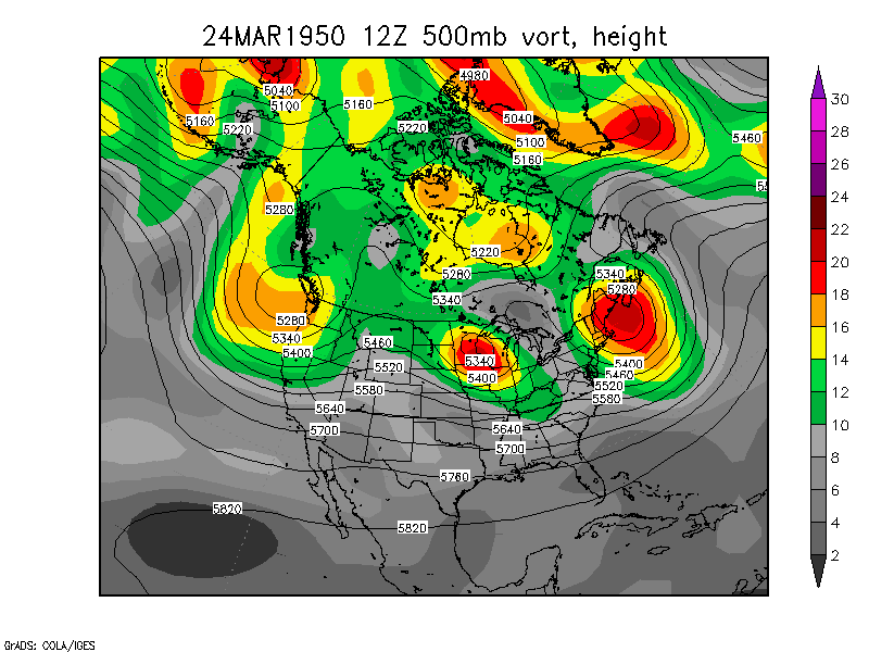
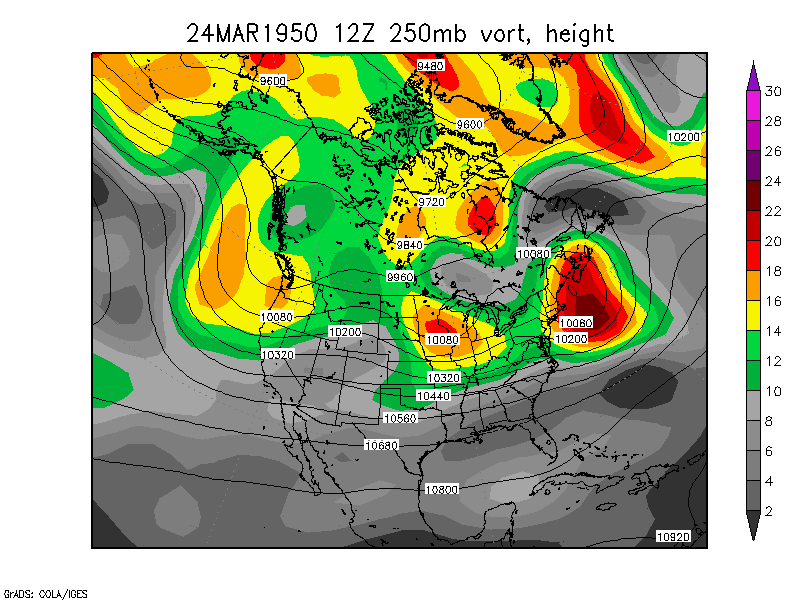
Dakota Blizzard and
Severe Weather Outbreak, March 24-28, 1950. 250mb loop 850mb loop Surface loop This storm
broke sea-level pressure records in KS, NE, CO, IA, and SD, lowest
pressrure 969.5mb in Sioux Falls SD.
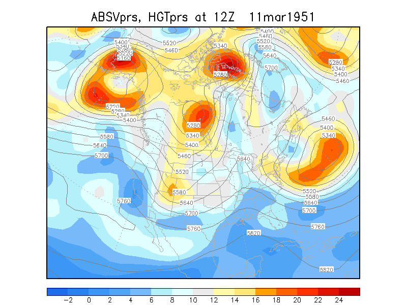
Cut off low March 11-15,
1951
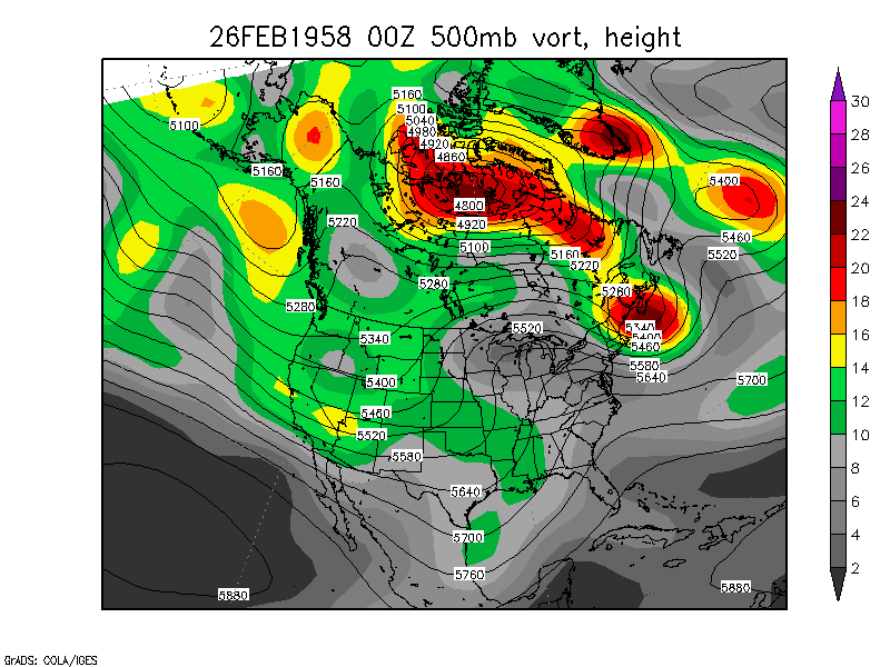
Snowstorm and Severe
Weather Outbreak, February 26-28, 1958 250mb loop 850mb loop Surface loop
Blizzard and Tornado
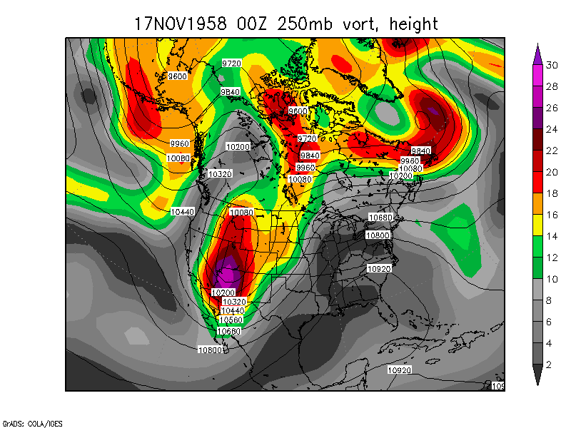
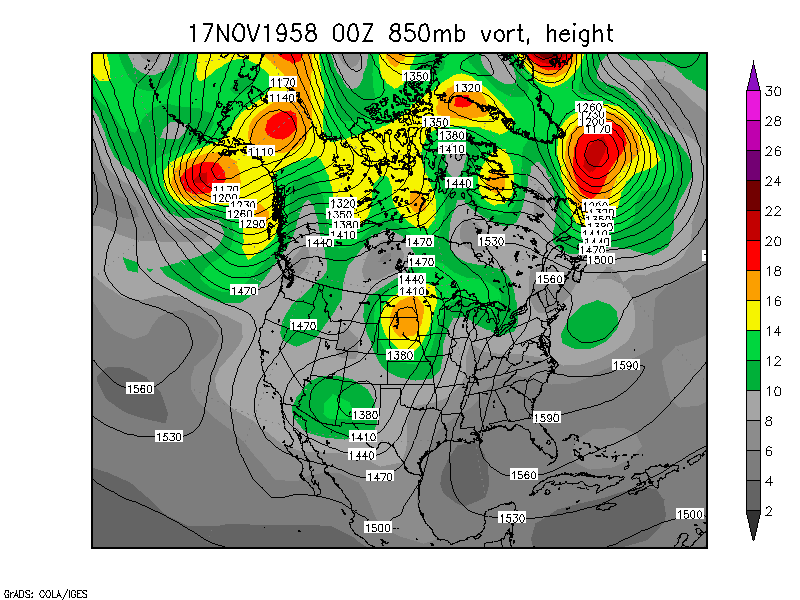
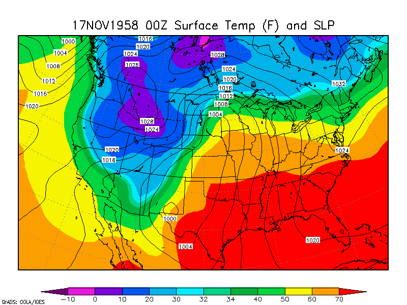
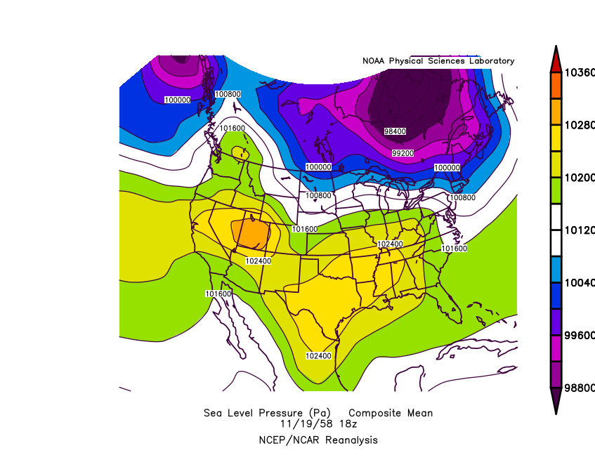
Outbreak November 17-19, 1958 250mb loop 850mb loop Surface loop
Sea Level Pressure Loop (long)
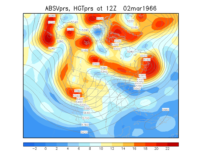
Plains Blizzard of 1966,
March 2-5, 1966
Upper Midwest Snowstorm,
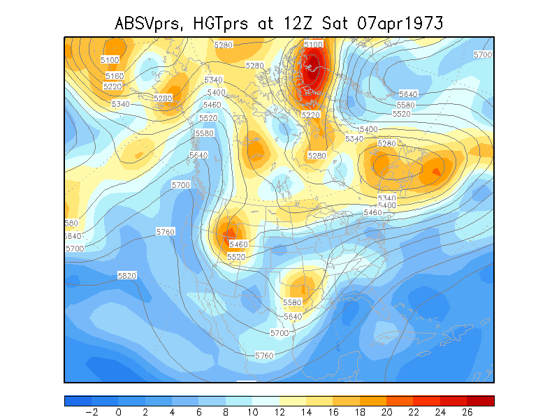
April 7-11, 1973
Plains and Upper Midwest
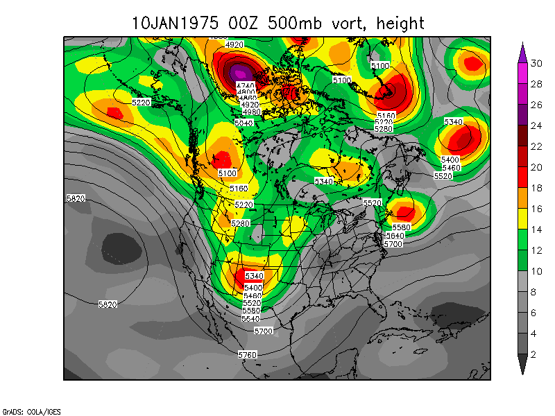
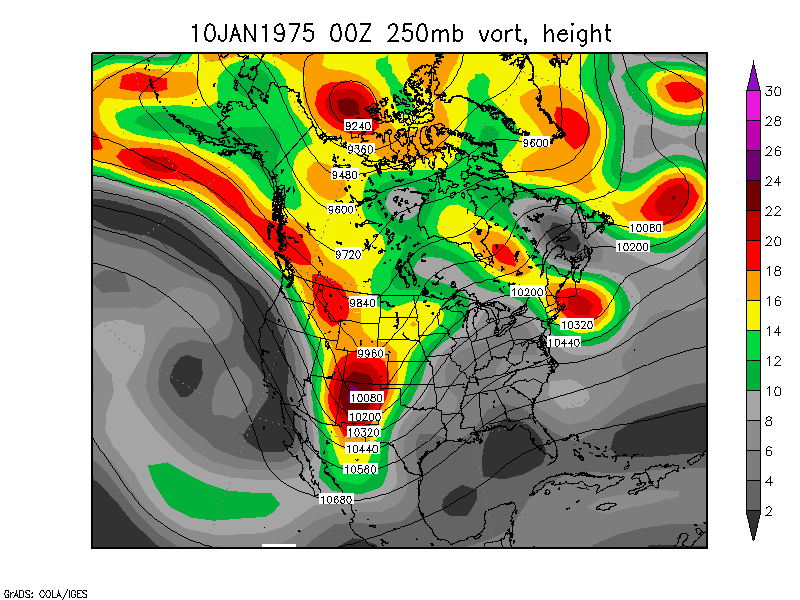
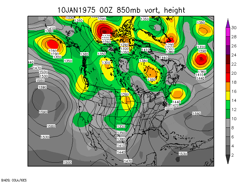
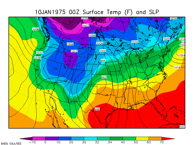
Blizzard of 1975, January 10-12, 1975 250mb loop 850mb loop Surface loop
Edmund Fitzgerald
Storm/Blizzard, November 9-11, 1975
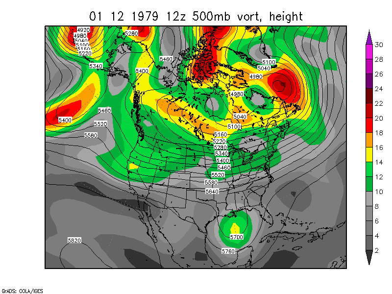
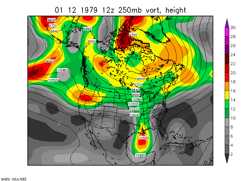
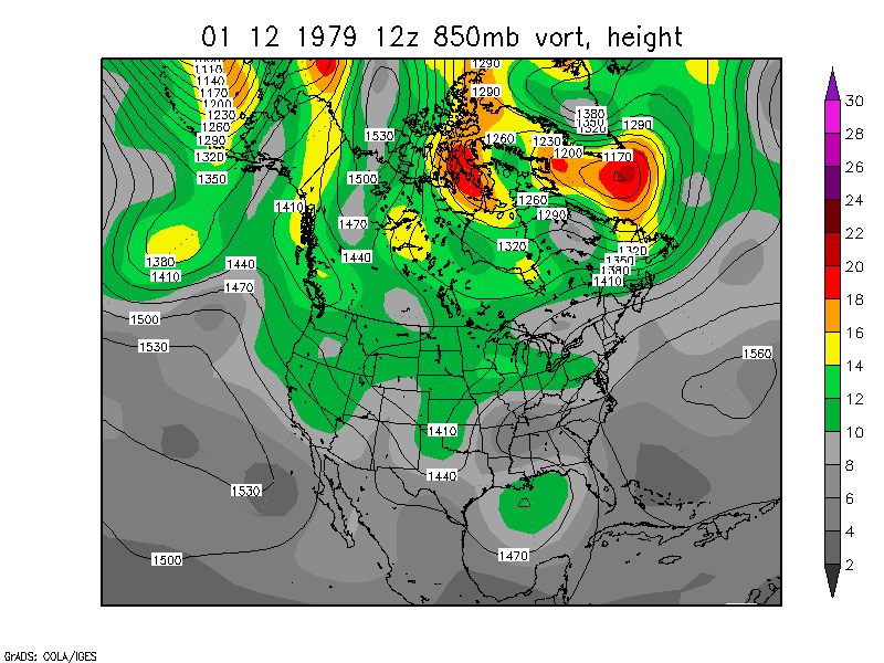
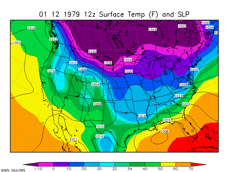
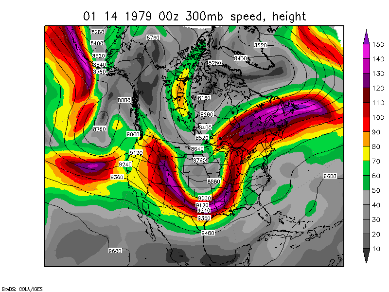
Chicago Blizzard of '79 January
12-14, 1979 NARR Animation January 12-14, 1979 NCEP
Reanalysis Animation 250 loop 850 loop Surface loop
Near the end of this animation, you can see a second vort max moving
into the system, traveling through Manitoba and Minnesota.
January 14, 1979 00z
300mb wind speed
October 28 - November 2,
1991
Minnesota Blizzard/snowstorm October 31 - November 1
Plains and Upper Midwest
Blizzard of 1996, January 17-20, 1996
Blizzard and Severe
Weather, November 9-11, 1998. This storm broke sea-level pressure
records in Minnesota and reached a low of about 972mb in
Minnesota.
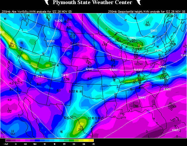
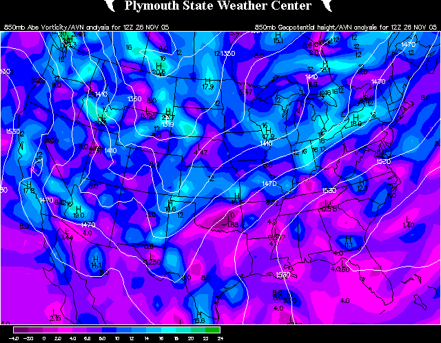
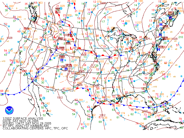
Northern Plains
Blizzard, ice storm, and tornadoes/severe weather November 26-28, 2005 - 500mb Loop 250mb Loop 850mb Loop Surface Analysis
Loop
April 11, 2008 - strong trough amplification in the central Plains
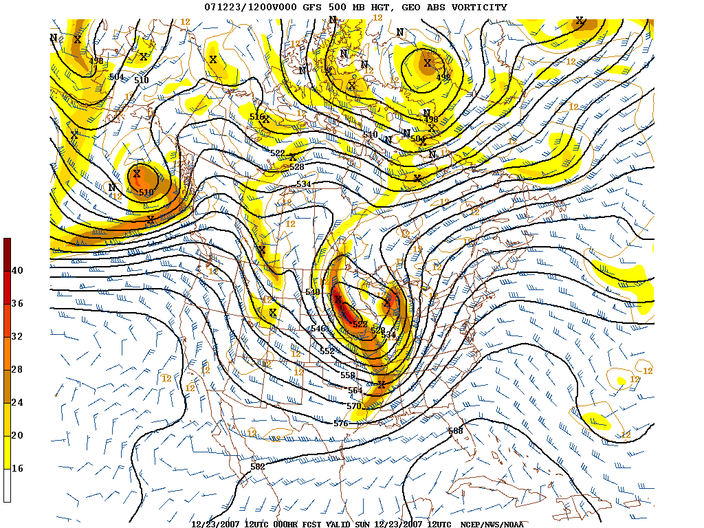
The Great Christmas Storm of 2009
December 22-23, 2007 - two upper lows combined in the Upper
Midwest
500mb plot from 12z
December 23
The purpose is to provide high quality information on historical storms
and provide links to weather information. The "Toledo Snowstorms" web page includes my own research of many snowstorms.